The worst of the brutal Arctic Invasion is now over and warmer conditions are on the way. However, with the warmer conditions will come the threat for some snow showers and by this weekend periods of rain. At least temperatures won't be in the single digits though as high temperatures will be roughly 40 to 50 degrees warmer by Saturday!
Today, the high pressure system will shift off the coast with scattered cloud cover. Winds will back to the west at 5 to 15 mph. Temperatures will be much warmer with high temperatures in the mid to upper 10's over the interior and lower to mid 20's along the coast.
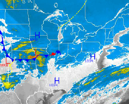
A series of weak low pressure systems will pass through the Philadelphia and New York City metropolitan areas tonight on through Friday morning with widely scattered snow showers expected. The snow showers will be capable of produce snowfall accumulations of a trace to as much as two inches in isolated locations. Best potential for snow showers will be over southeastern Pennsylvania and southern New Jersey. Low temperatures by tomorrow morning will range from the upper 10's to lower 20's. High temperatures tomorrow will range from the mid to upper 20's over the interior and lower to mid 30's along the coast.
Find out what's happening in Freeholdfor free with the latest updates from Patch.
On Friday, after a few passing snow showers, cloudy conditions are expected with a strengthening southwesterly wind at 10 to 20 mph. Temperatures will finally rise above freezing for the first time all week throughout the Philadelphia and New York City metropolitan areas. Low temperatures will range from the mid to upper 20's. High temperatures will range from the mid to upper 30's over the interior and lower to mid 40's along the coast.
A cold front will slowly approach the Philadelphia and New York City metropolitan areas on Saturday evening with periods of rain Saturday evening through Sunday morning. The rain will be heavy at times. Temperatures this weekend will be well above normal. Temperatures on Saturday will range from the mid to upper 30's for lows and mid to upper 50's for highs. Temperatures on Sunday will range from the mid to upper 40's for lows and upper 40's to lower 50's for highs. Temperatures will not much move on Sunday.
Find out what's happening in Freeholdfor free with the latest updates from Patch.
High pressure will take hold Monday through Tuesday with scattered cloud cover. Temperatures will remain above normal as the January thaw continues. Low temperatures will range from the upper 20's to mid 30's. High temperatures will range from the upper 40's to lower 50's on Monday and lower to mid 40's on Tuesday.


