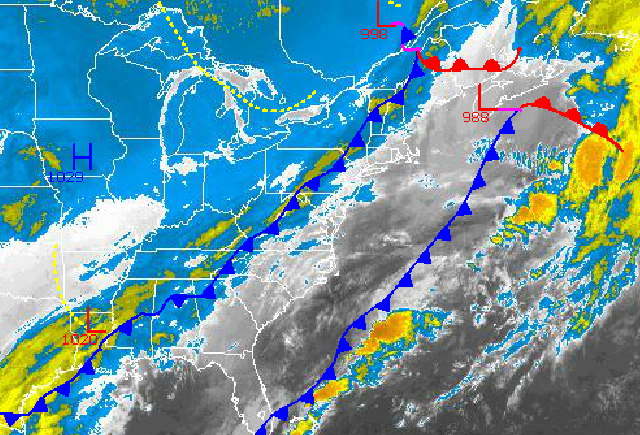
A secondary cold front will move through the region today, transporting a strong Polar air mass into the Philadelphia and New York City metropolitan areas. As such, temperatures won't be moving all that much today and will crash tonight. While the cold air settles in, the potential for a significant winter storm is brewing for Thursday evening that will bring significant snowfall to much of the northern Mid Atlantic and New England.
Today, the cold front will move through the region with scattered cloud cover and a few flurries possible. Winds will veer to the northwest at 5 to 15 mph, increasing to 10 to 20 mph this evening. Temperatures will hold in the mid to upper 30's over the interior and upper 30's to lower 40's through the early afternoon before falling into the 30's and later 20's.
Tonight through Wednesday, high pressure will take hold with scattered cloud cover and an isolated flurry possible. A few passing disturbances will keep the threat for an isolated snow shower alive. Otherwise, tranquil conditions can be expected with winds from the west at 5 to 15 mph. Temperatures will be below normal through the period. Temperatures tomorrow will range from the mid 10's to lower 20's for lows and upper 20's to mid 30's for highs. Low temperatures on Wednesday will range from the lower to mid 10's over the interior and upper 10's to mid 20's along the coast. High temperatures on Wednesday will range from the mid 20's over the interior and upper 20's to lower 30's along the coast.
Find out what's happening in Freeholdfor free with the latest updates from Patch.
A complicated and potentially intense area of low pressure is expected to impact the New York City and Philadelphia metropolitan areas on Thursday. The exact track and area of redevelopment of the coastal low pressure system is still uncertain and will have significant impacts on snowfall totals for this storm. At this time, the best potential for the heaviest snowfall will be over the interior, the New York City metropolitan area, and the northern half of New Jersey with at least 6 inches of snow expected. For southeastern Pennsylvania and south-central New Jersey at least 4 inches of snow can be expected. While southern New Jersey, especially coastal southern New Jersey can expect the least amount of snowfall. A very tight snow gradient is expected with this storm with the difference of one inch of snow to over ten inches of snow to be rather dramatic, as is the case with these types of snow storms. As such, this storm will have to be monitored closely. Low temperatures will range from the mid 10's to lower 20's over the interior, lower to mid 20's over the New York City metropolitan area, mid to upper 20's over the Philadelphia metropolitan area, and upper 20's to lower 30's along the southern New Jersey coast. High temperatures will range from the mid to upper 20's over the interior, upper 20's to lower 30's over the New York City metropolitan area, lower to mid 30's over the Philadelphia metropolitan area, and mid to upper 30's along the southern New Jersey coast.
The storm will exit on Friday morning with lingering snow showers followed by clearing skies. High pressure will be in control through Saturday. Another area of low pressure will approach the region on Sunday with periods of snow possible. Details on this second storm remains uncertain at this time. Temperatures will average well below normal through this period. On Friday, temperatures will range from the single digits to mid 10's for lows and lower to mid 10's for highs. On Saturday, temperatures will range from the single digits to mid 10's for lows and mid to upper 20's for highs. On Sunday, temperatures will range from the upper 10's to mid 20's for lows and upper 20's to mid 30's for highs.


