An area of low pressure in the Gulf of Mexico will drive northward through New Jersey and into New England by tomorrow evening. This area of low pressure will produce very heavy rainfall tonight through tomorrow morning with rainfall amounts of two to four inches! Meanwhile, a mix of snow, sleet, and rain will be a threat for northeastern Pennsylvania. Details on specific impacts can be found here!
Today, an area of low pressure in the Gulf of Mexico will drive northward towards central Pennsylvania. Rain and snow will spread northward, changing over to rain by this afternoon for all locations. Some minor accumulations up to an inch will be possible over portions of northeastern Pennsylvania and northwestern New Jersey. Winds will develop from the south at 10 to 20 mph, increasing to 15 to 30 mph. Temperatures will rise into the mid to upper 30's over the interior, lower to mid 40's over the Philadelphia and New York City metropolitan areas, and mid to upper 40's over Long Island.
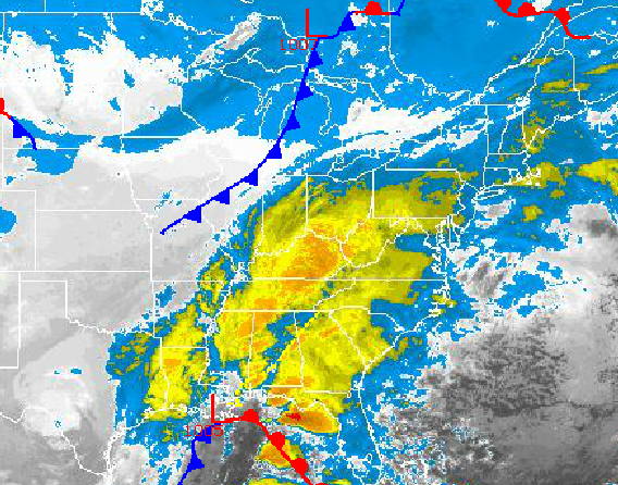
Periods of rain can be expected tonight on through tomorrow morning, which will be very heavy at times. Localized flash flooding will be a threat with rainfall amounts of two to four inches expected. Winds will be from the southeast at 15 to 30 mph. Temperatures will hold in the lower to mid 40's along the coast and mid to upper 30's over the interior.
Find out what's happening in Freeholdfor free with the latest updates from Patch.
Tomorrow afternoon, the low pressure system will lift through New Jersey and towards central New England with periods of heavy rain changing over to snow over the interior and snow showers along the coast. As the low pressure system lifts north, temperatures will peak in the upper 30's to lower 40's over northeastern Pennsylvania, mid to upper 40's over the Philadelphia and New York City metropolitan areas, and lower to mid 50's over Long Island and Connecticut. Temperatures will crash through the 50's, 40's, and 30's by tomorrow afternoon and evening as the low pressure system lifts north. Winds will veer to the northwest at 15 to 30 mph with gusts up to 45 mph.
High pressure will take hold for Thanksgiving on through Friday with scattered clouds and scattered snow showers. Winds will be from the northwest at 15 to 30 mph with gusts over 40 mph. Temperatures will on Thanksgiving will range from the mid to upper 20's for lows and lower to mid 30's for highs. Wind chills on Thanksgiving will range from the upper 10's to mid 20's. Temperatures on Friday will range from the upper 10's to lower 20's over the interior and mid to upper 20's along the coast for lows and mid to upper 30's for highs.
Find out what's happening in Freeholdfor free with the latest updates from Patch.
A series of disturbances will move through the region Saturday through Monday with widely scattered rain and snow showers. Temperatures will remain below normal through the period. Low temperatures will range from the mid to upper 20's along the coast and lower to mid 20's over the interior. High temperatures will range from the upper 30's to lower 40's over the interior and lower to mid 40's along the coast.


