
Tranquil conditions will be in place for today with high pressure in place over the region. However, another area of low pressure will bring periods of light snow, mixed with rain in some locations, by tomorrow morning making the rush hour tomorrow rather slick. The good news is that high pressure will be in control thereafter with a steady warm up by this weekend.
Increasing clouds can be expected through the day with light and variable winds. Temperatures will remain well below normal. High temperatures will rise into the mid 20's over the interior and upper 20's to lower 30's along the coast and in urban areas. With these cold temperatures, black ice will be a threat through today.
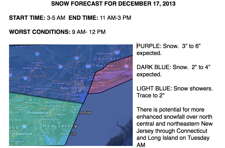
An Alberta Clipper will dive from the Great Lakes to the central New Jersey coastal waters by tomorrow morning and then rapidly southeast of New England. A band of light to moderate snowfall can be expected with generally two to four inches of snow over northeastern Pennsylvania through northern New Jersey, southeastern New York, and much of Connecticut. A trace to an inch of snow can be expected over the Philadelphia metropolitan area and much of southern New Jersey. A burst of moderate snow will be possible over Long Island and southeastern Connecticut potentially pushing snowfall totals to 3 to 6 inches. There is a potential for higher snowfall totals if the low pressure system lingers, but this is not expected at this time. Snow showers will linger tomorrow afternoon and evening with minor accumulations possible. Winds will veer from the north to the northwest at 5 to 15 mph. Temperatures will range from the upper 10's to lower 20's for lows. High temperatures will range from the mid to upper 20's over the interior, upper 20's to lower 30's over the New York City metropolitan area, and mid to upper 30's over the Philadelphia metropolitan area and southern New Jersey. See the snow map below!
Find out what's happening in Freeholdfor free with the latest updates from Patch.
A series of cold fronts will move through the region with the threat for showers each day from Friday on through Sunday. Temperatures will be well above normal, enjoy it while you can. Temperatures will range from the upper 30's to mid 40's for lows and upper 40's to mid 50's for highs.


