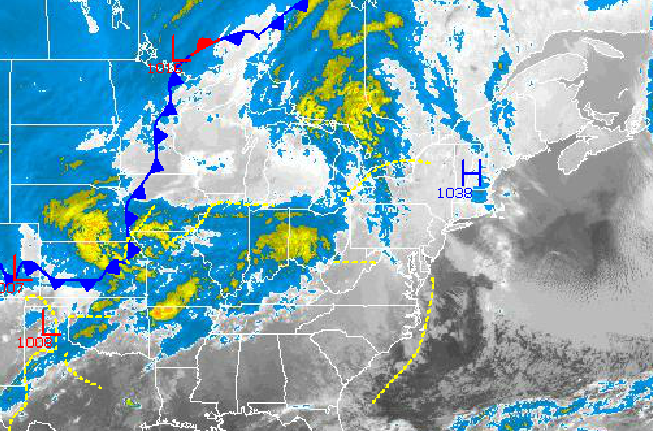
High pressure shifting off the coast will lead to winds shifting to the southwest which will transport warmer temperatures into the Philadelphia and New York City metropolitan areas today and tomorrow. However, an Arctic cold front moving through the region on Friday night will lead to a very cold weekend on the way.
Today through tomorrow afternoon, high pressure will produce scattered cloud cover, increasing to broken cloud cover by tomorrow afternoon. Winds will veer from the east to the southwest at 5 to 15 mph, increasing to 10 to 20 mph. Temperatures will rise into the mid to upper 40's for highs this afternoon. Tomorrow, temperatures will range from the upper 30's to lower 40's for lows and lower to mid 50's for highs.
An arctic cold front will move through the Philadelphia and New York City metropolitan areas late tomorrow night into Saturday morning with rain showers expected. Some snow showers may mix in with the rainfall towards the end of the rain shield, however no accumulation is expected. Temperatures will fall into the mid to upper 30's over the interior and upper 30's to lower 40's along the coast.
Find out what's happening in Freeholdfor free with the latest updates from Patch.
High pressure will be in control Saturday afternoon through Monday with scattered cloud cover expected. Temperatures will be well below normal through the period. High temperatures on Saturday will rise into the lower to mid 40's. On Sunday, temperatures will range from the mid to upper 20's for lows and lower to mid 30's for highs. On Monday, temperatures will range from the upper 10's to lower 20's for lows and mid 30's for highs.
Another cold front will move through the region on Tuesday with scattered rain and snow showers. No snow accumulation is expected. Temperatures will remain below normal but not as cold as previous days. Low temperatures will range from the mid to upper 20's. High temperatures will range from the lower to mid 40's.
Find out what's happening in Freeholdfor free with the latest updates from Patch.
An area of low pressure will produce periods of rain along the coast and a mix of rain and snow over the interior. Locations above 1,000 feet can expect a change over to all snow, although accumulations if any will be very light. Temperatures will range from the upper 20's to mid 30's for lows and upper 30's to lower 40's over the interior and mid to upper 40's along the coast for highs.


