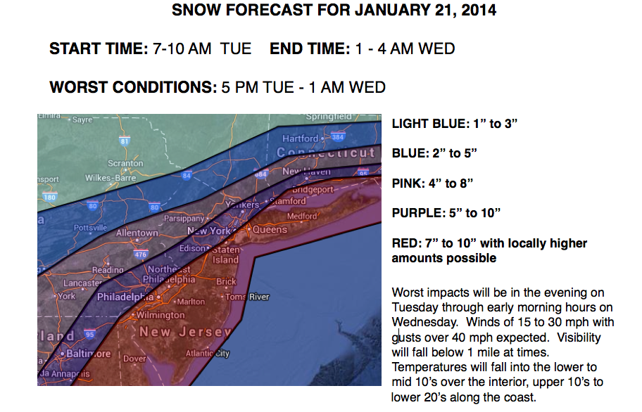
A major winter storm is expected to impact the region starting tomorrow morning and continuing into the early morning hours on Wednesday. A strong disturbance over the northern Plains will dive towards the New Jersey coastal waters by tomorrow afternoon leading to a rapidly intensifying areas of low pressure off the northern Mid Atlantic coast on Tuesday evening. As the low pressure system intensifies, arctic cold air will invade and drive towards the coast, dropping temperatures into the 10's and lower 20's. As a result, snow ratios will rise to 15:1 to 20:1 ratios. Winds will be strong from the northwest at 15 to 30 mph with gusts over 40 mph. Visibility will fall below a mile at times. Details on snowfall amounts can be found below with the focus for the heaviest snowfall along the coast.


