A series of weak disturbances will move through the Philadelphia and New York City metropolitan areas through tomorrow with variable cloud cover and isolated showers. Warm temperatures can be expected before an arctic cold front drives through the region with a return winter like conditions.
Today through tomorrow, scattered to broken cloud cover can be expected with isolated to widely scattered showers. Locally dense fog will be a threat in the morning hours. Winds will veer from the southeast to southwest at 5 to 15 mph, increasing to 10 to 20 mph. Temperatures will rise into the upper 40's to lower 50's over the interior and lower to mid 50's along the coast for highs today. Tomorrow morning, temperatures will fall into the upper 30's to lower 40's over the interior and mid to upper 40's along the coast. High temperatures tomorrow will range from the lower to mid 50's over the interior and upper 50's to lower 60's along the coast.
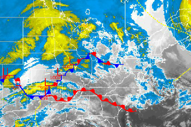
An Arctic cold front will approach the Philadelphia and New York City metropolitan areas on Friday with periods of rain expected. The rain will be heavy at times. Temperatures will rise into the lower to mid 50's for highs.
Find out what's happening in Freeholdfor free with the latest updates from Patch.
As the cold front drops south on Friday evening, temperatures will rapidly fall through the 50's, 40's, and 30's. The rain will mix with and change over to light snow before ending on Saturday morning. Preliminary snowfall forecast for Saturday morning can be found here.
Scattered cloud cover and a brisk northerly wind can be expected Saturday afternoon through Sunday afternoon as Arctic high pressure builds over the region. Temperatures will fall to below normal levels once again. High temperatures on Saturday will range from the upper 30's to lower 40's. Temperatures on Sunday will range from the upper 10's to mid 20's for lows and lower to mid 30's for highs.
Find out what's happening in Freeholdfor free with the latest updates from Patch.
An area of low pressure will lift northward from the Gulf Coast to the Eastern Great Lakes with a warm front slowly moving through the region by Monday morning. Periods of snow can be expected on Sunday night changing over to sleet and freezing rain and then rain by Monday morning. While coastal locations are expected to change over to rain at a face pace, there is a threat for significant ice accumulation over portions of interior eastern Pennsylvania, northwestern New Jersey, the Hudson River Valley, and Connecticut. Temperatures on Monday will rise into the upper 30's to lower 40's over the interior and mid to upper 40's along the coast.
Arctic cold air return by Tuesday as the cold front exits in the morning with rain and snow showers. Temperatures on Tuesday will range from the mid to upper 30's for lows and upper 30's to lower 40's for highs.


