Community Corner
High Rip Current Risk in Effect at the Jersey Shore Wednesday
The risk is the result of the lingering effects of Tropical Storm Bertha.

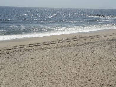
Visitors to the Jersey Shore should beware of rip currents on Wednesday, the National Weather Service warns.
Long period swells from departing Tropical Storm Bertha are expected to bring a high risk of rip currents to the Jersey Shore, this the National Weather Service out of Mount Holly has issued a High Rip Current Risk for Cape May, Atlantic, Ocean and Eastern Monmouth counties through Wednesday evening.
This suggests that wind and/or wave conditions support the possibility of very strong rip currents that can be life threatening for anyone who enters the surf.
Find out what's happening in Gallowayfor free with the latest updates from Patch.
Rip currents are powerful channels of water flowing quickly away from shore, and occur most often at low spots or breaks in the sandbar near groins, jetties and piers.
The surf height is expected to be 3-5 feet with occasional higher waves.
Find out what's happening in Gallowayfor free with the latest updates from Patch.
Earlier this summer, a rip tide claimed the life of a Philadelphia teenager who was visiting Ocean City for the weekend.
The National Weather Service advises visitors to the shore to heed the advice of life guards and the beach patrol and to pay attention to flags and posted signs.
Get more local news delivered straight to your inbox. Sign up for free Patch newsletters and alerts.