Weather
New Thunderstorms Hit NJ, Bringing Flood Warnings, 'Damaging' Winds
Some roads were beginning to flood and flash flood warnings were posted for multiple parts of the Garden State.


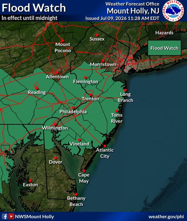
Flash flood warnings and watches have been issued for much of New Jersey on Thursday afternoon as the latest round of thunderstorms moves into the Garden State.
Flash flood warnings are in effect through Thursday evening in Middlesex, Monmouth, Mercer, Somerset, Camden, southeastern Hunterdon, northwestern Gloucester and northwestern Salem counties, the National Weather Service said.
Video shared by meteorologist Collin Gross on X showed Route 1 flooded in Edison on Thursday afternoon, with traffic moving through it.
Find out what's happening in Haddonfield-Haddon Townshipfor free with the latest updates from Patch.
In South Brunswick, flash flooding swamped several vehicles and forced the closure of New Road between Route 1 and Route 27, police said.
East Brunswick police were warning people to stay home due the flood threat.
Find out what's happening in Haddonfield-Haddon Townshipfor free with the latest updates from Patch.
The thunderstorms were packing lightning that appears to be the cause of a fire at a home in Old Bridge, officials said. Firefighters from multiple towns were responding to fight the blaze.
In addition, flood watches are in effect for Burlington, Ocean, Cumberland and Atlantic counties along with the portions of Salem, Gloucester, Middlesex, Mercer and Hunterdon counties not currently under warnings, the weather service said.
Ahead of the storms, Brick Township officials postponed Thursday's planned SummerFest concert and fireworks.
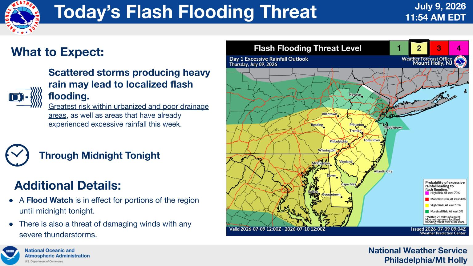
"Showers and thunderstorms are expected to develop this
afternoon and evening, capable of producing heavy downpours," the National Weather Service said. "Rainfall rates of 1 to 2 inches per hour are likely and short term training could result in flooding over southeast Pennsylvania, northern Delaware, and portions of southern New Jersey."
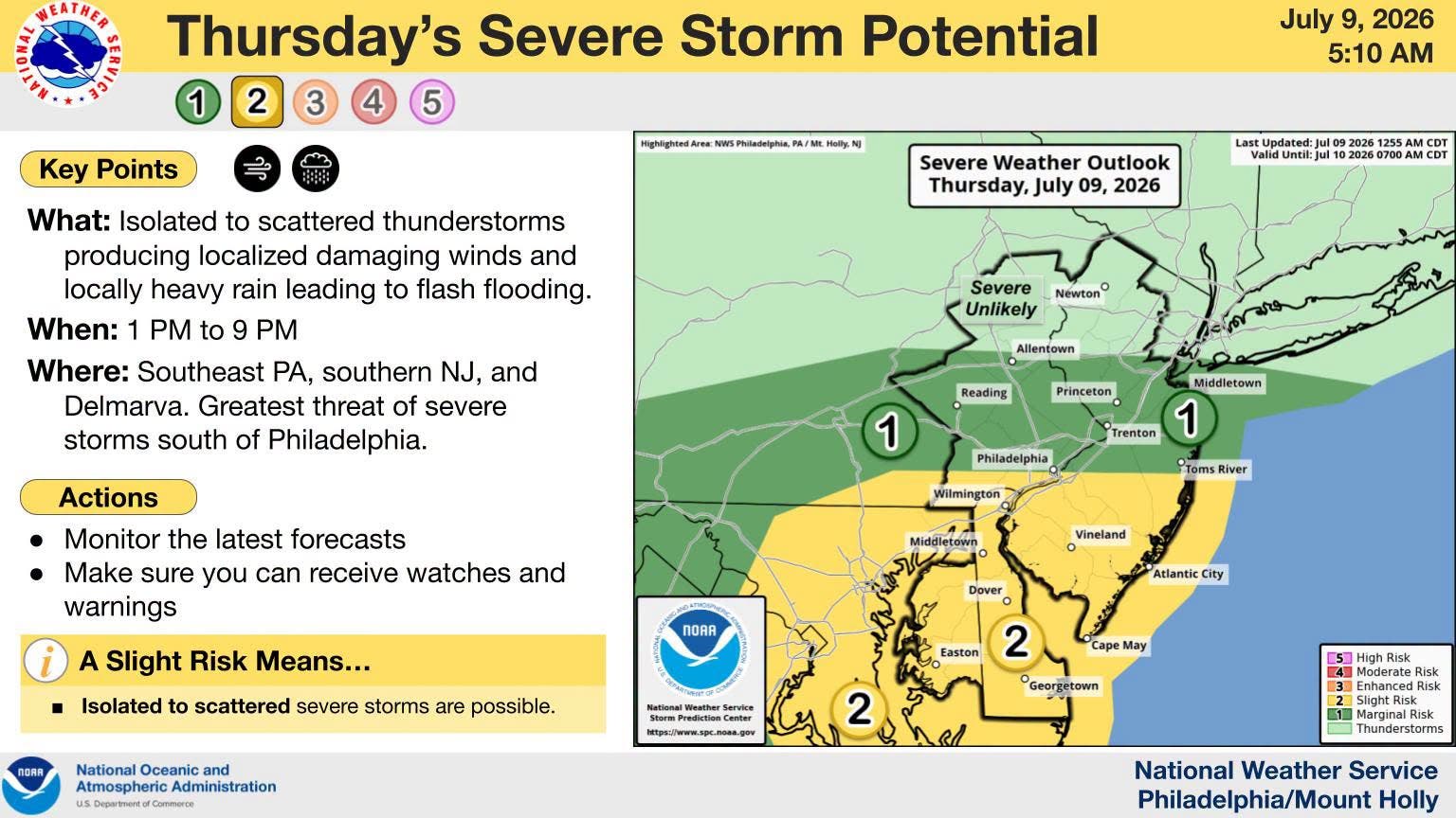
The main timing of the storms will be 3 p.m. to 9 p.m., forecasters said.
Severe storms are most likely in South Jersey.
"While showers and thunderstorms capable of damaging winds and localized flash flooding are likely for the northern zones as well, the highest impacts in terms of potential severe weather and flash flooding should be focused generally south of Philadelphia," National Weather Service forecasters said.
Another round of showers and thunderstorms is expected Friday. Again, heavy rain and flash floods are the biggest threat. The flood watch may be expanded depending on where rain falls Thursday.
These showers may linger into Saturday, according to the forecast.
"There remains a vast amount of uncertainty with how Saturday will pan out as guidance continues to struggle with how quickly the cold front clears the area," the National Weather Service said. "Some guidance slows the progression of the front, keeping more in the way of showers around on Saturday, whereas others show a faster progression, yielding mainly dry weather."
As we head into next week, dry weather returns to New Jersey, forecasters said.
Get more local news delivered straight to your inbox. Sign up for free Patch newsletters and alerts.


