Weather
UPDATE: With Possible Flooding On Way, Hoboken Issues Advisory
A coastal flood watch is in effect for the Hoboken area from 4-10 a.m. Monday. Find out what time snow and rain are expected to start.

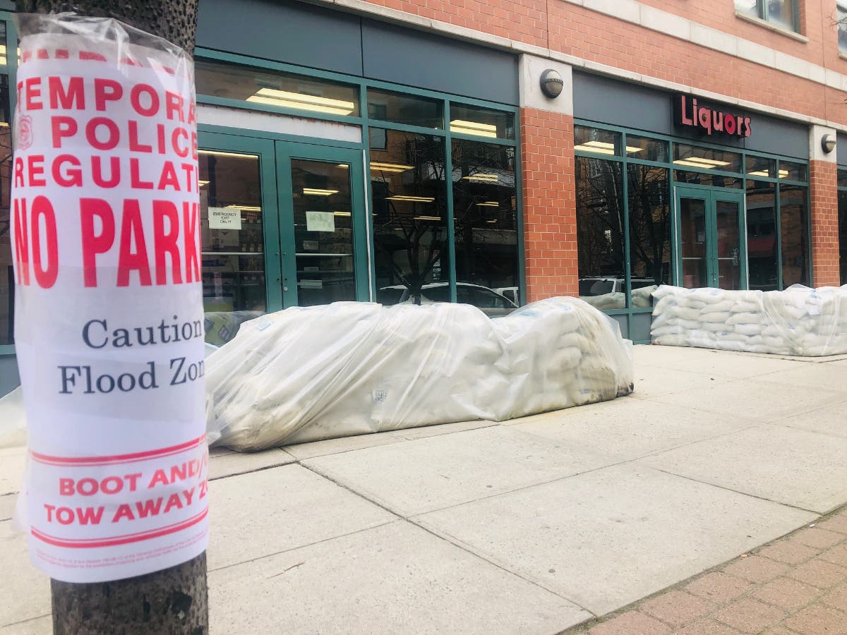


HOBOKEN, NJ — The National Weather Service says that a storm predicted to hit the Northeast Sunday into Martin Luther King Jr. Day will bring more rain than snow to Hoboken. However, there is a potential for coastal flooding at high tide.
High tide in the Hoboken/Jersey City area on Martin Luther King morning will be 8:06 a.m. Monday.
The most recent National Weather Service update on Sunday evening at 6 p.m. predicted an inch of snow and slippery conditions overnight.
Find out what's happening in Hobokenfor free with the latest updates from Patch.
The city of Hoboken warned in an advisory on Sunday: "Snow accumulation of 1-2 inches followed by rain is possible. Any rain over 0.8 inch per hour could result in flooding in low-lying areas ... wind gusts of 50 MPH are predicted."
Read more of the city's advisory here. Report downed wires and power outages here: https://nj.myaccount.pseg.com/myservicepublic/outagepublic
Find out what's happening in Hobokenfor free with the latest updates from Patch.
The storm is expected to bring rain and snow before 11 p.m. Sunday night, and then rain overnight. See precipitation maps with predicted amounts here.
There is a coastal flood watch for the area from 4-10 a.m. Monday:
"IMPACTS...Widespread moderate flooding of vulnerable areas is possible near the waterfront and shoreline, including roads, parking lots, parks, lawns, and homes and businesses with basements near the waterfront. Several road closures are possible, and vehicles parked in vulnerable areas near the waterfront may become flooded. Flooding will also extend inland from the waterfront along tidal rivers and bays."
The Forecast For The Area Says:
Sunday: Increasing clouds, with a high near 39. Wind chill values between zero and 10. North wind 6 to 9 mph becoming east in the afternoon.
Sunday Night: Rain and snow before 10 p.m., then rain, snow, and sleet between 10 p.m. and 11 p.m., then rain after 11 p.m. Temperature rising to around 45 by 4 a.m. Breezy, with an east wind 11 to 16 mph increasing to 19 to 24 mph after midnight. Winds could gust as high as 48 mph. Chance of precipitation is 100 percent. New snow and sleet accumulation of less than a half inch possible.
M.L.King Day: A chance of rain before 3 pm, then a slight chance of rain and snow. Mostly cloudy, with a temperature falling to around 38 by 3 pm. Southeast wind 16 to 18 mph becoming west in the afternoon. Winds could gust as high as 33 mph. Chance of precipitation is 40 percent.
The NWS forecast for the area can be found here.
In Hoboken, property owners and occupants have six hours after the completion of a storm to remove snow and ice from sidewalks adjacent to their property, along with adjoining curb ramps or curb cuts. It is illegal to shovel snow back onto streets or onto fire hydrants.
Sign up to get a free daily newsletter each morning at 6 a.m. with either Hoboken or Jersey City news, or to get breaking news alerts when news happens: Sign up with your zip code here and you'll get an email asking for your preferences.
Get a free 6 a.m. newsletter with news in your Hudson County town: https://patch.com/subscribe
Get more local news delivered straight to your inbox. Sign up for free Patch newsletters and alerts.


