Community Corner
WEATHER ALERT: Snow, 'Harsh' Arctic Weather Set For New Jersey This Weekend
Ice, strong wind gusts are expected to make travel difficult, and frigid temps are expected to accompany two snow storms in the few days.

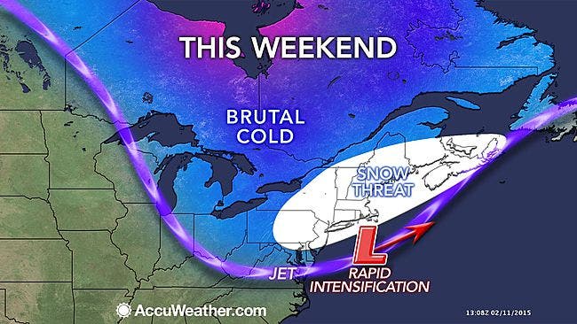
It’s the winter that just won’t end, as a harsh arctic outbreak will likely be around this holiday weekend.
Two systems are expected drop snow on New Jersey in the next few days.
There is a chance for a light accumulating snow on Thursday, but potentially heavier accumulations of snow are expected to come on Saturday and Saturday night - and again on Tuesday, according to the National Weather Service.
Find out what's happening in Hobokenfor free with the latest updates from Patch.
Plummeting temperatures and gusty winds pose a threat to the warmth of the Valentine’s Day, as gusty, possibly advisory level winds are likely out of the northwest in association with these storms.
Strong winds are expected in the wake of the system Thursday night and Friday, and Sunday into Monday. Gusts topping 45 mph are possible for the Philadelphia area, according to Accuweather.com. Travel could be difficult and dangerous in portions of Pennsylvania, New Jersey and New York.
Find out what's happening in Hobokenfor free with the latest updates from Patch.
Wind chill values may come close to advisory levels on Thursday night and Friday morning, as well as Sunday. Monday morning is expected to be especially frigid.
Accuweather RealFeel Temperatures are expected to drop below zero.
“The storm could bring life-threatening conditions, especially in New England with very low temperatures and strong winds combining with snow to bring blizzard conditions,” AccuWeather.com Senior Meteorologist Henry Margusity said.
The NWS advises residents to make preparations to have sufficient fuel to heat homes and businesses and to protect pipes from freezing.
Subscribe to the Patch free daily newsletter for more local news, and breaking news alerts delivered to your inbox, by clicking here.
Other Patch stories:
- Prosecutor: Probe Into Possible Murder-Suicide Continues; Baby Survives
- UPDATE: Chinese Student’s I-78 Truck Death Second In Last Month
- UPDATE: One Dead, Truck Lanes Reopened After 40-Vehicle New Jersey Turnpike ‘Skating Rink’ Crash
- Ocean City Mother On Daughter’s Suicide: ‘I Would Like To See A Child’s Life Saved’
Get more local news delivered straight to your inbox. Sign up for free Patch newsletters and alerts.