Weather
Gov. Murphy: Next Threat From 'Unpredictable' Nor'Easter Is Wind, Outages Into Wednesday
Gov. Phil Murphy said the nor'easter hitting New Jersey is likely to bring strong winds and power outages as late as Wednesday afternoon.

NEW JERSEY —New Jersey Gov. Phil Murphy said Tuesday afternoon that the next big threat from the nor'easter swirling over the state is heavy wind that could knock down power lines and cause outages as late as Wednesday afternoon.
"The big X factor still in front of us is the wind conditions," he told WINS-88. "It's going to get more significant in the early evening and even into tomorrow ... if you don't have to go out, don't go out. Even though there's a lull, particularly with the wind, it's a good day and night to stay in."
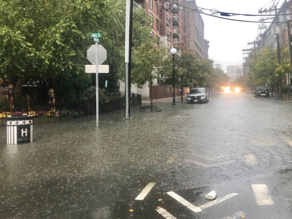
Murphy said the flooding has not been as severe as during Tropical Depression Ida last month, but people in parts of Piscataway, Middlesex, and Dunellen have been evacuated.
Find out what's happening in Livingstonfor free with the latest updates from Patch.
He said North Jersey could see another 1 to 2 inches of rain before the storm is over.
"If your power does go out, call it in," he said. "Don't assume your neighbor did. And if you see a downed power line, don't go near it. Call that in as well."
Find out what's happening in Livingstonfor free with the latest updates from Patch.
He noted that 10 counties and 6.3 million people are under a flood warning, the most severe warning level. He said that while people may not take flood warnings as seriously as tornado warnings, the state learned a "tragic" lesson last month with fatalities during Tropical Depression Ida.
He said the National Weather Service called the storm "unpredictable."
"There is one benefit to this storm unlike Ida," he said. "This is a longer storm that presents its own challenges, but not that much intensity. It's many inches of rain, but over a 36-hour period. That's a better flooding [situation]. We won't know until we're done."
Significant rains are also predicted in the area on Friday night, as of now.
READ MORE: NJ Nor'easter Timeline: Heavy Rain, Winds, Anticipated Outages
Forecasts And Closings
As of Tuesday afternoon, more than 3 inches of rain had fallen in some parts of New Jersey, with another 1 to 2 inches of rain expected to fall Tuesday, the National Weather Service's Mount
Holly office said in an updated morning briefing.
While the risk of severe thunderstorms has decreased, stronger wind gusts could develop throughout the day, the weather service said. The primary hazard in the storm is heavy rain that could lead to flooding. The heaviest rain is expected to fall along and north of the I-78 corridor and along the northern coast.
Flash flooding of creeks, streams, urban areas and areas of poor drainage is possible with the heaviest rain.
Murphy had declared a state of emergency in advance of the storm on Monday night at 8 p.m.
Residents are urged to report any power outages by calling JCP&L or PSE&G.
Several schools throughout the state announced delays and closures due to the ongoing flooding.
READ MORE: NJ Nor'easter Timeline: Heavy Rain, Winds, Anticipated Outages
- See the morning NWS briefing for North Jersey here.
- Check the up-to-date radar with this link.
- See photos of flooding in Hoboken Tuesday morning here.
Kimberlee Bongard contributed reporting to this story.
Did you know? You can get breaking news alerts in your town or a free daily newsletter at 6 a.m. each morning with news in your town. Sign up with your preferences here.
Get more local news delivered straight to your inbox. Sign up for free Patch newsletters and alerts.