Weather
Hurricane Dorian NJ: Tropical Storm Warning Issued Offshore
A number of NJ communities have issued alerts as the region is bracing for Hurricane Dorian's impact, storms and possible 55-mph winds.

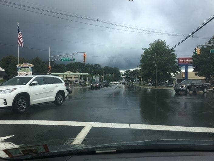
NEW JERSEY – A tropical storm warning was issued offshore as New Jersey braced for the impact of Hurricane Dorian on Friday. A number of New Jersey communities have issued alerts and taken precautions as flooding and 55-mph winds are possible (see below).
Gov. Phil Murphy said "we are closely tracking weather conditions in our coastal communities" as Hurricane Dorian continues to move up the East Coast.
Well #Dorian has reached North Wildwood, NJ. pic.twitter.com/rvmlHmSbpp
— Joseph Brooks (@JosephBrooksPA) September 6, 2019
#njmornings Local Summer is quiet today @oceancity_nj as residents here and throughout the South Jersey Coast prepare in case #Dorian pays a visit. My updates @News12NJ pic.twitter.com/m9CzgiJmK2
— Tony Caputo (@TonyCaputo) September 6, 2019
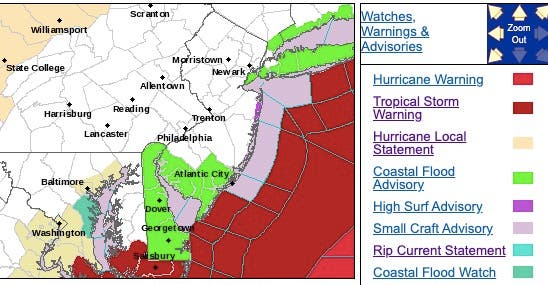
The National Weather Service has issued a tropical storm warning directly off the coast of Cape May County, and further away from the shoreline of Monmouth, Ocean and Atlantic counties. A coastal flood advisory also was issued for South Jersey.
Find out what's happening in Manasquan-Belmarfor free with the latest updates from Patch.
Point Pleasant Beach waived parking rules in restricted areas – such as the train station – so residents can move their cars to higher ground. Read more: Point Pleasant Beach Addresses Possible Hurricane Dorian Impact
Ocean City Mayor Jay Gillian said everyone should still stay prepared. Streets could experience minor flooding around high tide at 2:55 p.m. Friday and 3:21 a.m. Saturday. Be ready to move vehicles from streets that typically experience flooding. Read more: How Hurricane Dorian Could Impact Ocean City
Find out what's happening in Manasquan-Belmarfor free with the latest updates from Patch.
Read more: Hurricane Dorian Flooding, Wind Threats Continue; 4 U.S. Deaths
Here is what else you should expect or know:
- Unlike New York City, New Jersey officials have not banned swimming in the ocean, but they are telling people: Stay out of the water. Strong rip currents could bring you under.
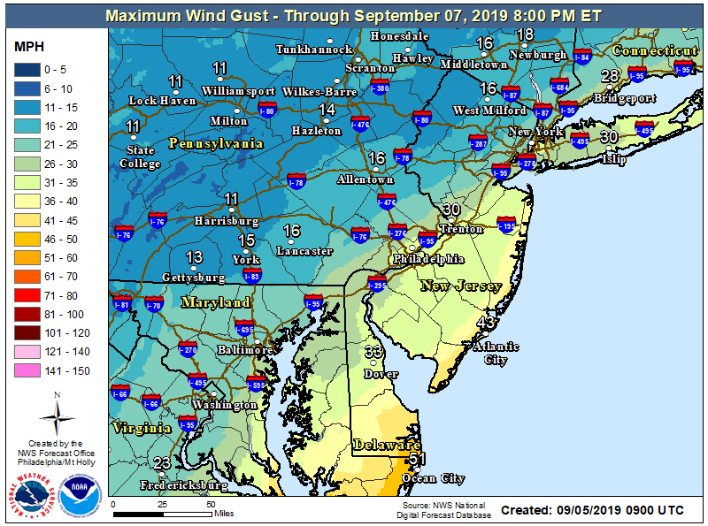
- Northeast winds are increasing to 35 to 55 mph, then turning north to northwest and diminishing at night.
![]()
- Seas will be at 4 to 6 feet and build to 9 to 14 feet through Friday, posing a flooding threat.
- High tide on the New Jersey and Delaware oceanfront occurs between 2 and 3 p.m. on Friday afternoon.
- Localized roadway flooding is expected at the Jersey Shore. Some roads may be closed due to high water.
- Rain – heavy to light at times – is expected in Central and South Jersey and the Jersey Shore.
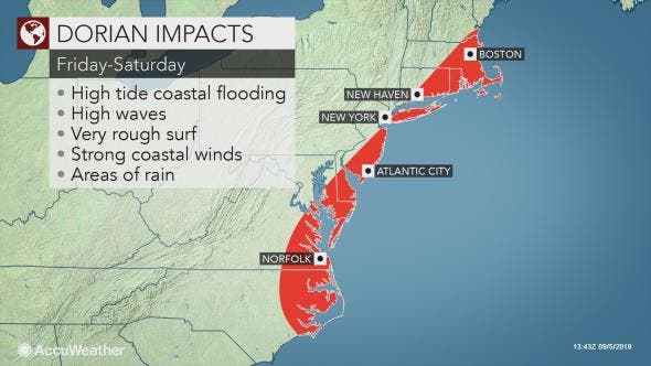
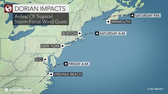
The mid-Atlantic and New England coasts will be spared a direct hit by Dorian as the eyewall is forecast to remain at sea, according to AccuWeather. The storm, currently moving at around 14 mph, is expected to continue to speed up in the coming days.
"Dorian will move off the northeast coast of North Carolina by midday Friday and then accelerate to the northeast," AccuWeather Hurricane Expert Dan Kottlowski said in a release.
The jet stream is expected to be strong enough to steer Dorian away from the United States coast and cause the storm's forward speed to increase dramatically, according to AccuWeather.
Still, tropical storm conditions are forecast for portions of the mid-Atlantic into Friday night and southeastern New England during Friday night and Saturday, according to AccuWeather. Minor coastal flooding and beach erosion with stiff winds will spread northward over the Delmarva Peninsula and South Jersey on Friday night.
Stormy conditions are likely as far north in the mid-Atlantic as Atlantic City, and Montauk, New York, according to AccuWeather.
Here is the forecast for the southern Jersey Shore:
- Friday: Showers likely before 1pm, then periods of rain after 1pm. High near 74. Breezy, with a northeast wind 21 to 24 mph, with gusts as high as 55 mph. Chance of precipitation is 80%. New precipitation amounts between a quarter and half of an inch possible.
- Friday night: Showers likely, mainly before midnight. Cloudy, then gradually becoming partly cloudy, with a low around 61. Breezy, with a north wind 14 to 21 mph, with gusts as high as 35 mph. Chance of precipitation is 60%. New precipitation amounts of less than a tenth of an inch possible.
Get more local news delivered straight to your inbox. Sign up for free Patch newsletters and alerts.