Weather
Snow Chance Doubles As Forecasters Update Maps, Guidance For President’s Day Storm Targeting NJ
The National Weather Service in Mt. Holly reports a change in the storm track has increased the chance of snow for Sunday into Monday.

The potential for snow has increased for Sunday evening through early Monday morning in Garden State as of 3 p.m. Saturday, according to the National Weather Service.
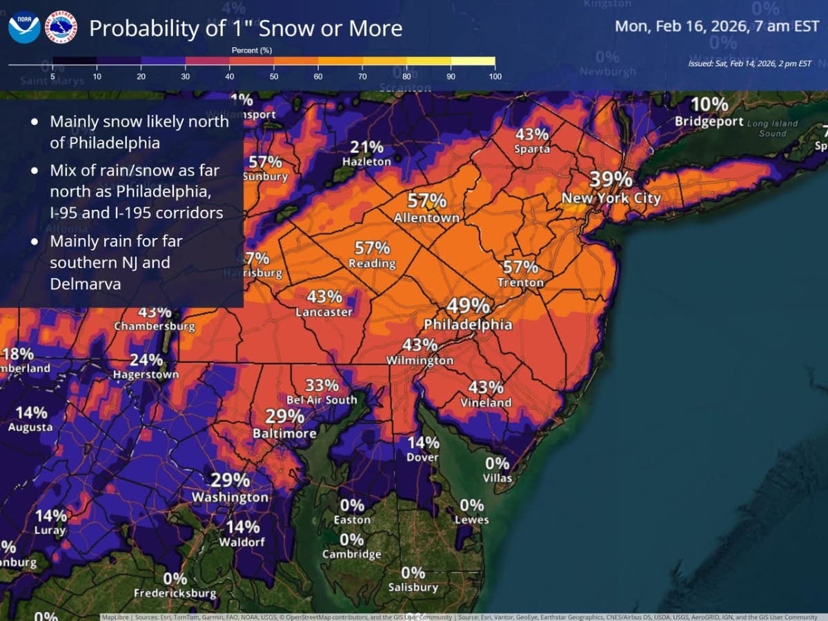
The best chance of snow accumulations will be from near the I-95 and I-195 corridors and north, where 1" or more of snow is possible. Mainly rain south of there, forecasters said.
The character of the snow will be wet and slushy, the kind that will stick to trees, ground, and power lines, but should tend to be slushy on the roads, the NWS said. Slippery roads could result for the Monday morning commute.
Find out what's happening in Mendham-Chesterfor free with the latest updates from Patch.
The chance of snow had increased for the Garden State as the storm track for Sunday’s storm has shifted north, but guidance showed only a 20 percent chance of widespread impacts. Those numbers doubled Saturday afternoon.
"We continue to monitor the low expected to pass to the south of the region Sunday into Monday," the National Weather Service said. "Details remain uncertain, but primarily rain is expected for the southern coastal plain with potentially some snow for areas further north."
Find out what's happening in Mendham-Chesterfor free with the latest updates from Patch.
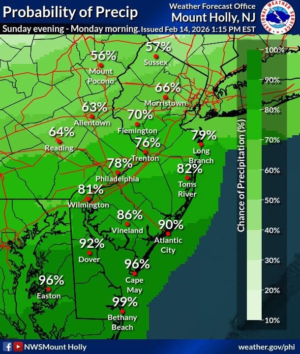
The heaviest precipitation is anticipated to affect the area on Sunday night, according to the National Weather Service. This precipitation is expected to taper off by Monday morning. "The big question remains how far north the precipitation gets," the National Weather Service added.

The forecast for Sunday indicates a slight chance of snow after 1 p.m., with partly sunny conditions and a high near 39 degrees. The chance of precipitation for Sunday is 20 percent. Sunday night brings a chance of snow, with mostly cloudy skies and a low around 28 degrees. New snow accumulation of around an inch is possible during Sunday night, and the chance of precipitation rises to 40 percent.
Looking ahead to Washington's Birthday, the forecast calls for partly sunny weather with a high near 42 degrees. Monday night is expected to be mostly cloudy with a low around 28 degrees. Tuesday will be partly sunny with a high near 48 degrees, followed by a mostly cloudy Tuesday night with a low around 33 degrees.
Wednesday introduces a chance of rain, with cloudy conditions and a high near 46 degrees, and a 50 percent chance of precipitation. Wednesday night also has a 50 percent chance of rain before 1 a.m. and a low around 35 degrees. The forecast for Thursday includes a chance of rain, mostly cloudy skies, and a high near 50 degrees, with a 30 percent chance of precipitation.
Get more local news delivered straight to your inbox. Sign up for free Patch newsletters and alerts.