Weather
More Bad Weather In N.J. Is Possible Thursday Night
Another round of thunderstorms could hit the region - much like the ones that knocked down trees and caused flooding on Wednesday.


Another round of thunderstorms could hit New Jersey on Thursday night - and they could resemble the storms that hit the region on Wednesday that caused flooding and knocked down trees.
The National Weather Service has issued severe thunderstorm warnings for parts of Burlington, Mercer, Monmouth and Ocean counties. A hazardous weather outlook has been issued for the rest of the state.
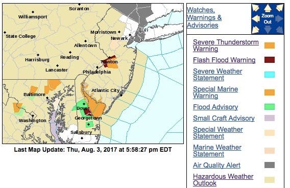
A severe thunderstorm was located over Columbus, or 10 miles south of Trenton, moving southeast at 5 mph.
Find out what's happening in Point Pleasantfor free with the latest updates from Patch.
- HAZARD...60 mph wind gusts and quarter size hail.
- SOURCE...Radar indicated.
- IMPACT...Minor damage to vehicles is possible. Expect damage to trees and power lines.
Elsewhere, scattered thunderstorms will continue through Thursday evening. A few of these storms could produce locally damaging winds.
These storms will also be moving slowly, resulting in locally heavy rainfall and the potential for flooding, especially in urban and poor drainage areas.
Find out what's happening in Point Pleasantfor free with the latest updates from Patch.
Tom Davis photo
Get more local news delivered straight to your inbox. Sign up for free Patch newsletters and alerts.