Crime & Safety
Did Tornadoes Touch Down In New Jersey? NWS Investigating
The National Weather Service is investigating whether tornadoes touched down in the middle of a damaging New Jersey thunderstorm.

The National Weather Service says it’s investigating whether reports of tornadoes touching down in the middle of a damaging New Jersey thunderstorm on Tuesday were, indeed, true.
Valerie Meola, a meteorologist with the National Weather Service in Mount Holly, said the agency - acting on a county government request - will do a survey of the Gloucester County area Wednesday to help determine whether a tornado did hit the area.
The investigation will look at the pattern of the storm’s destruction, and if it’s consistent with the damage typically caused by a tornado, Meola said.
Find out what's happening in Princetonfor free with the latest updates from Patch.
“We’re here for extra support,” she said.
Meola said the National Weather Service did not receive a request to investigate whether another possible tornado hit the Long Beach Island area - although she did see the video provided by an eyewitness showing a quick, destructive weather pattern hitting the Harvey Cedars shoreline.
Find out what's happening in Princetonfor free with the latest updates from Patch.
>>Related:
- WATCH: Possible Tornado Footage From Long Beach Island
- Tornado Rips Through South Jersey Tuesday Evening: Eyewitnesses
Meola acknowledged, however, that the quick-moving storm pattern that hit Harvey Cedars Tuesday could have been either a tornado or a downburst. A downburst can pack the punch of a tornado but without the hard-driving, spiraling winds.
The National Weather Service only investigates tornado activity if a local government agency requests it. No Ocean County official, as of 1 p.m. Wednesday, had requested a probe in the Long Beach Island area.
“It’s hard to make a determine just from the video, Meola said. “We know there was damage in that area.”
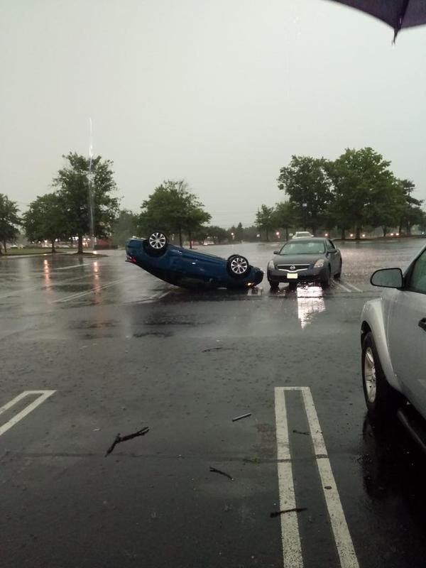
The storm packed strong winds in much of New Jersey on Tuesday, causing tens of thousands of people to lose power.
In Burlington County, more than 90,000 were without power, while more than 80,000 in Camden County, 68,000 in Gloucester County, 54,000 in Cape May County, 20,000 in Atlantic, 5,000 in Ocean County and 1,000 in Morris also dealt with outages.
Twitter users also reported the craziness that was unfolding in front of them:
“While I was driving a tree got struck right next to my car, caught on fire and hit the back of my car. I’m home now and safe” ~ Follow Matty B @mattbeltrann
A “Severe Thunderstorm Watch,” which covered 17 counties, was in place until 11 p.m., the National Weather Service said. The previous alert was supposed to end at 7 p.m.
The watch meant showers and thunderstorms were likely and could bring damaging wind gusts and hail, in addition to rain, according to the service. There was a potential in some areas for a few tornadoes, though in New Jersey, they are rare.
According to the National Weather Service’s Mount Holly office:
“AT 607 PM EDT...DOPPLER RADAR INDICATED A LINE OF SEVERE THUNDERSTORMS CAPABLE OF PRODUCING DESTRUCTIVE WINDS IN EXCESS OF 70 MPH. THESE STORMS WERE LOCATED ALONG A LINE EXTENDING FROM FEASTERVILLE-TREVOSE TO NEAR SOUTH PHILADELPHIA TO HOLLYWOOD BEACH... MOVING EAST AT 45 MPH. A WIND GUST OF 71 MPH OCCURRED AT THE PHILADELPHIA INTERNATIONAL AIRPORT.”
Get local news in your inbox from Patch. Find your town and sign up here.
(Photo: Twitter user @King_Juice_13)
Get more local news delivered straight to your inbox. Sign up for free Patch newsletters and alerts.