Traffic & Transit
Severe Thunderstorm Watch For North Jersey: See Map, Use Links To Track Storms
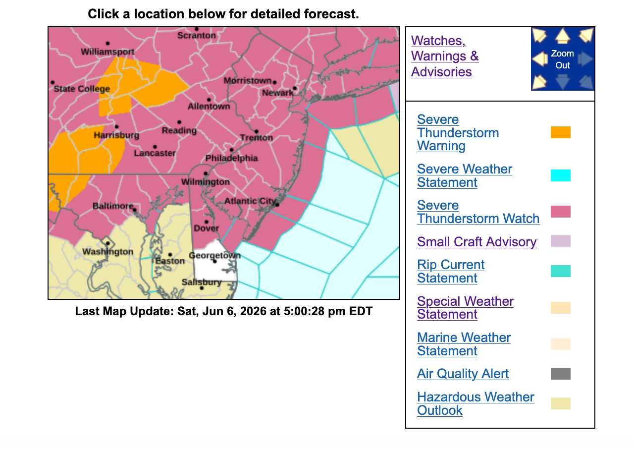
A severe thunderstorm watch has been issued for North Jersey as of Saturday evening.

As 90-degree heat descended on North Jersey, a line of thunderstorms was heading toward the Garden State on Saturday evening, forecasters said.
A severe thunderstorm watch was issued statewide late on Saturday.
A line of severe storms was seen in Pennsylvania, heading east, before 6 p.m. See a link to the radar below.
Find out what's happening in Ridgewood-Glen Rockfor free with the latest updates from Patch.
The rest of the weekend will be sunny and dry, with wind gusts, the NWS said.
The skies and forecast can change rapidly, so use the links below to see the radar and more.
Find out what's happening in Ridgewood-Glen Rockfor free with the latest updates from Patch.
If you see the Northern Lights from North Jersey, send a photo to Patch.
Local Links To Track Storms
- Keep an eye on the radar here.
- Check out the Accuweather Minutecast here.
- See a current map of all watches and warnings in New Jersey here.
- The NOAA (National Oceanic and Atmospheric Administration) keeps us informed about larger weather events. Follow them here.
Updated NWS forecasts, watches, and warnings in each county:
What about the rivers? This NWS map of the United States will show the potential for river flooding.
Get more local news delivered straight to your inbox. Sign up for free Patch newsletters and alerts.