Weather
Severe Thunderstorm Warnings Issued Across NJ
Forecasters say some storms could turn severe this afternoon, with the biggest threats being damaging winds and a possible isolated tornado.

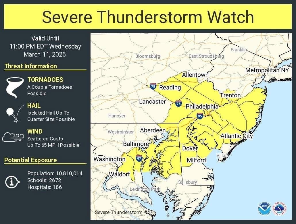
Severe thunderstorm warnings have been issued across a large swath of the Garden State Wednesday night, according to the National Weather Service.
Morris, Salem, Somerset, Warren, Camden, Hunterdon, Cumberland, and Gloucester counties are under the warning until 9:15 p.m.
Forecasters say the storms are capable of damaging winds, large hail and an isolated tornado are possible as this powerful cold front moves through.
Find out what's happening in South Brunswickfor free with the latest updates from Patch.
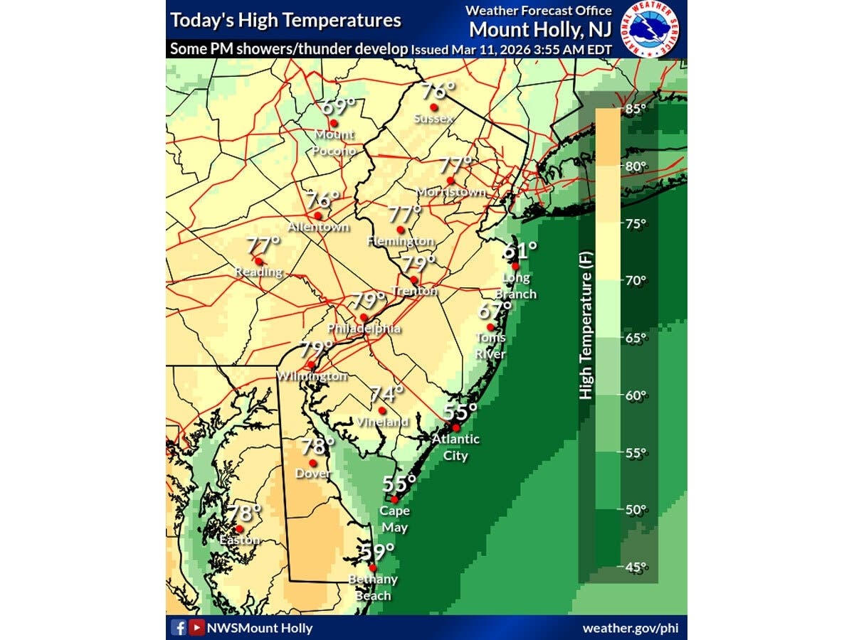
"Today is the last day of this very warm stretch," the NWS said. "Some showers and thunderstorms should arrive later this afternoon, and some storms could turn severe. The severe weather risk will depend on how quickly storms arrive and their coverage."
Temperatures will push into the upper 60s to mid-70s inland before storms arrive. Record highs are within reach — Newark already broke its March 10 record Tuesday, hitting 82 degrees.
Find out what's happening in South Brunswickfor free with the latest updates from Patch.
The weather service said it cannot rule out quarter- to half-inch hail and an isolated tornado, with wind gusts between 60 and 70 mph when storms move through.
On Thursday temperatures will tumble from the 60s in the morning to the 40s in the afternoon to near 30 at night — with scattered rain possibly transitioning to a wintry mix or snow by Thursday afternoon. The weekend looks seasonable, with highs recovering into the low-to-mid 50s.
Here’s the forecast:
- Wednesday afternoon: Sunny to partly cloudy, highs 72-77 inland / 63-68 Shore. Winds gusting 20-30 mph.
- Wednesday evening: Showers and possible severe thunderstorms. Wind gusts to 70 mph. Isolated tornado cannot be ruled out.
- Overnight: Temps hold in the low 60s. Occasional showers between storm bands.
- Thursday morning: Cold front sweeps northwest to southeast. Rain, possible thunder, strong gusts.
- Thursday afternoon: Temps crashing from 60s to 40s. Rain may mix with or transition to snow, especially in southern NJ.
- Thursday night: Low near 30 degrees.
- Friday: Cool and breezy. Highs in the mid-40s.
Have a correction or news tip? Email sarah.salvadore@patch.com
Get more local news delivered straight to your inbox. Sign up for free Patch newsletters and alerts.