Weather
NJ Hurricane Season 2017 Could Be Worse Than Usual: Forecast
The forecast conflicts with another one released last month, saying New Jersey could be in the line of fire this year.

A new forecast says the 2017 hurricane season could be worse than normal — and the potential impact on New Jersey could be increasingly troublesome.
The Weather Channel says the 2017 Atlantic hurricane season, which begins June 1 and ends Nov. 30, will be more active than usual, and the number of named storms and hurricanes should be higher than usual.
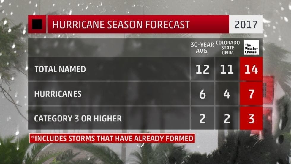
The report conflicts with the 2017 Atlantic forecast released Thursday from Colorado State University, which says the number of named storms and hurricanes will likely be below historical averages.
Find out what's happening in Toms Riverfor free with the latest updates from Patch.
A total of 14 named storms — seven hurricanes and three major hurricanes — are expected this season, which is higher than the 30-year average (1981-2010) for the Atlantic basin, according to The Weather Channel. It would be a slight drop from last year, when there were 15 named storms, seven hurricanes and four major hurricanes.
Putting it in context, however, 2016 was he costliest season since 2012, and it was the deadliest since 2008, according to forecasters.
Find out what's happening in Toms Riverfor free with the latest updates from Patch.
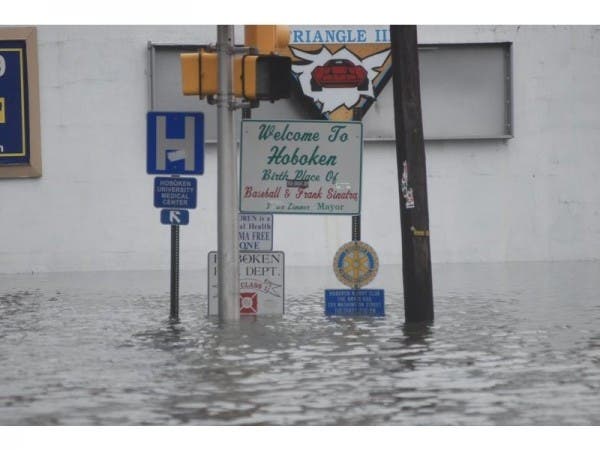
While New Jersey has suffered few direct hits over the past 100 years — the most notable being Superstorm Sandy in 2012 — the National Weather Service says the state should be increasingly worried about the potential impact of these storms.
Even if the storms don't hit New Jersey directly, the rising sea levels caused by climate change could cause a devastating flooding impact on the state — even if the storm lands as far south as South Carolina and Florida, according to the NWS.
"Climate change exacerbates any flooding concerns," said Joe Miketta, meteorologist with the National Weather Service. "We could have an increase in the potential for problems."
The Weather Company increased its forecast compared to the one issued in April because of a couple of factors:
- Warmer sea-surface temperatures have been observed in the North Atlantic, which have correlated with more active seasons in the past. In addition, there are indications that further warming is likely.
- There is a reduced potential for the development and strength of El Niño later this summer.
Given the current trends, according to The Weather Channel, there is the potential for another increase with the next update in June.
"The historically strong North Atlantic blocking event in early May also suggests the possibility of continued increases in North Atlantic sea-surface temperature anomalies, so it would be no surprise if we increased our forecast numbers again," Todd Crawford, chief meteorologist with The Weather Company, said on the website.
Patch file photo
Get more local news delivered straight to your inbox. Sign up for free Patch newsletters and alerts.