Weather
NJ Storm Aftermath: 24K Without Power After 58-MPH Wind, Flooding
Downed wires and trees and flooding were reported throughout the state. Find out what towns got hit the worst, and still don't have power.

Persistent rain, 58-mph winds and other weather-related problems left 24,000 without power across New Jersey on Sunday. A number of towns were also dealing with downed trees, downed wires and flooding issues after a storm that resembled a nor'easter blew through.
Some towns such as Toms River have as many as 1,900 without power, and Patch has the whole list of towns without outages (see below).
More bad weather was expected later Sunday. Patch also has the forecast, videos of towns with flooding and the wind speeds reported in many communities.
Find out what's happening in Toms Riverfor free with the latest updates from Patch.
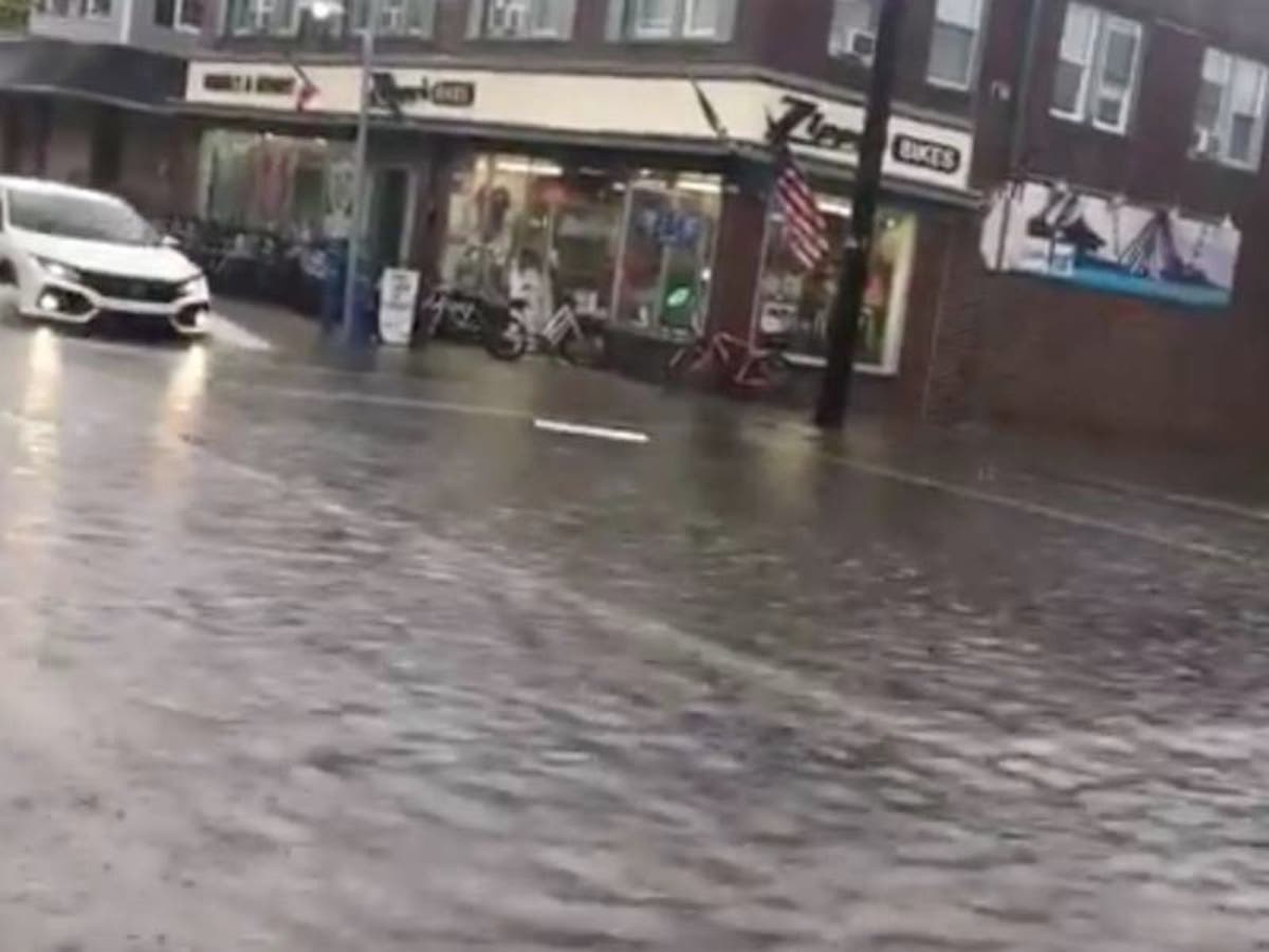
Flooding was also happening in certain parts of the state, such as Wildwood, Sea Isle City and Avalon. The George Redding Bridge was closed because of flooding.
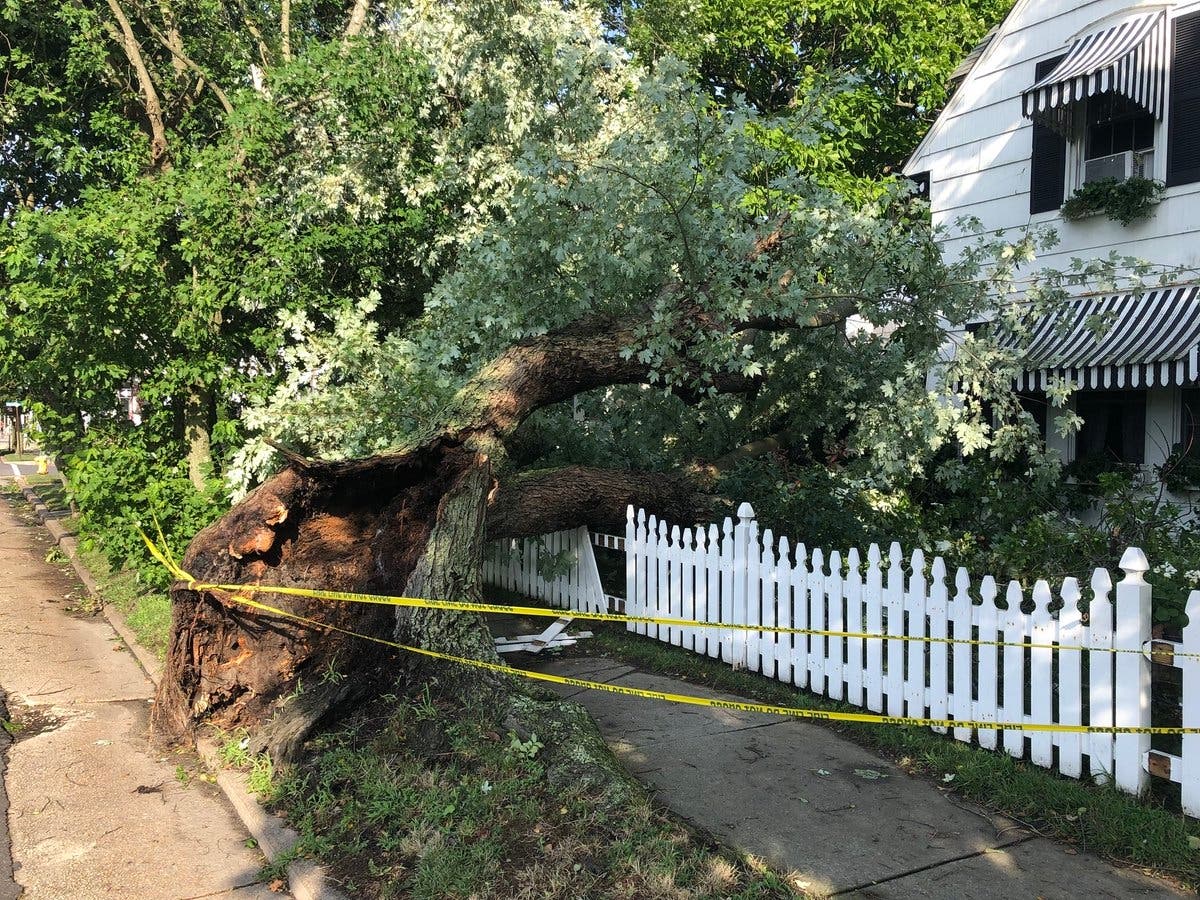
Here is one of the many downed trees in Ventnor:
Find out what's happening in Toms Riverfor free with the latest updates from Patch.
Here is the list of towns without power:
- TOMS RIVER TOWNSHIP 1,904
- WASHINGTON TOWNSHIP 1,666
- WALL TOWNSHIP 1,348
- OLD BRIDGE TOWNSHIP 1,257
- HOWELL TOWNSHIP 1,101
- LEBANON TOWNSHIP 1,051
- KEANSBURG BOROUGH 866
- BRICK TOWNSHIP 776
- LIBERTY TOWNSHIP 759
- MILLSTONE TOWNSHIP 662
- INDEPENDENCE TOWNSHIP 610
- ABERDEEN TOWNSHIP 598
- MARLBORO TOWNSHIP 590
- KNOWLTON TOWNSHIP 575
- MONROE TOWNSHIP 538
- MOUNT OLIVE TOWNSHIP 514
- COLTS NECK TOWNSHIP 502
- MIDDLETOWN TOWNSHIP 449
- HOLMDEL TOWNSHIP 423
- SPRINGFIELD TOWNSHIP 364
- MANSFIELD TOWNSHIP 342
- UPPER FREEHOLD TOWNSHIP 339
- MENDHAM BOROUGH 315
- MANALAPAN TOWNSHIP 305
- NEW PROVIDENCE BOROUGH 298
- PLUMSTED TOWNSHIP 297
- TINTON FALLS BOROUGH 282
- MOUNTAIN LAKES BOROUGH 260
- MENDHAM TOWNSHIP 247
- DENVILLE TOWNSHIP 218
- EAST ORANGE CITY 200
- CALIFON BOROUGH 187
- NORTH PLAINFIELD BORO 175
- PLAINFIELD CITY 158
- Fairfield Twp 156
- FARMINGDALE BOROUGH 155
- BERKELEY HEIGHTS TOWNSHIP 143
- LAKEWOOD TOWNSHIP 139
- BLAIRSTOWN TOWNSHIP 137
- JACKSON TOWNSHIP 130
- PISCATAWAY TWP 122
- BERNARDS TOWNSHIP 118
- MATAWAN BOROUGH 116
- BAYONNE CITY 113
- HOPE TOWNSHIP 105
- COLLINGSWOOD BORO 99
- EDISON TWP 97
- ROOSEVELT BOROUGH 94
- Millville City 94
- WASHINGTON BOROUGH 89
- PEMBERTON TOWNSHIP 81
- EAST BRUNSWICK TWP 81
- ROBBINSVILLE TOWNSHIP 74
- SCOTCH PLAINS TWP 74
- CLIFTON CITY 73
- Glassboro Boro 72
- RIVER VALE TWP 70
- Estell Manor City 66
- FREEHOLD TOWNSHIP 63
- EAST AMWELL TOWNSHIP 59
- SUMMIT CITY 59
- RARITAN TOWNSHIP 58
- LACEY TOWNSHIP 58
- CARTERET BORO 58
- Hammonton Town 54
- WARREN TOWNSHIP 53
- MANCHESTER TOWNSHIP 48
- EAST WINDSOR TOWNSHIP 46
- POINT PLEASANT BOROUGH 46
- BERNARDSVILLE BOROUGH 46
- WASHINGTON TOWNSHIP 45
- BRIELLE BOROUGH 44
- FLORHAM PARK BOROUGH 44
- ROCKAWAY TOWNSHIP 44
- Stratford Boro 42
- CRANBURY TWP 41
- MAPLEWOOD TWP 40
- FANWOOD BORO 39
- CHESTERFIELD TOWNSHIP 38
- EATONTOWN BOROUGH 38
- CHESTER TOWNSHIP 38
- VERNON TOWNSHIP 37
- Egg Harbor Twp 36
- ENGLISHTOWN BOROUGH 35
- WOODBRIDGE TWP 35
- Paulsboro Boro 34
- NORTH HANOVER TOWNSHIP 32
- BOONTON TOWN 32
- WEST LONG BRANCH BOROUGH 31
- Washington Twp 30
- SPRINGFIELD TOWNSHIP 28
- ESSEX FELLS BORO 28
- Lindenwold Boro 28
- UNION TOWNSHIP 27
- HOPATCONG BOROUGH 27
- Hamilton Twp 27
- HACKETTSTOWN TOWN 24
- NORTH BRUNSWICK TWP 24
- NEW HANOVER TOWNSHIP 22
- GLEN GARDNER BOROUGH 22
- SPRING LAKE HEIGHTS BOROUGH 21
- BERKELEY TOWNSHIP 21
- PERTH AMBOY CITY 21
- Elk Twp 21
- Pittsgrove Twp 21
- WATCHUNG BORO 20
- Margate City 20
- Ventnor City 20
- HARDING TOWNSHIP 19
- JERSEY CITY 18
- HAZLET TOWNSHIP 17
- Ocean City 17
- EAST BRUNSWICK TOWNSHIP 16
- LONG BRANCH CITY 15
- PALISADES PARK BORO 15
- NEWARK CITY 14
- RAHWAY CITY 14
- MONTCLAIR TWP 13
- CRANFORD TWP 13
- Evesham Twp 13
- BARRINGTON BORO 12
- LINDEN CITY 12
- ALLAMUCHY TOWNSHIP 10
- Middle Twp 10
- BETHLEHEM TOWNSHIP 9
- OCEANPORT BOROUGH 9
- BOONTON TOWNSHIP 9
- JEFFERSON TOWNSHIP 9
- SOUTH BRUNSWICK TWP 9
- Mullica Twp 9
- ENGLEWOOD CITY 8
- METUCHEN BORO 8
- KENILWORTH BORO 8
- Pleasantville City 8
- DEAL BOROUGH 7
- GLEN ROCK BORO 7
- HADDONFIELD BORO 7
- ALLENHURST BOROUGH 6
- OCEAN TOWNSHIP 6
- WEST MILFORD TOWNSHIP 6
- Carneys Point Twp 6
- ALEXANDRIA TOWNSHIP 5
- CLINTON TOWNSHIP 5
- KINGWOOD TOWNSHIP 5
- HADDON HEIGHTS BORO 5
- WESTFIELD TOWN 5
- Upper Deerfield Twp 5
Here are some of the highest wind speeds:
Atlantic County
- Pleasantville Point 51
- Atlantic City Intern 47
- Forsythe 45
- Nacote Creek NERRS 44
- Mullica Twp. 40
Burlington County
- McGuire AFB 40
Cape May County
- Ocean City 49
Cumberland County
- Fortesque 41
Middlesex County
- Perth Amboy 42
Monmouth County
- Sandy Hook 51
- Sea Girt 48
- Allaire Airport 41
- Cream Ridge 40
Ocean County
- Tuckerton 58
- Harvey Cedars 46
- Seaside Heights 43
- Mantoloking 43
- Barnegat Inlet 42
- Rutgers 42
- North Beach Haven 41
- Trixies 41
- Island Heights 40
- Beach Haven 40
Sussex County
- High Point Monument 41
Here are the flooding issues around the state:
Conditions in Wildwood less than desirable for a Saturday in late July. pic.twitter.com/Bqqji5fvFH
— Joe Holden (@JoeHoldenCBS3) July 21, 2018
#FirstAlert Weather Update in Wildwood, NJ ☔️ Pacific Ave & Spicer #IThinkWereGonnaNeedABiggerBoat @NBCPhiladelphia @6abc @weatherchannel @HurricaneNBC10 @FOX29philly @phl17 pic.twitter.com/Cpj62047Lg
— Philly Sports Digest (@PhSportsDigest) July 21, 2018
Some moderate flooding along Ocean Drive in Avalon. pic.twitter.com/GWnpfsSuRK
— Ann Delaney (@AnnDelaneyBeach) July 21, 2018
Flooding in #seaislecity, #nj. @6abc pic.twitter.com/f2LdA73xA0
— Ryan Lingo (@ryanclingo) July 21, 2018
~In addition to the heavy rain and isolated tornado threat in NJ tomorrow, strong winds will also be the case! Winds will gust 35-45mph, occasional gusts reaching 50mph+ for the coast and in embedded thunderstorms. pic.twitter.com/0vDQzYTEu5
— BLIZZARD Bronsky(@NJoutdoors11) July 20, 2018
I would bet the house that there will be waterspouts and potentially weak tornadoes along the NJ Coast tomorrow afternoon and evening. Tremendous amount of low level shear and a tongue of instability with tropical moisture. #njwx pic.twitter.com/KXTbqj209A
— John Homenuk (@jhomenuk) July 20, 2018
While our coastal hybrid begins to take shape, we may have to watch for the potential for a tornado or two along the NJ/DE coast tomorrow evening. Hi-res models have been hinting at a line of thunderstorms moving in with impressive dynamics aloft #njwx #nywx pic.twitter.com/gw3sEgCzOF
— Steve Copertino (@TheSteveCop) July 20, 2018
Here is the forecast:
- Sunday: Showers likely, with thunderstorms also possible after 8am. Mostly cloudy, with a high near 80. South wind 13 to 16 mph. Chance of precipitation is 60%. New rainfall amounts between a tenth and quarter of an inch, except higher amounts possible in thunderstorms.
- Sunday night: Showers likely and possibly a thunderstorm. Cloudy, with a low around 74. South wind around 14 mph. Chance of precipitation is 60%. New rainfall amounts between a quarter and half of an inch possible.
Photo courtesy of Philly Sports Digest @PhSportsDigest
Get more local news delivered straight to your inbox. Sign up for free Patch newsletters and alerts.