Community Corner
Sandy, Then And Now: Photos From The Storm And Rebuilding
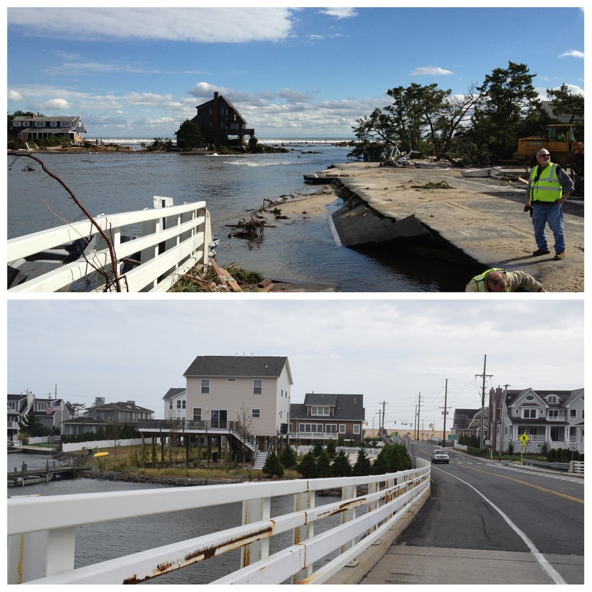
A Toms River police officer shares photos he took during Superstorm Sandy, side-by-side with photos showing those sites now, 5 years later.


It seems hard to believe that it's been five years since Superstorm Sandy plowed into the Jersey Shore. For many, life has resumed some sense of normalcy. Homes have been repaired, daily routines have returned.
For others, however, going home remains elusive. Some have given up entirely, abandoning homes or putting what had been their patch of heaven on the market, hoping someone will buy their plot of land so they can put the storm behind them forever.
Toms River Police Cpl. Christopher Raia was on duty as Superstorm Sandy hit the Jersey Shore five years ago and snapped a number of photos of what he saw as the storm hit and as he patroled during its aftermath. Raia, who is now retired, was trapped on the island for the entire storm, according to the Toms River Police Benevolent Association.
Find out what's happening in Toms Riverfor free with the latest updates from Patch.
Recently, he went back to those sites to take updated photos that show how they look today, and has generously shared those photos with media outlets. We've shared them here.
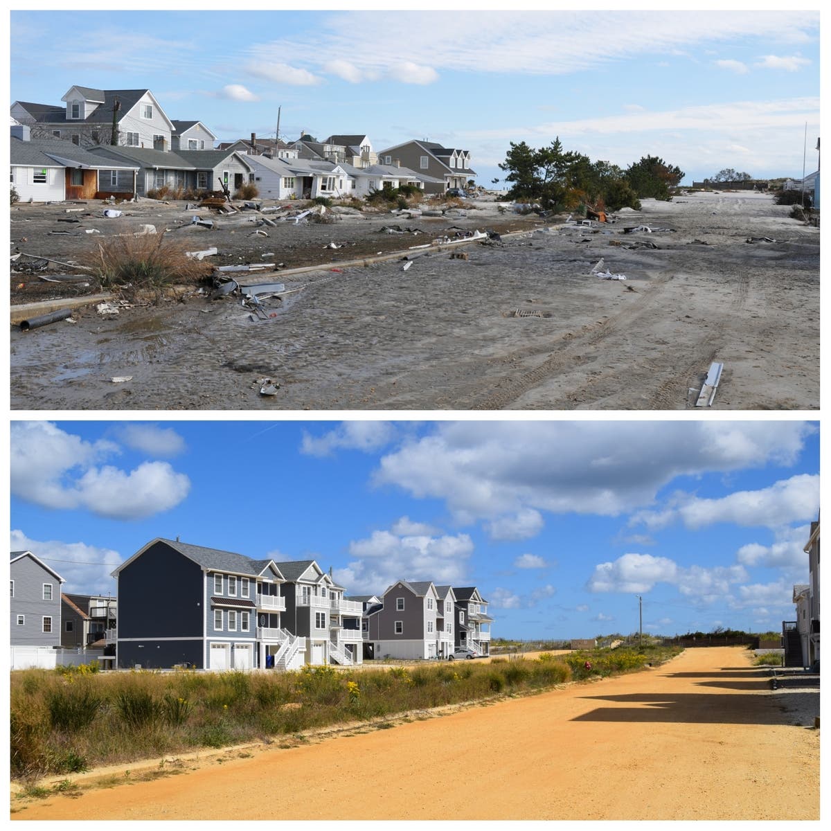
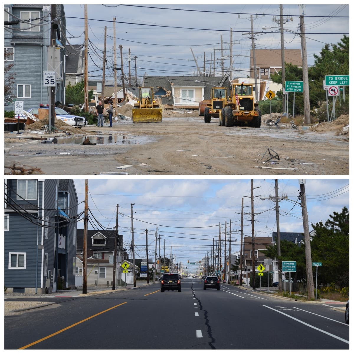
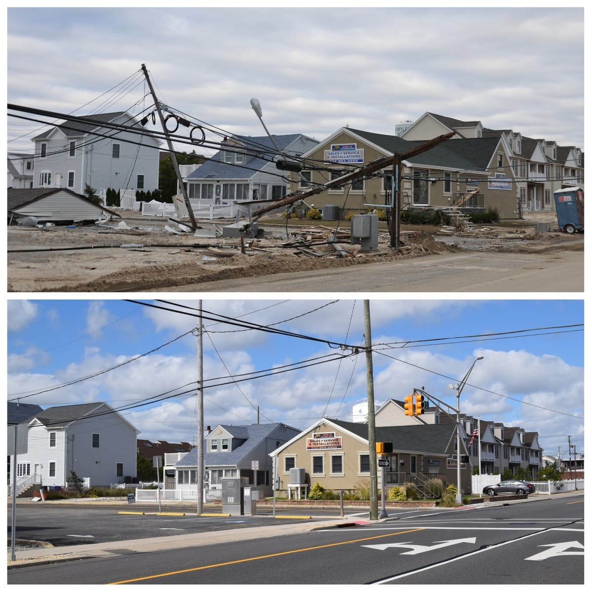

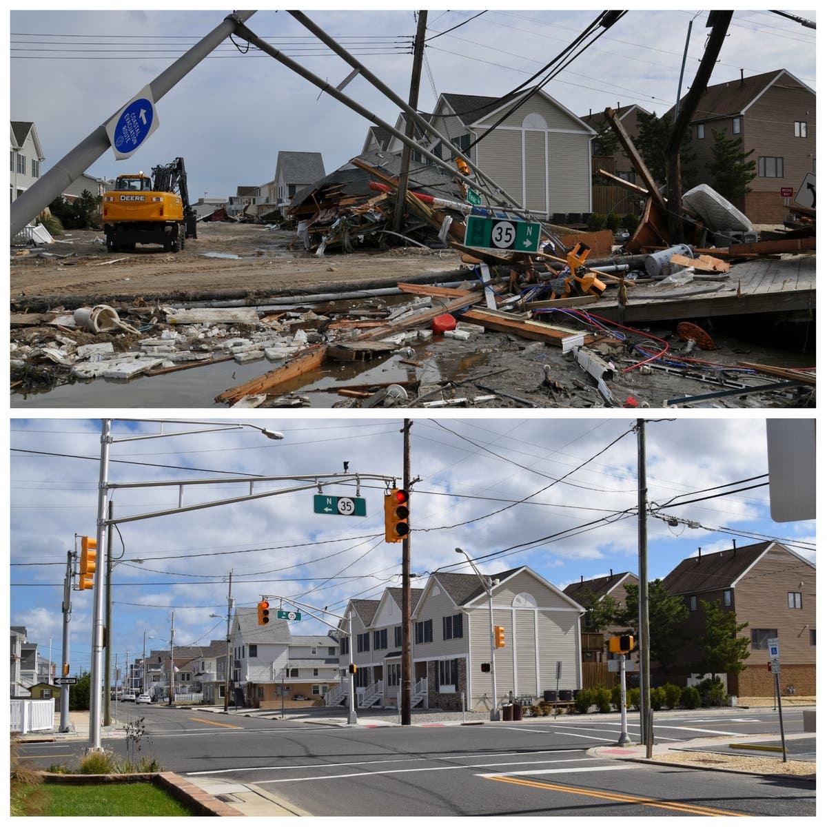
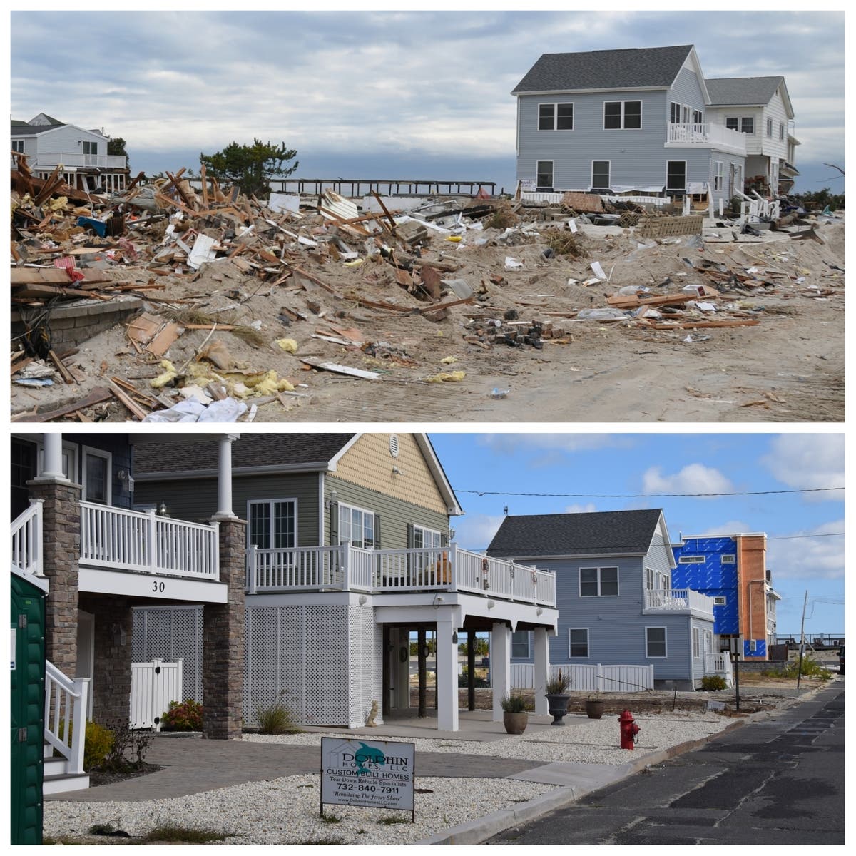
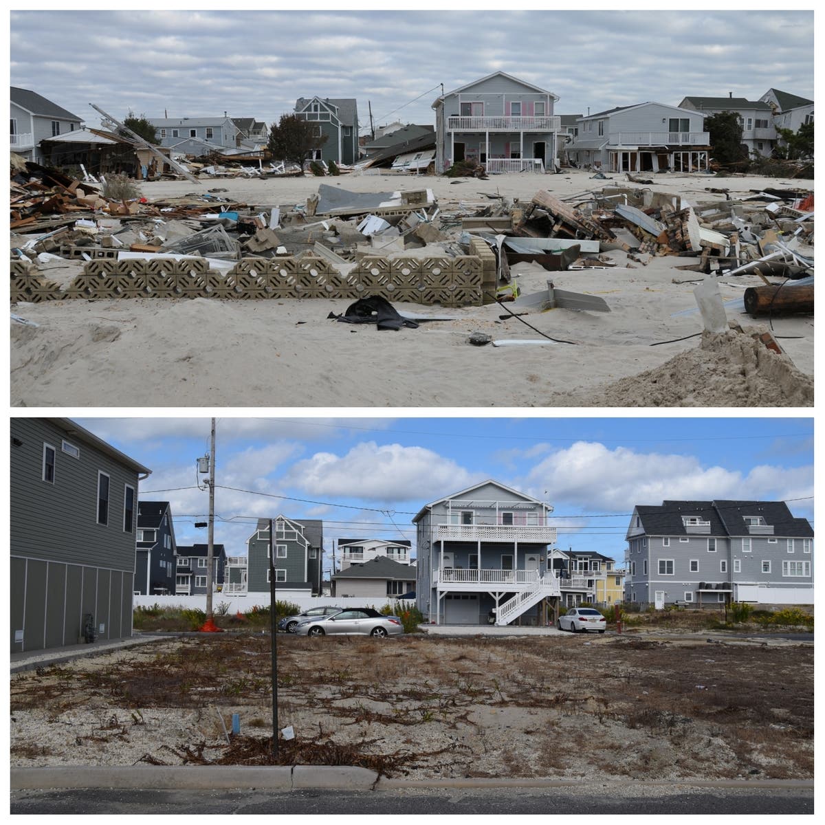
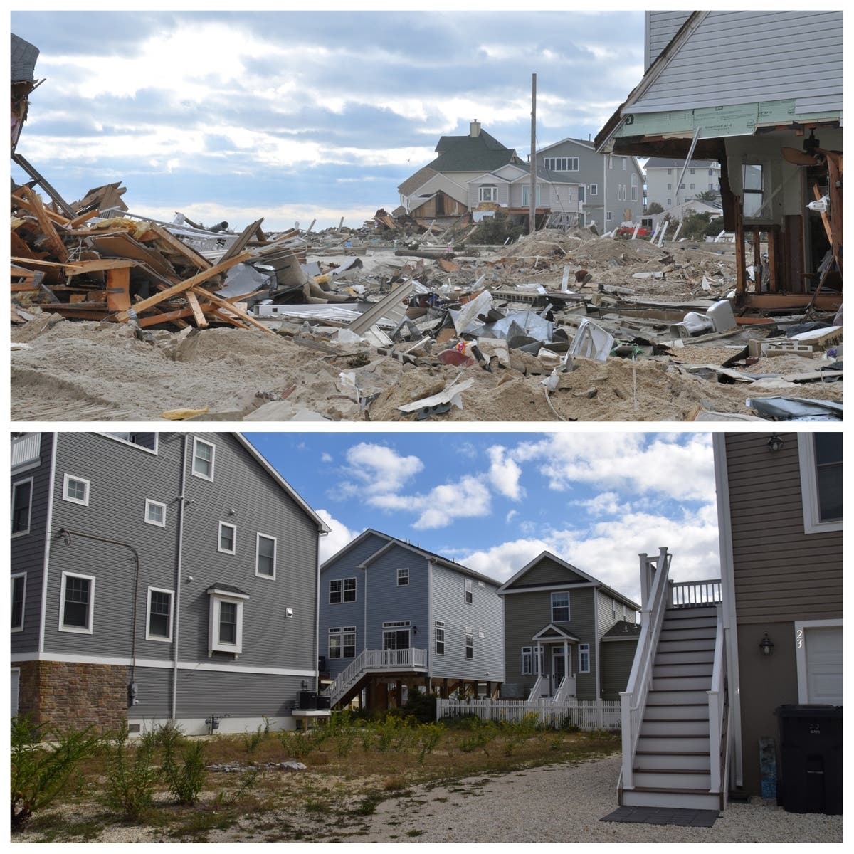


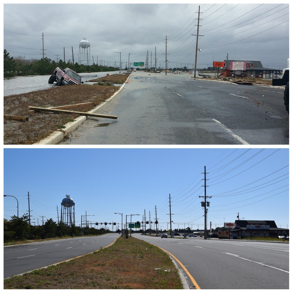
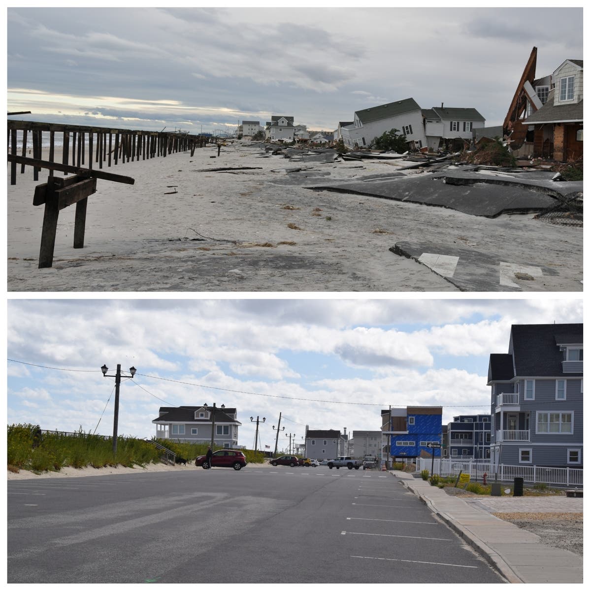
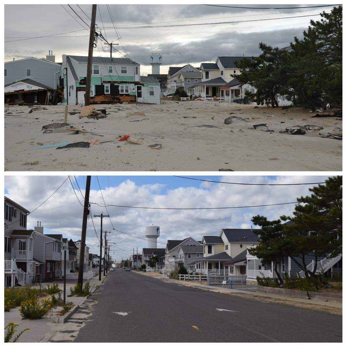

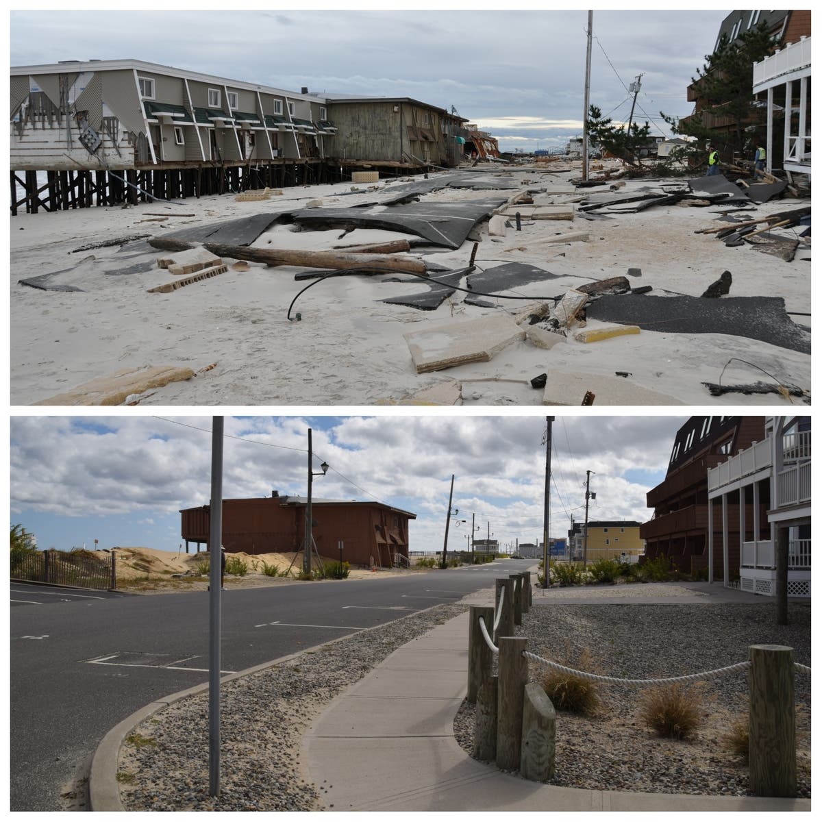

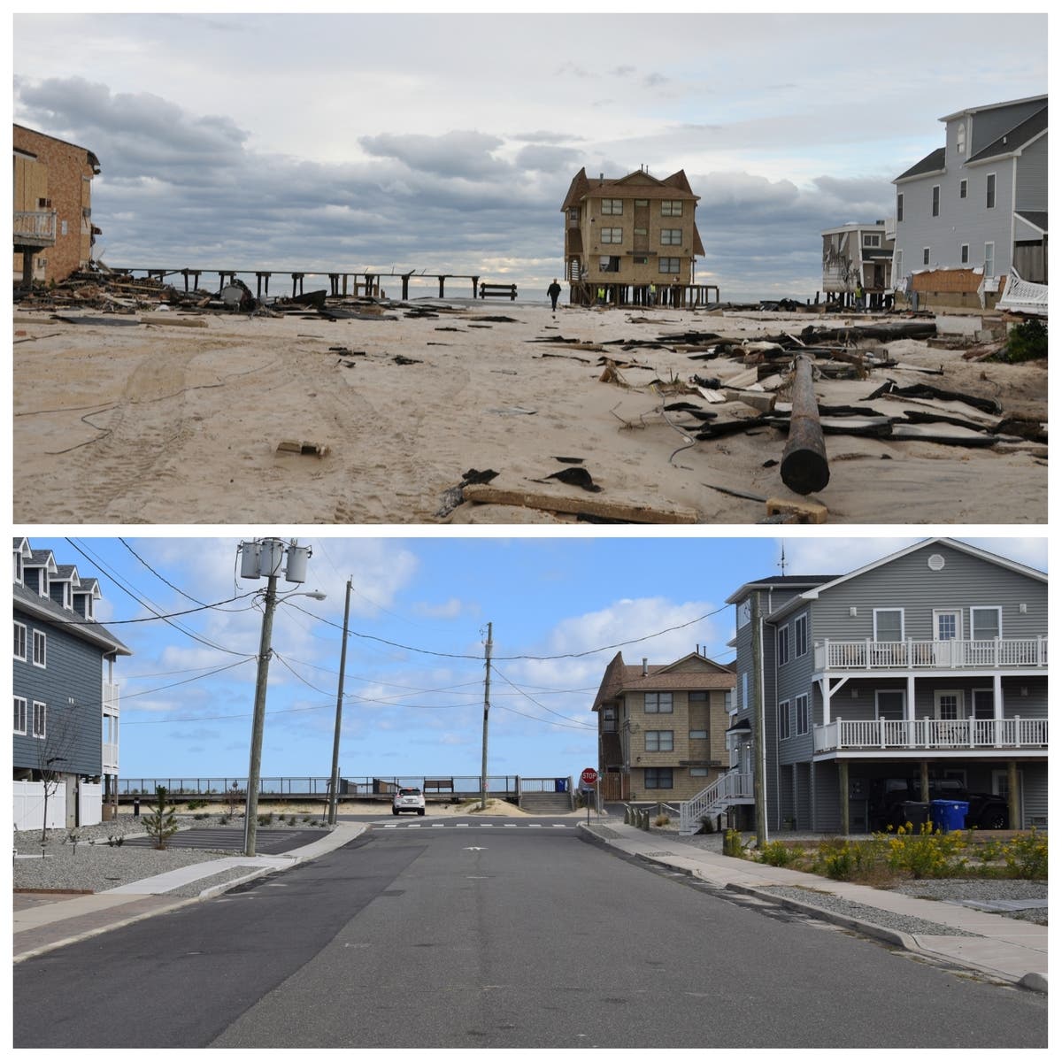
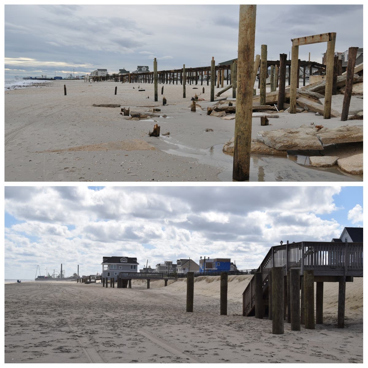
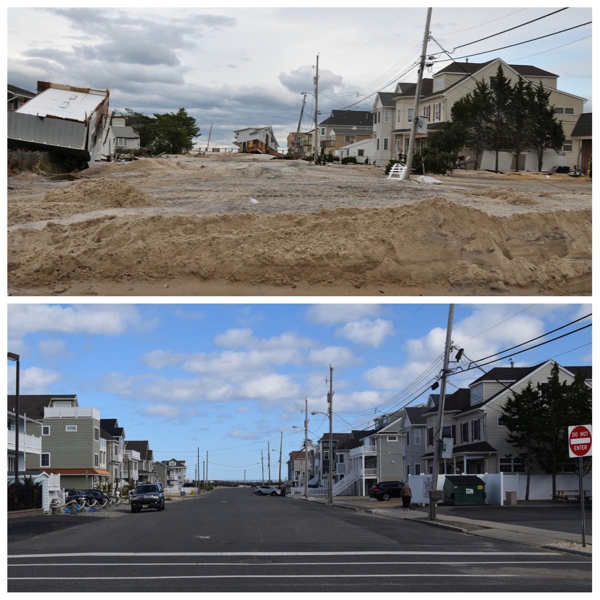
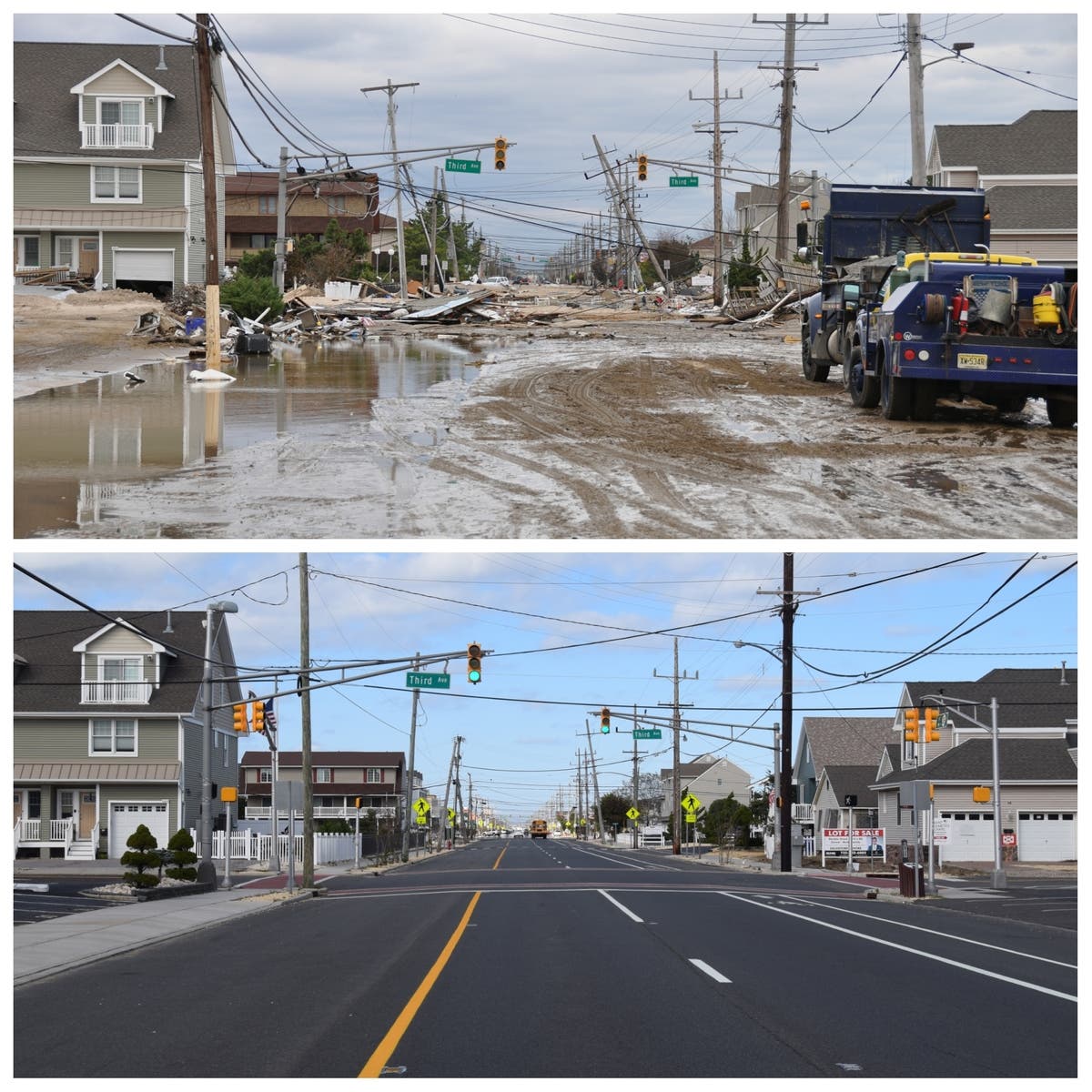


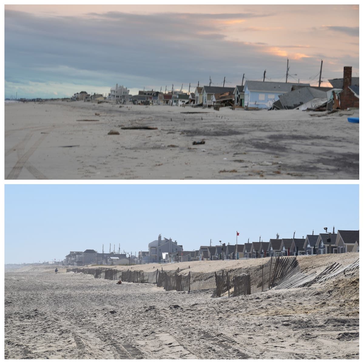
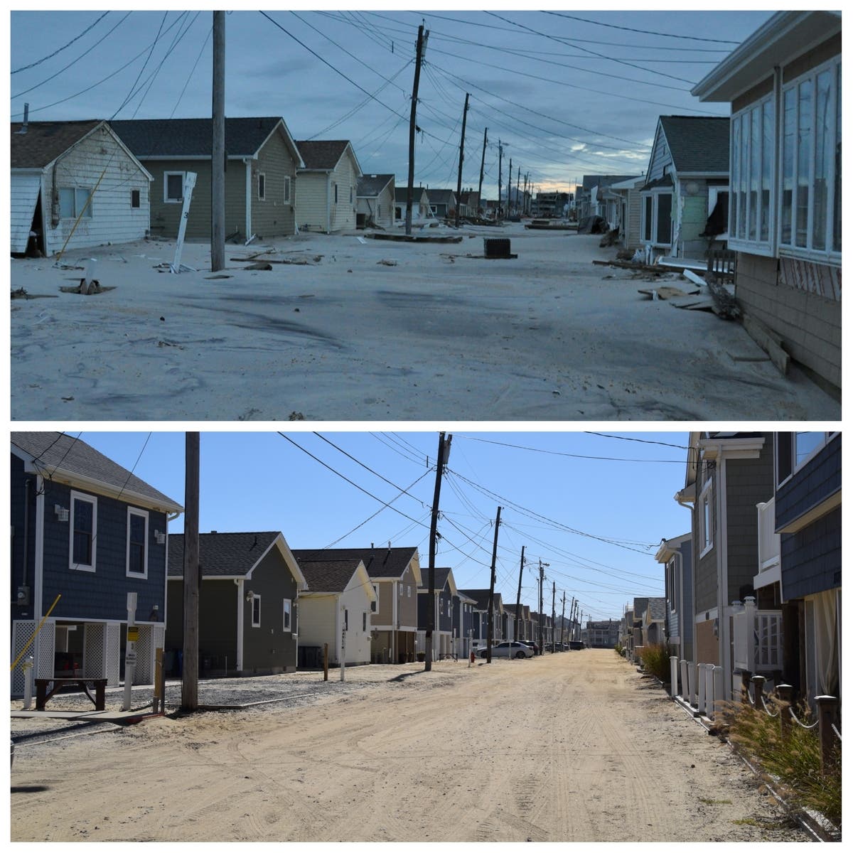

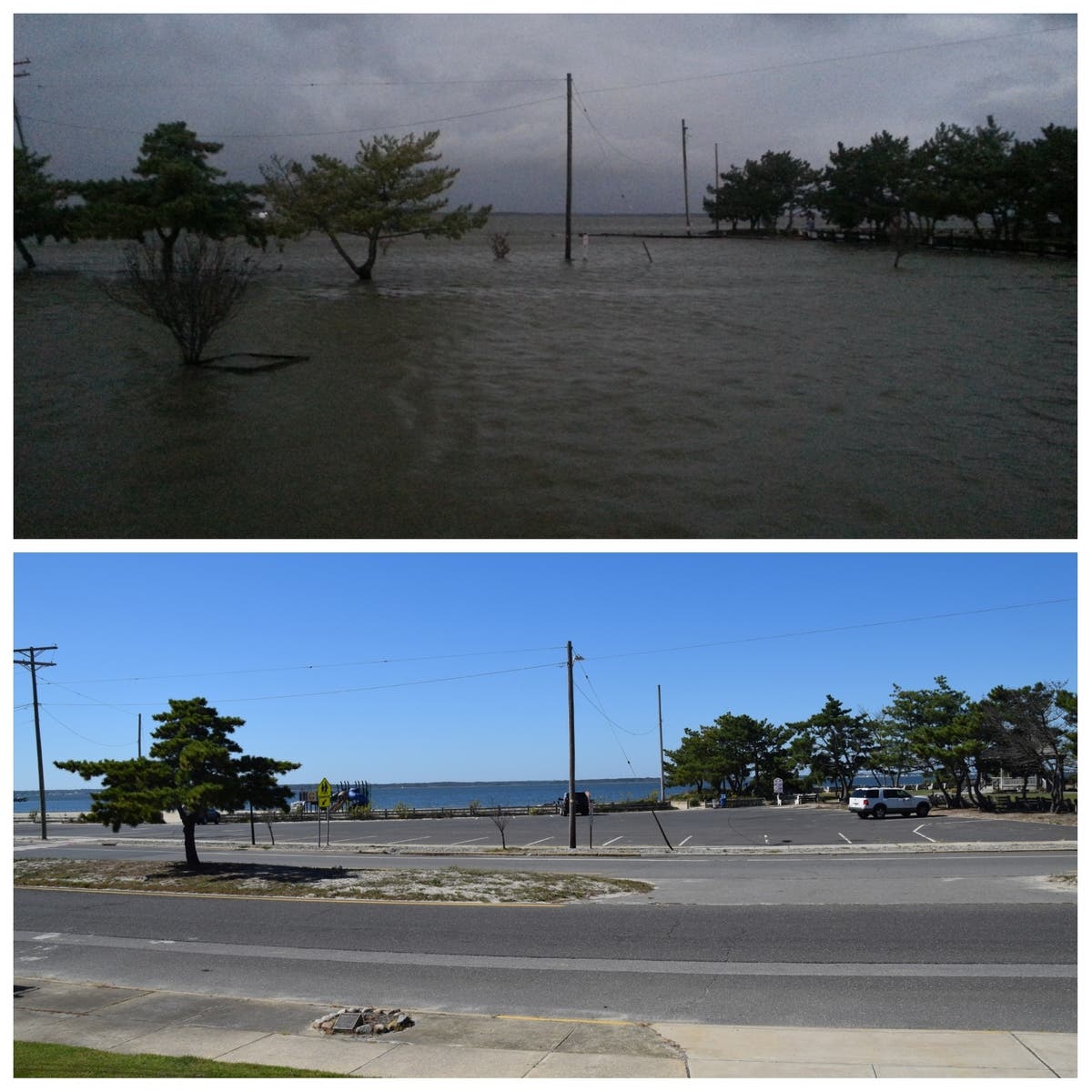
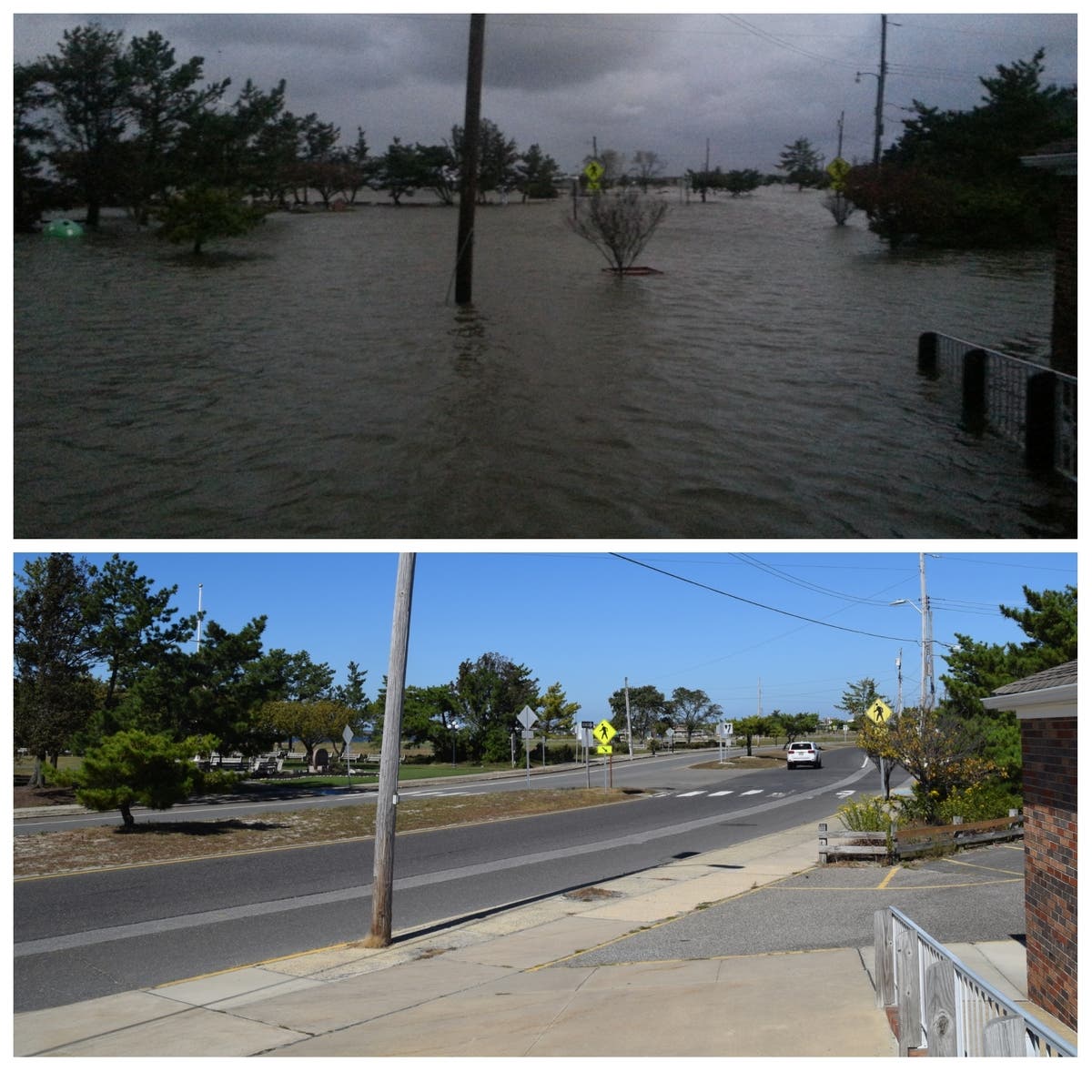
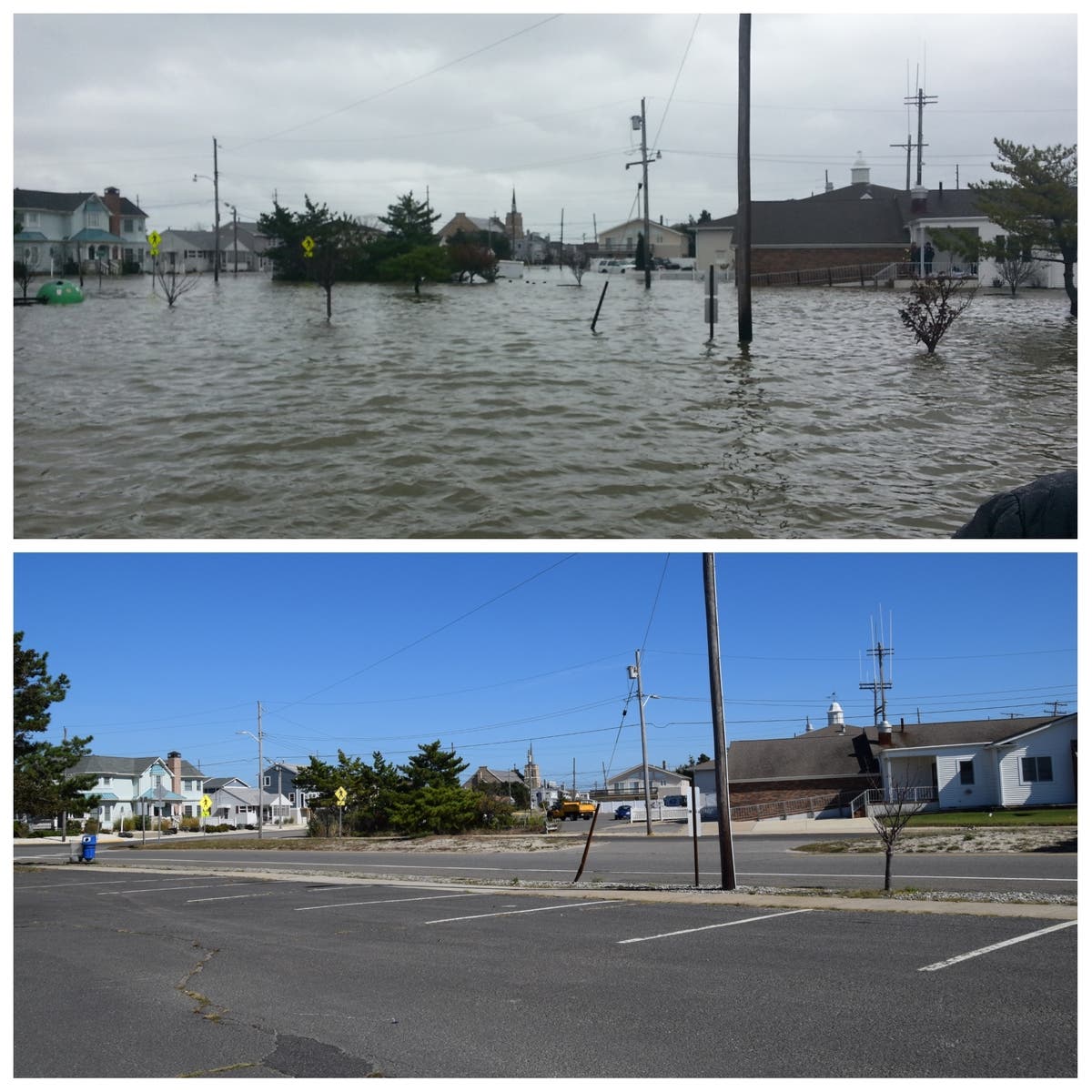
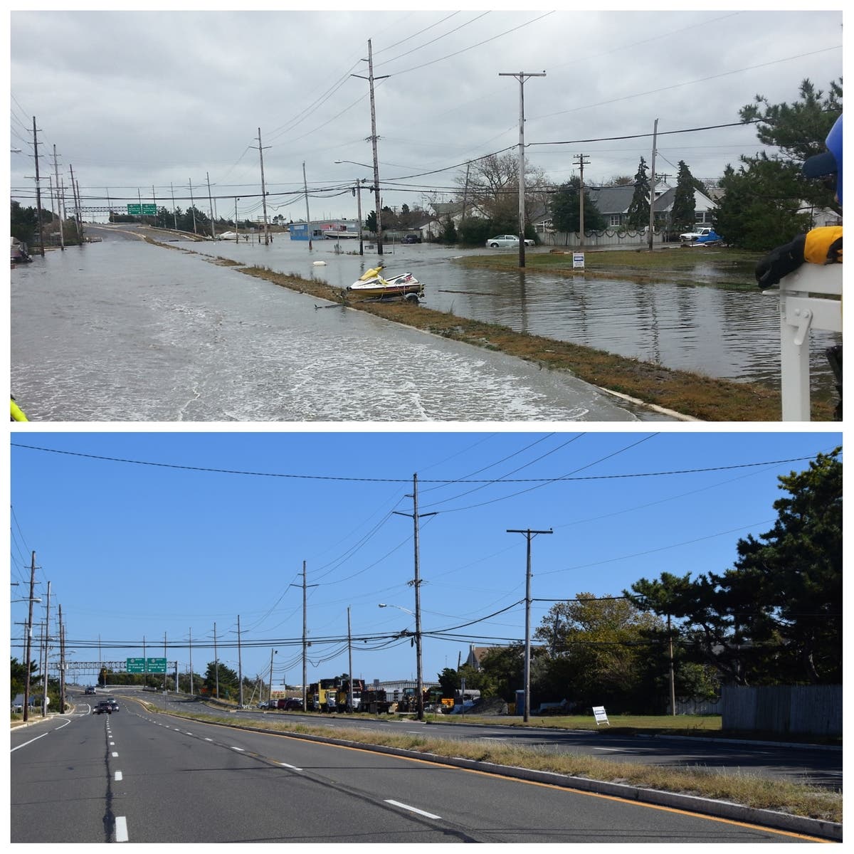
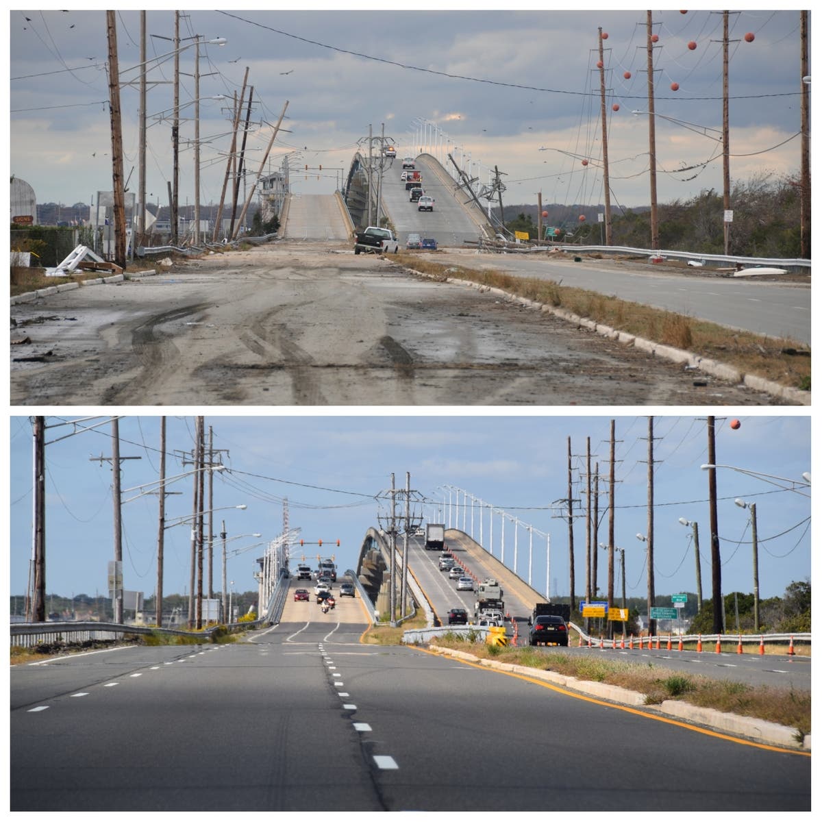
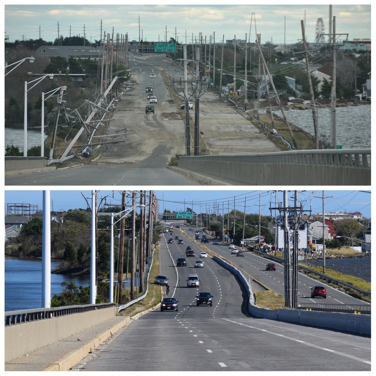
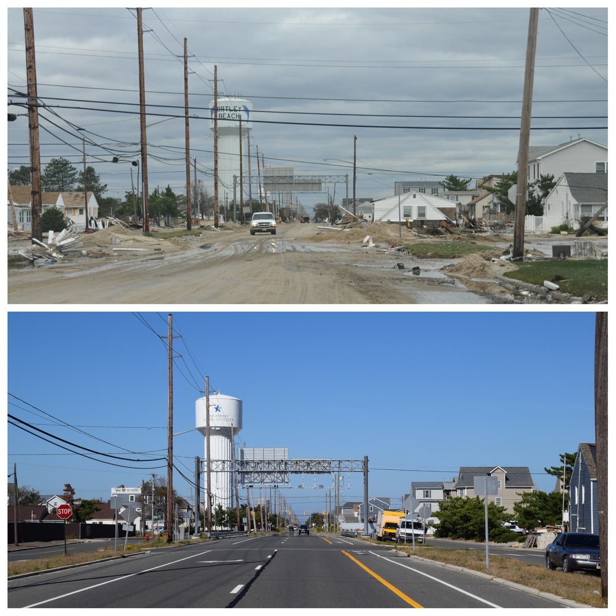
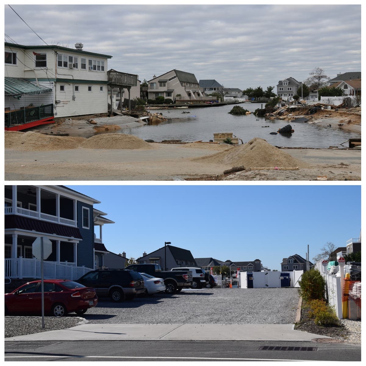
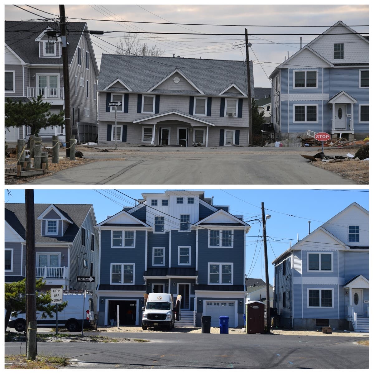
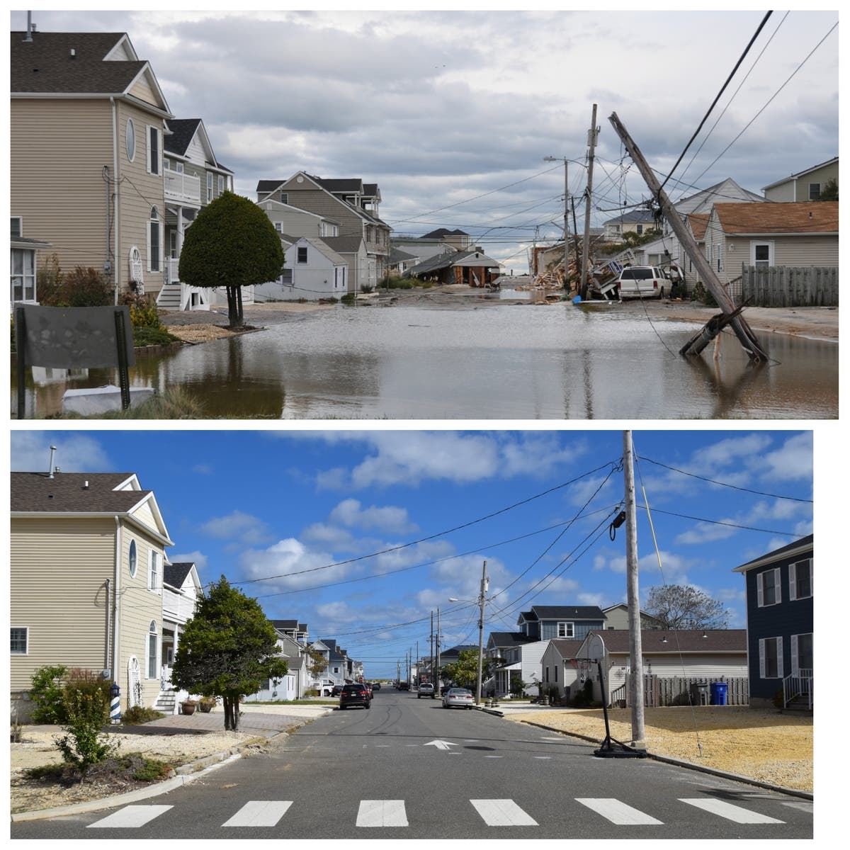
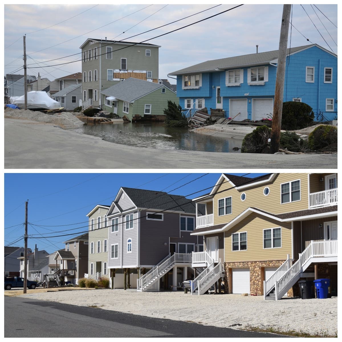


All photos by Christopher Raia, used with permission
Find out what's happening in Toms Riverfor free with the latest updates from Patch.
Get more local news delivered straight to your inbox. Sign up for free Patch newsletters and alerts.