Community Corner
Hour-by-Hour Snow, Freezing Rain Forecast for Long Island
A winter weather advisory is now in effect. Significant icing threat ahead for untreated roads and walkways.

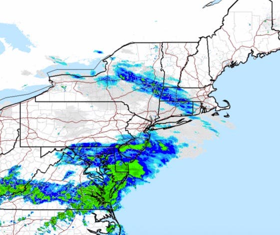
Just an inch or two of snow is expected to fall on Long Island Monday, but combined with freezing rain, there’s the potential for roads to turn into sheets of ice during the evening hours.
A winter weather advisory went into effect at 1 p.m. and lasts until midnight. The latest NWS snowfall totals map says 1-2 inches of snow is likely in Nassau and western Suffolk, with less than an inch expected to accumulate in eastern Suffolk.
The snow is expected to develop across the island Monday afternoon before briefly mixing with and then changing to freezing rain in the evening. The precipitation is expected to turn to all rain by midnight.
“A slow thaw of frozen ground will likely result in icing of untreated road surfaces and walkways this evening into late tonight...making travel dangerous,” the winter weather advisory says. “These conditions will impact the evening commute.”
RELATED: Newark, New York City Flight Delays, Cancellations As Snow, Ice Move In
While air temperatures are forecast to climb above freezing Monday evening, the ground surface itself will likely still be below freezing, the NWS said in a storm briefing. It could take a few hours after the transition to rain for the ground surface to warm above freezing.
The icing threat should end by the Tuesday morning commute as temperatures are expected to top 40 degrees on their way to the mid-50s in the afternoon.
Moderate to heavy rain will be likely on Tuesday, which combined with any snow melt and initially frozen ground could cause flooding, the NWS says. A coastal flood advisory will be in effect for southern Nassau and southwestern Suffolk from 1 a.m. until 5 a.m. Tuesday. Wind gusts on Tuesday could also reach 45 mph.
Here’s the latest hour-by hour forecast:
MONDAY
- 1 p.m.- Chance of snow, 25 degrees
- 2 p.m.- Chance of snow, 28 degrees
- 3 p.m.- Snow likely, 29 degrees
- 4 p.m.- Snow likely, 29 degrees
- 5 p.m.- Snow likely, 30 degrees
- 6 p.m.- Snow/freezing rain, 31 degrees
- 7 p.m.- Snow/freezing rain, 33 degrees (1.1 inches of snow from 1-7 p.m.)
- 8 p.m.- Snow/freezing rain, 34 degrees
- 9 p.m- Freezing rain, 35 degrees
- 10 p.m.- Freezing rain, 35 degrees
- 11 p.m- Freezing rain, 36 degrees
TUESDAY
- Midnight- Rain, 37 degrees
- 1 a.m.- Rain, 38 degrees (0.28 inches of rain from 8 p.m. to 1 a.m.)
- 2 a.m.- Rain, 38 degrees
- 3 a.m.- Rain, 39 degrees
- 4 a.m.- Rain, 40 degrees
- 5 a.m.- Rain, 40 degrees
- 6 a.m.- Rain, 41 degrees
- 7 a.m.- Rain, 42 degrees (0.16 inches of rain from 1 a.m. to 7 a.m)
- 8 a.m.- Rain, 42 degrees
- 9 a.m.- Rain, 44 degrees
- 10 a.m- Rain, 45 degrees
- 11 a.m.- Rain, 47 degrees
- 12 p.m., Rain, 50 degrees
- 1 p.m.- Rain, 52 degrees (0.26 inches of rain from 7 a.m. to 1 p.m.)
- 2 p.m..- Rain, 53 degrees
- 3 p.m. Rain, 53 degrees
- 4 p.m.- Rain, 53 degrees
- 5 p.m.- Rain, 49 degrees
- 6 p.m.- Chance of rain, 46 degrees
- 7 p.m.- Chance of rain, 44 degrees (0.44 inches of rain from 1-7 p.m.)
Get more local news delivered straight to your inbox. Sign up for free Patch newsletters and alerts.