Community Corner
Weekend Forecast: Long Island to Cool Off, Sidestep Nor'easter
Thanks to a summer vortex at the Canadian border.

BY SIMONE WILSON
Sick of swimming in your own sweat day in, day out? Then this weekend is for you, Long Island.
The National Weather Service predicts that — after weeks of humid, hot weather — this Friday, Saturday and Sunday will top out near 80 degrees.
Find out what's happening in Kings Parkfor free with the latest updates from Patch.
And because the extreme humidity of early summer has for the most part eased off in August, this weekend’s highs will only feel a few degrees hotter than they really are.
“Friday is shaping up to be ideal for outdoor activities, similar to Thursday, as high pressure promotes low humidity and seasonable temperatures,” says AccuWeather meteorologist Kristina Pydynowski. ”A high near 84 F is more common this time of year.”
Find out what's happening in Kings Parkfor free with the latest updates from Patch.
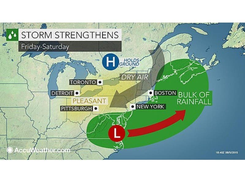
There is a slight chance that Long Island will get sprayed by the outer edge of a major storm rolling across the East Coast on Friday and Saturday.
However, the NWS says the storm system will stay “far enough offshore to only bring a slight chance of light rain” for New York City and Long Island.
According to Bloomberg News, these cooler temps come courtesy of a summer vortex up at the Canadian border.
“It is going to be cool there,” said Bob Oravec, a meteorologist with the U.S. Weather Prediction Center in College Park, Maryland. “There’s a big vortex over the eastern Ontario-Quebec border, similar to the patterns we had during the cold season.”
Yes, he used the v-word. That wonderful dip in weather patterns that drives cold air down from the Arctic like a conveyor belt. The same vortex that is the favorite of forecasters everywhere in the winter to explain why the air seems to freeze and snow falls by the foot.
Here’s your full weekend forecast, via the National Weather Service:
Thursday afternoon: Mostly sunny, with a steady temperature around 79. West wind 9 to 11 mph.
Thursday night: Mostly cloudy, with a low around 64. Southwest wind around 6 mph becoming calm in the evening.
Friday: A slight chance of light rain. Partly sunny, with a high near 80. Northeast wind 8 to 10 mph. Chance of precipitation is 20%.
Friday Night: A slight chance of light rain before midnight. Partly cloudy, with a low around 63. Northeast wind around 9 mph. Chance of precipitation is 20%.
Saturday: A slight chance of light rain. Partly sunny, with a high near 79. Northeast wind 11 to 13 mph. Chance of precipitation is 20%.
Saturday Night: A slight chance of light rain. Mostly cloudy, with a low around 64. Chance of precipitation is 20%.
Sunday: Mostly sunny, with a high near 80.
Sunday Night: Partly cloudy, with a low around 67.
Image courtesy of Accuweather.com
Get more local news delivered straight to your inbox. Sign up for free Patch newsletters and alerts.