Weather
Heat Advisory, Hazardous Outlook: Hudson Valley Forecast
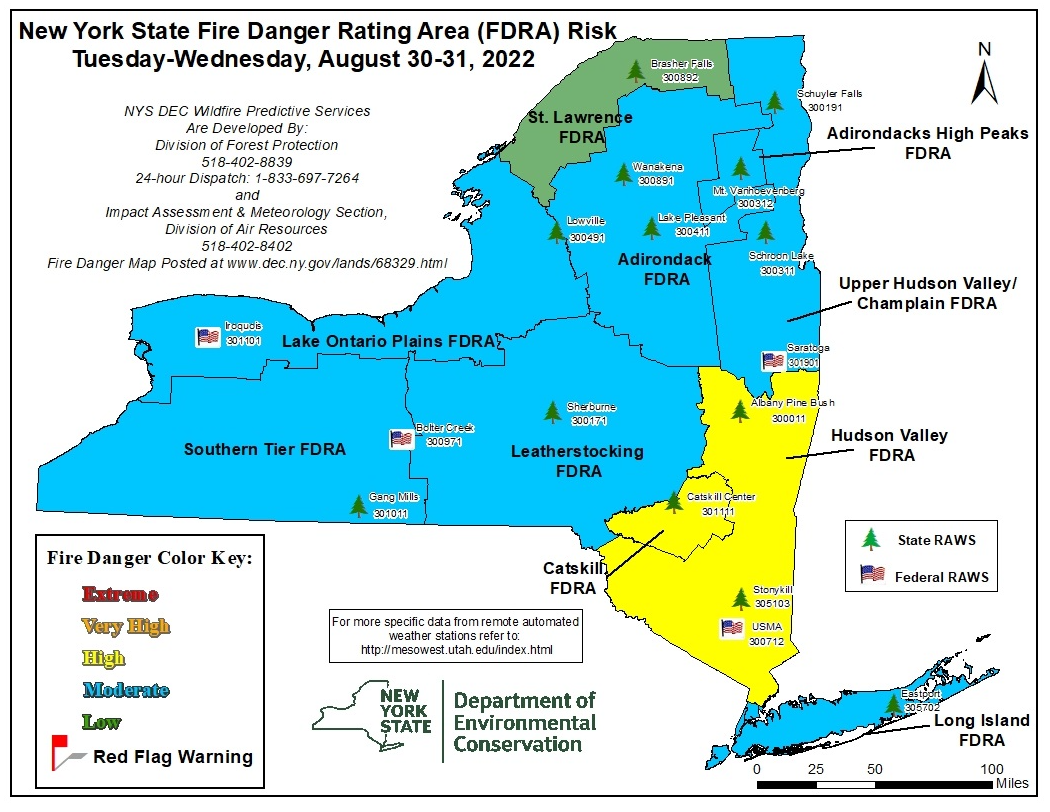
The Hudson Valley is at high risk of wildfires, and firefighters and forest rangers are working to get the latest one under control.

HUDSON VALLEY, NY — It continues hot and humid, with only a chance of severe thunderstorms later, and the National Weather Service has issued both a heat advisory and a hazardous weather outlook for Dutchess County and Ulster County, where efforts continue to contain the latest wildfire to hit the Hudson Valley.
The NWS said there is a marginal risk of severe weather and excessive rainfall. Showers and thunderstorms could produce isolated damaging wind gusts and locally heavy rainfall leading to urban and poor drainage flooding and isolated flash flooding.
"Our only real shot at rain comes on Tuesday, as a front pushes east, and the Hudson Valley could see late day scattered showers & T-Storms," said Alex Marra and Bill Potter of Hudson Valley Weather. "It doesn't look like a ton of precipitation, but we'll keep our fingers crossed that some widespread soaking showers and T-Storms develop."
Find out what's happening in Mid Hudson Valleyfor free with the latest updates from Patch.
In a drought statement Aug. 16, the NWS said the last 30 days had seen less than half of normal rainfall. "The most significant dryness has been since the start of June. Temperatures have been well above normal for the last 30 days, as much as 5 degrees above normal. The below normal rainfall and above normal temperatures have contributed to a rapid deterioration of drought conditions over the last 30 to 45 days. Since then, drought conditions have intensified."
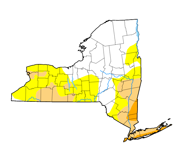
The Hudson Valley is at high risk of wildfires, and in fact firefighters and forest rangers have been fighting several in August. They've been struggling to get the most recent one, in Ulster County, under control: Napanoch Wildfires Expected To Spread Over 24 Hours: County
Find out what's happening in Mid Hudson Valleyfor free with the latest updates from Patch.
Here's a look at the rest of the work-week, based on Ulster County.
- Tuesday - Mostly sunny. A chance of showers and thunderstorms this afternoon. Hot with highs in the lower 90s. South winds 5 to 10 mph. Chance of rain 30 percent.
- Tonight - A chance of thunderstorms. Showers likely. Humid with lows in the mid 60s. Southwest winds around 5 mph. Chance of rain 70 percent.
- Wednesday - Sunny. Highs in the mid 80s. West winds around 5 mph. Gusts up to 20 mph in the afternoon.
- Wednesday Night - Mostly clear. Lows in the upper 50s. West winds around 5 mph in the evening, becoming light and variable.
- Thursday - Sunny. Highs in the lower 80s. Northwest winds 5 to 10 mph.
- Thursday Night And Friday - Clear. Lows in the lower 50s. Highs in the lower 80s.
- Friday Night And Saturday - Mostly clear. Hot. Lows in the mid 50s. Highs in the upper 80s.
Get more local news delivered straight to your inbox. Sign up for free Patch newsletters and alerts.