Weather
2 More Shots Of Snow Forecast For NYC: See When
A storm system is expected to make its way to the New York City area during the overnight hours on Wednesday.

NEW YORK CITY — New Yorkers may have to keep their shovels nearby as more snow is expected to hit the city after a massive blizzard dumped around two feet of snow on Monday.
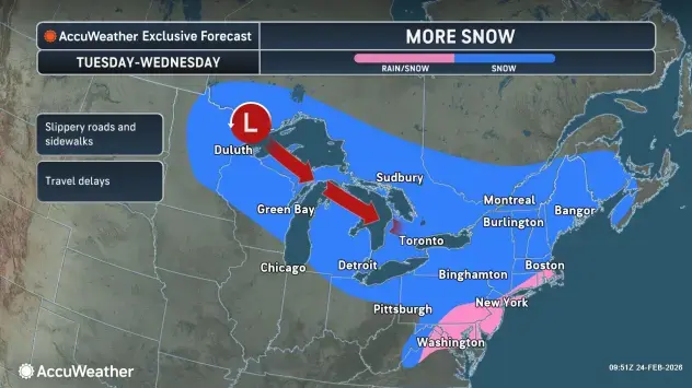
A storm system is expected to make its way to the New York City area during the overnight hours Tuesday and could affect the morning commute on Wednesday.
According to forecasters, snowfall will start after midnight and continue into Wednesday morning. The snow is expected to stop by the afternoon hours on Wednesday.
Find out what's happening in New York Cityfor free with the latest updates from Patch.
New York City could see 1 to 2 inches on Wednesday, but there is also a chance for more snow on Thursday.
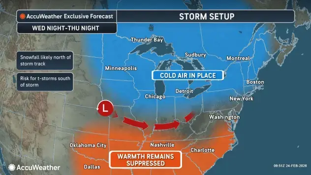
Another storm system is currently tracking south of the city but if it shifts its direction, New Yorkers could get yet another round of snow, according to forecasters.
Find out what's happening in New York Cityfor free with the latest updates from Patch.
"A clipper storm will track across the Great Lakes Tuesday and Wednesday, spreading a swath of snow from northern Minnesota into New England," Accuweather said. "Farther south, including Washington, D.C., Philadelphia and New York City, snow can mix with rain as the storm moves through the region."
On Tuesday, temperatures will reach the low 30s with wind chills making it seems like the temperatures are in the 20s.
For Wednesday, high temperatures will reach around 42 degrees, with a low of 22 degrees. Thursday's high temperature will reach 38 degrees, with a low of 31.
Get more local news delivered straight to your inbox. Sign up for free Patch newsletters and alerts.