Community Corner
Canadian Wildfire Smoke Returning To The Hudson Valley
Southern Rockland and Westchester, much of Long Island, NYC and northern New Jersey will experience near-surface smoke, the NWS said.


HUDSON VALLEY, NY — Smoke from Canadian wildfires will be making a return to the region late Thursday into Friday, the National Weather Service said.
While it will mostly stay in the upper atmosphere, southern Rockland and Westchester counties, much of Long Island, New York City and northern New Jersey will experience near-surface smoke, the NWS said.
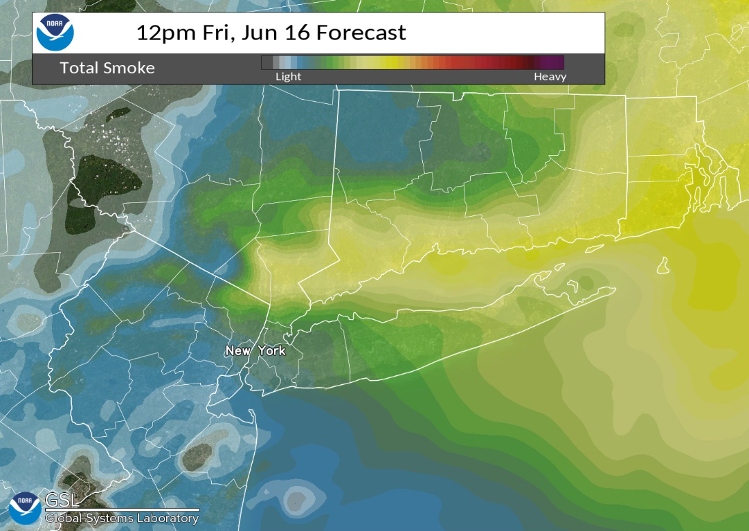
"The good news is that per the latest High-Resolution Rapid Refresh (HRRR) Smoke model forecasts, the vast majority of the smoke should remain aloft," the NWS tweeted.
Find out what's happening in New Cityfor free with the latest updates from Patch.
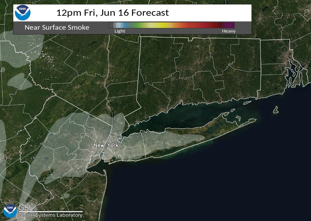
The NWS does not expect a return to the dense smoke that blanketed the region with toxic fumes and fine particulates, sending the air quality index soaring to 400-plus levels, well above the "safe" mark of 50.
Currently, AirNow.gov shows poor air quality from Canadian wildfire smoke mostly affecting the upper Midwest.
Find out what's happening in New Cityfor free with the latest updates from Patch.

There were almost 400 wildfires burning in Canada as of June 7 — in Alberta, Nova Scotia, Quebec, Ontario, British Columbia and the Northwest Territories, according to the country's National Wildland Fire Situation Report. The number of fires was already well above average for this time of year, and well above the average for area burned for this time of year. At least half were attributed to lightning.
The frequency, extent and severity of wildfires mark important indicators of climate change, environmental officials say.
Check Your Air Quality
AirNow.gov, which reports air quality using the official U.S. Air Quality Index (AQI), has an updated map of air quality in the U.S.
Air quality alerts are triggered by a number of factors, including the detection of fine-particle pollution — known as "PM 2.5" — which can irritate the lungs.
The AQI scale is as follows:
- Good/green: 0-50
- Moderate/yellow: 51-100
- Unhealthy for sensitive groups/orange: 101-150
- Unhealthy/red: 151-200
- Very unhealthy/purple: 201-300
- Hazardous/maroon: 301-500
AirNow partners with the U.S. Environmental Protection Agency, National Oceanic and Atmospheric Administration (NOAA), National Park Service, NASA, Centers for Disease Control, and tribal, state, and local air quality agencies.
Patch staffers Veronica Flesher and Michelle Rotuno-Johnson contributed to this report.
Get more local news delivered straight to your inbox. Sign up for free Patch newsletters and alerts.