Weather
Henri In The Hudson Valley: Heavy Rains, Flash Floods
Southern Westchester is under tropical storm and surge warnings as Henri heads toward eastern Connecticut, dropping lots of rain.

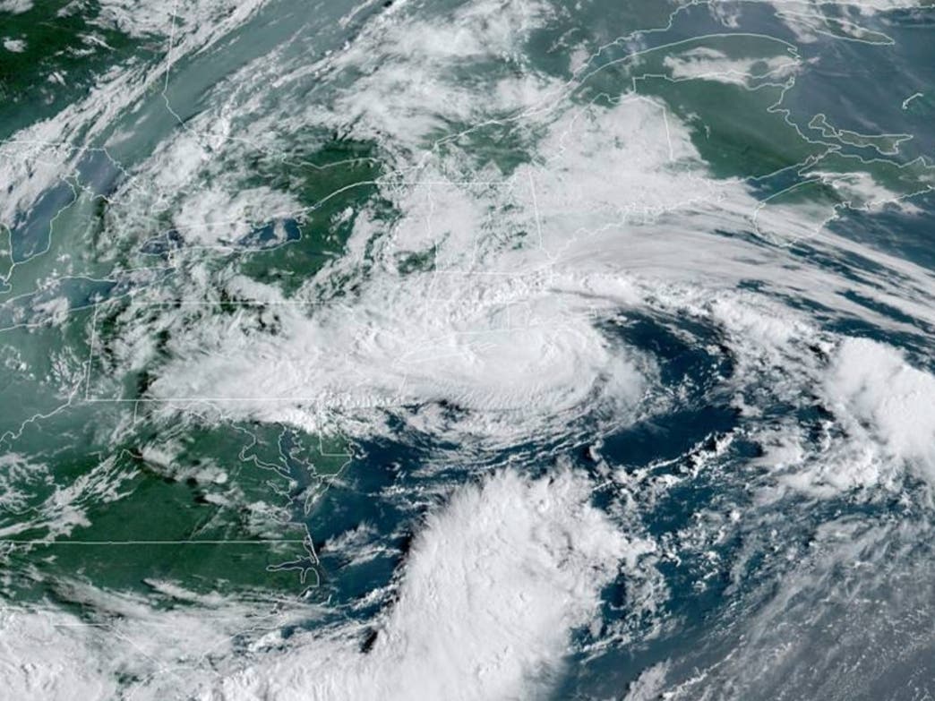
HUDSON VALLEY, NY — Tropical Storm Henri is bringing heavy rain to much of the lower tri-state area as it passes to the east of the Hudson Valley, expected to make landfall in eastern Connecticut.
SEE:
Prospect Park in Brooklyn saw 5.24 inches of rain in three hours and Route 17 was closed in northern New Jersey due to flash flooding — and that kind of downpour is headed to the lower Hudson Valley, according to Sunday morning forecasts.
Find out what's happening in New Cityfor free with the latest updates from Patch.
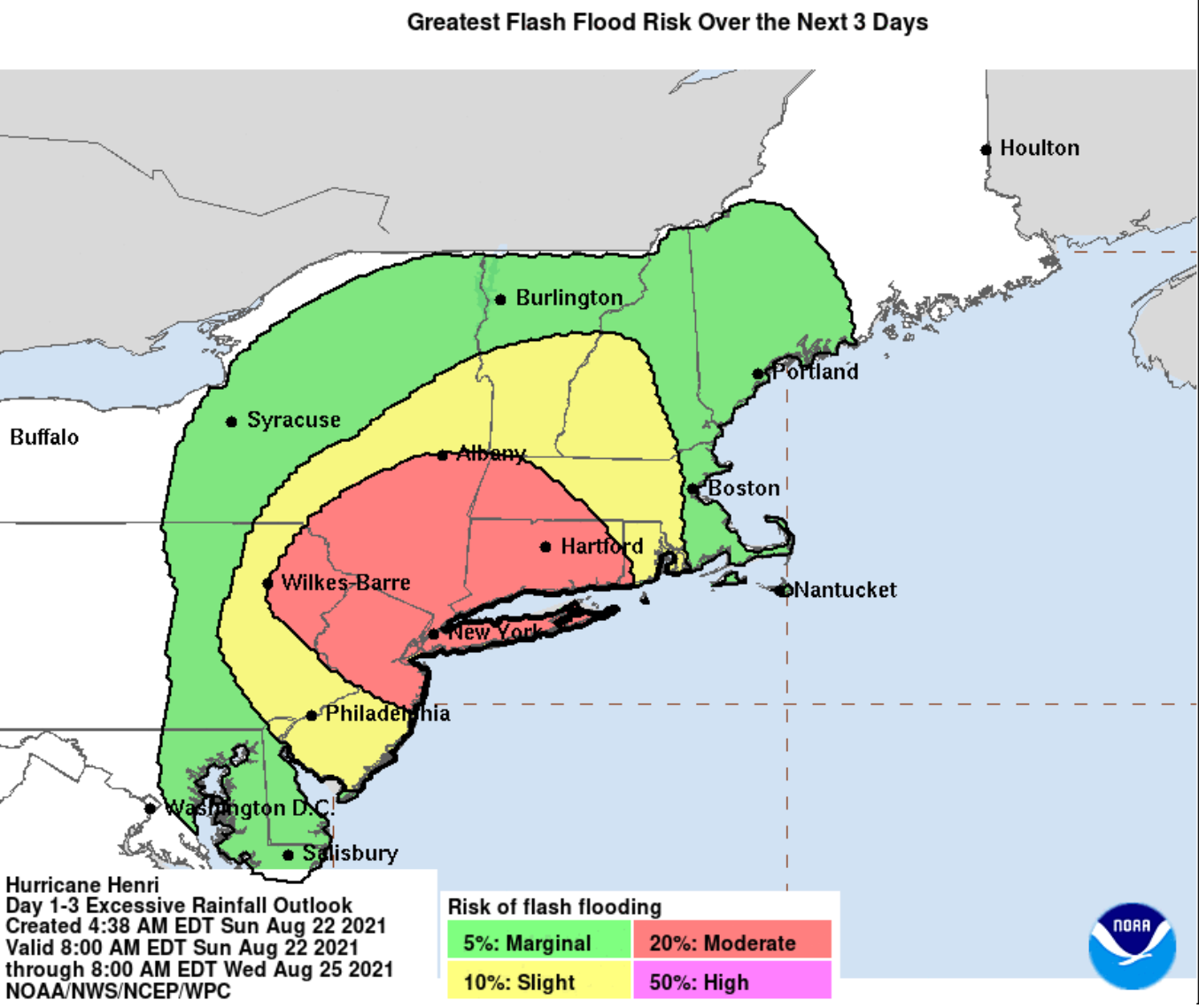
Flood watches are in effect for Dutchess, Orange, Putnam, Rockland, Ulster and Westchester counties until 8 p.m. Monday.
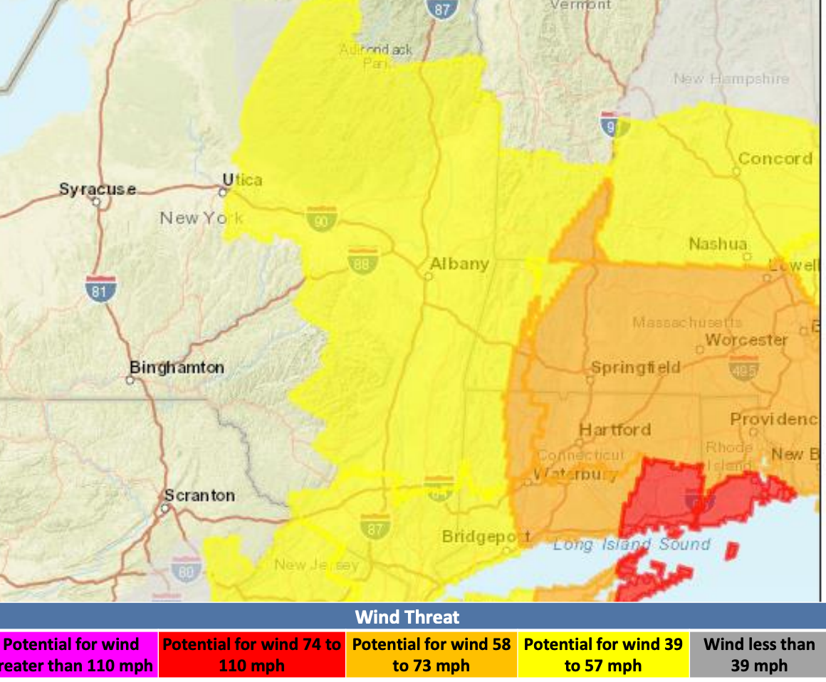
Southern Westchester is under a tropical storm warning and a storm surge warning as well.
Find out what's happening in New Cityfor free with the latest updates from Patch.
A widespread rainfall of 5 to 10 inches is possible for the Lower Hudson Valley, the National Weather Service said. Localized higher amounts will be possible through Monday evening. For Dutchess and Ulster, widespread rainfall of 2 to 6 inches is expected, though localized rainfall amounts up to 6 to 10 inches are possible, especially over the higher terrain areas of the eastern Catskills.
Rain bands will begin to move further inland and overspread the area from southeast to northwest, the National Weather Service said. Rainfall rates exceeding 1 to 2 inches per hour are possible at times.
Henri was reported just 40 miles south-southeast of Montauk Point at 8 a.m. with sustained winds of 70 mph, so the hurricane warning for eastern Long Island was downgraded back to a tropical storm warning.
The Sound Shore of Westchester County is affected by a storm surge warning for the north shore of Long Island from Montauk Point to Flushing.
What's most important to the Hudson Valley is that Henri is expected to slow down and turn back toward the north after making landfall in Connecticut.
With isolated totals near 10 inches, heavy rainfall from Henri could result in flash, urban, and small stream flooding, along with the potential for widespread minor to isolated moderate river flooding. Particularly in southern Westchester, the threats include:
- Rivers and streams may rapidly overflow their banks and small streams, creeks, canals, and ditches may become dangerous.
- Streets and parking lots become rivers of moving water with underpasses submerged.
- Driving conditions become dangerous.
- Road and bridge closures with some weakened or washed out.
SEE: Metro-North Suspends New Haven Line, Wassaic Branch
The wind threat has diminished for most of the Hudson Valley. However, southern Westchester could see winds 39 to 57 mph, bringing limited chances for damage including large tree limbs broken off, a few trees snapped or uprooted, and a few roads impassable from debris.
SEE ALSO:
Get more local news delivered straight to your inbox. Sign up for free Patch newsletters and alerts.