Weather
Hudson Valley Forecast: Thunderstorms, Flash Flood Watch
A week after Ida inundated the Hudson Valley, there's a chance of more heavy rain and scattered flooding.

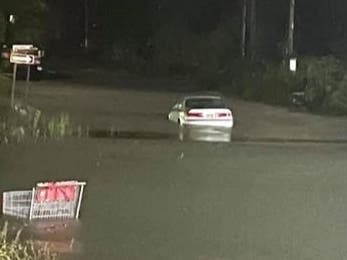
HUDSON VALLEY, NY — Rockland County is under a flash flood watch and hazardous outlooks have been issued for the whole Hudson Valley, where saturated soils from last week's excessive rainfall threat mean our region is particularly vulnerable.
The National Weather Service said thunderstorms are expected to develop in the late afternoon and evening hours Wednesday along and in advance of a cold front. The best chances for thunderstorms appear to be between 8 p.m. Wednesday and 2 a.m. Thursday.
As the cold front will be slow-moving, locally heavy rainfall is possible, with amounts of 1-2+ inches possible where storms occur, the NWS said.
Find out what's happening in New Cityfor free with the latest updates from Patch.
The environment appears marginal for severe weather, with the biggest threat being locally damaging wind gusts. With storms most likely to occur well after peak heating of the day, this may reduce the overall threat, the NWS said.
However, an isolated tornado also cannot be ruled out, especially north and west of New York City.
Find out what's happening in New Cityfor free with the latest updates from Patch.
In addition to the hazardous outlooks for Dutchess, Orange, Putnam, Rockland, Ulster and Westchester, in Orange and Rockland counties there is a flash flood watch in effect through 4 a.m. Thursday. Residents are urged to monitor forecasts and be prepared to take action should Flash Flood Warnings be issued.
In Dutchess and Ulster counties, the hazardous outlook also includes warning of a marginal to slight risk for flash flooding. Urban, low lying and poor drainage areas are most as risk, especially for locations that recently experienced flooding.
Get more local news delivered straight to your inbox. Sign up for free Patch newsletters and alerts.