Weather
Initial Snow Accumulation Estimates Released For Hudson Valley
The lower- to mid-Hudson Valley could see measurable amounts of snow.

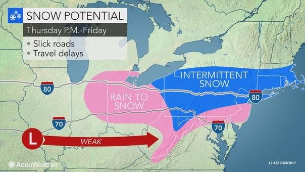
Enjoy the moderate temps for Wednesday and Thursday, because the Hudson Valley is likely to see some frozen precipitation late Thursday into Friday.
But at least the weekend was spared, though it will be quite chilly.
For all areas of the lower- to mid-Hudson Valley, there is at least a 50 percent chance of snow Thursday night into the early hours of Friday.
Find out what's happening in New Rochellefor free with the latest updates from Patch.
And snow is likely to continue into Friday morning.
Find out what's happening in New Rochellefor free with the latest updates from Patch.
For Putnam, Rockland and Westchester, the National Weather Service is predicting about a half inch or less of snow Thursday night, and from 1 to 2 inches of snow for Friday.
For southern Westchester, there is a chance of rain Friday night as well, though the temperatures will plunge to the mid-to-upper teens.
Folks in Dutchess, Orange and Ulster counties may have it better, with less than a tenth of an inch of snow Thursday night and up to a quarter inch for Friday.
The weekend will be mostly sunny but cold in the Hudson Valley.
Tuesday presents the next chance for snow. Early forecasts are calling for a 40 percent chance of snow and/or rain depending on where you are located.
Map: AccuWeather.com.
Get more local news delivered straight to your inbox. Sign up for free Patch newsletters and alerts.