Weather
Warmer Temps In Long-Term Hudson Valley Summer Forecast
A newly released summer forecast says we could see severe weather and above average temps. Some of the severe weather will hit this week.

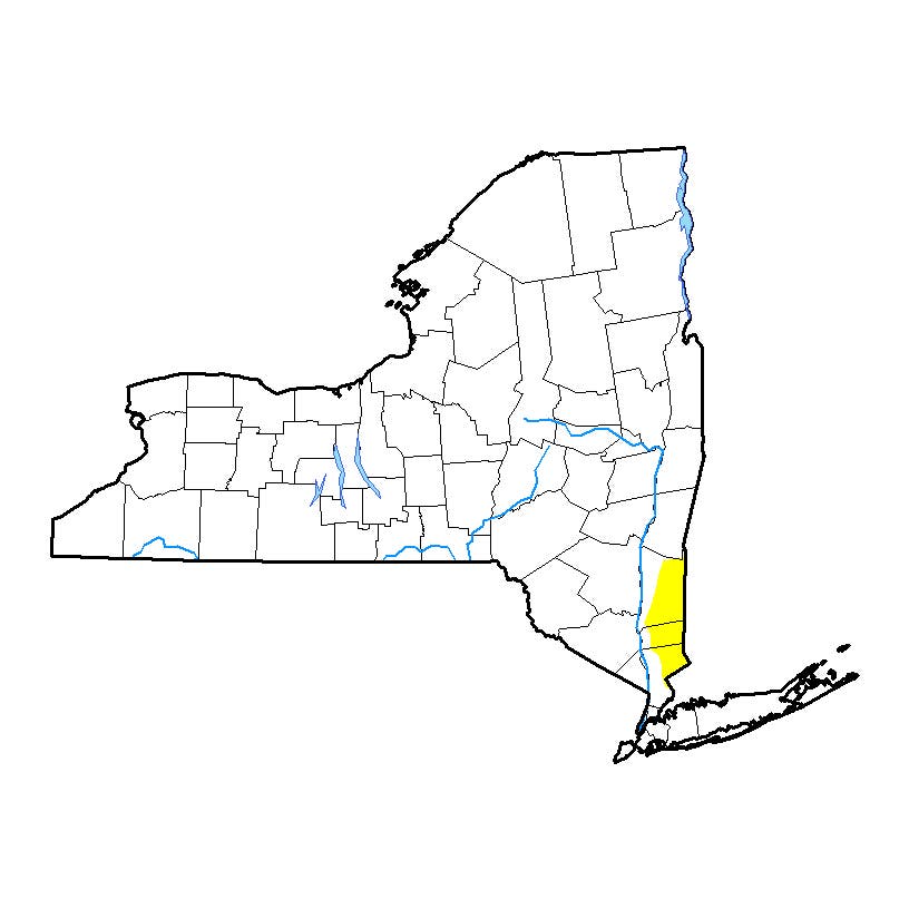
HUDSON VALLEY, NY — Expect some bad weather during the summer season. Wet weather and severe storms will hold back prolonged heat in New York, according to AccuWeather. Unlike the summer of 2016, when drought conditions gripped the Northeast and mid-Atlantic, the summer will bring on-and-off wet weather to the Hudson Valley, according to an AccuWeather release.
"Especially in June and July, we should see some showers and storms from time to time," AccuWeather Lead Long-Range Forecaster Paul Pastelok said in the release.
The moisture will help to hold back extreme and extended periods heat. "I think we'll have some hot weather, but it won't be as prolonged as we saw last year a couple of times," he said.
Find out what's happening in New Rochellefor free with the latest updates from Patch.

[Get Patch’s Daily Newsletter and Real Time News Alerts here.]
Some of that bad weather is expected to come this week. The Hudson Valley is expected to see heavy rain after midnight tonight and lasting through the day on Friday. Some areas can expect to receive in excess of an inch of rain before it ends early Saturday. On the plus side, the Hudson Valley is gradually coming out of the severe drought due to numerous rainstorms over the past month or so.
Find out what's happening in New Rochellefor free with the latest updates from Patch.

Northeastern I-95 cities including New York City may end up with slightly more 90-degree days than normal — although still fewer than last year.
"[Areas] farther south may be at or slightly below normal due to a little bit more moisture over the summer," Pastelok said.
The forecast contradicts a report issued earlier this year that said warmer-than-usual temperatures are expected across much of New York this summer, and the weather could also be dryer than normal.
The storms could be an extension of the tropical weather that's expected to hit the South. The weather is expected to be hot and occasionally stormy.
Areas more likely to be impacted by the tropics early on include the western Gulf Coast, including New Orleans and Houston. The Carolina coast may also be at risk.
"I'd be concerned about Charleston up to Cape Hatteras," Pastelok said, adding that water temperatures are already running above normal in that area.
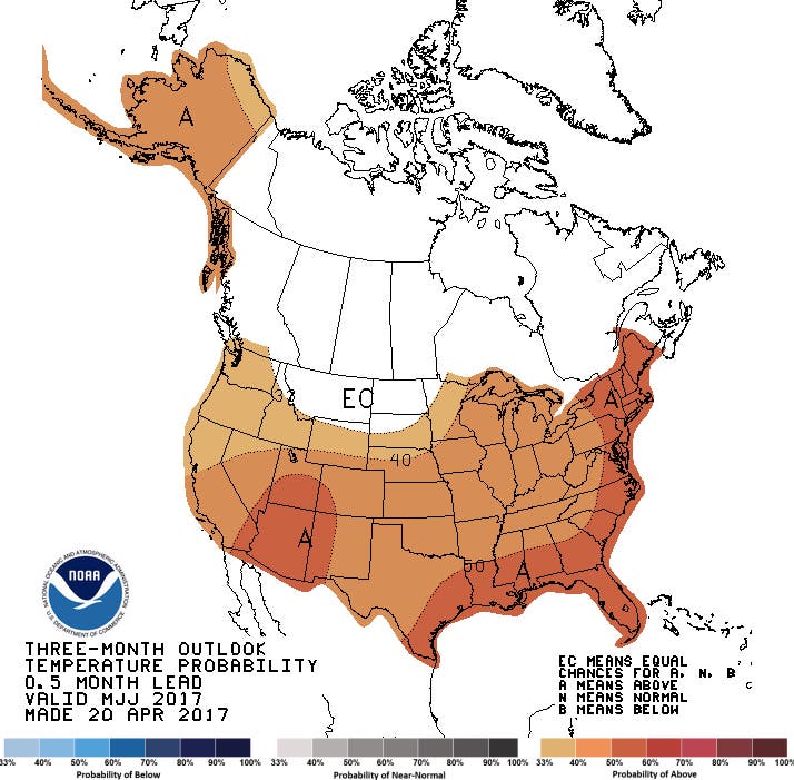
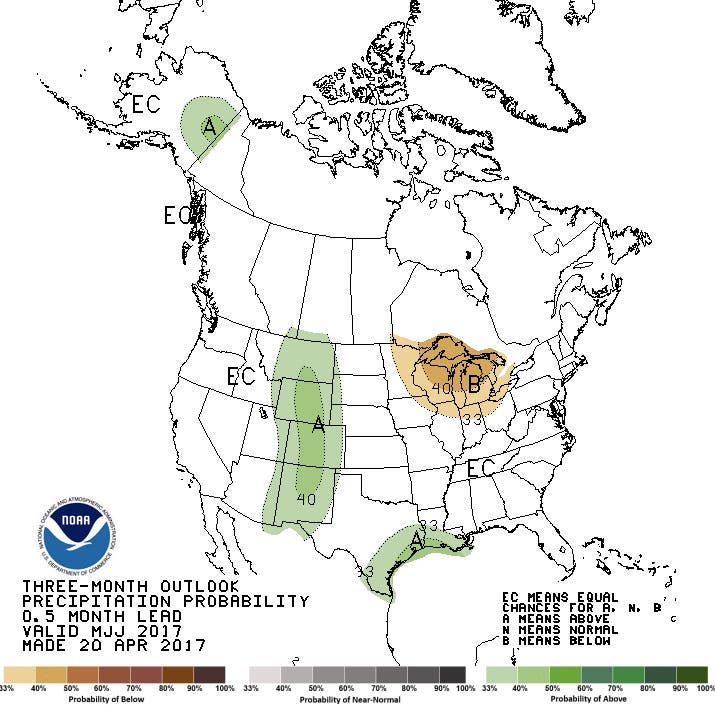
Here are National Weather Service's temperature and precipitation probability maps for the next three months:
Patch File Photo
Written by Tom Davis, Patch Staff
Get more local news delivered straight to your inbox. Sign up for free Patch newsletters and alerts.