Weather
Wintry Mix, Hazardous Outlook For Hudson Valley
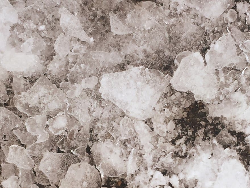
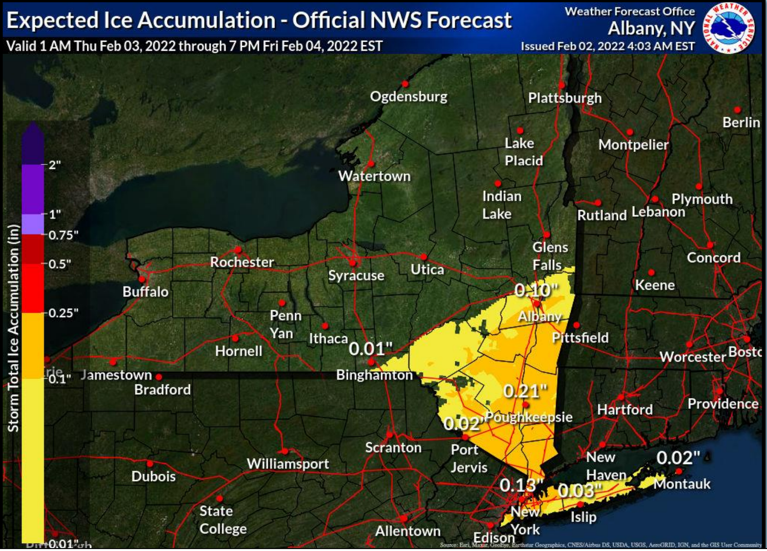
Rain, snow and sleet will freeze solid, so clear storm drains ahead of time and expect icy roads Thursday night and Friday.

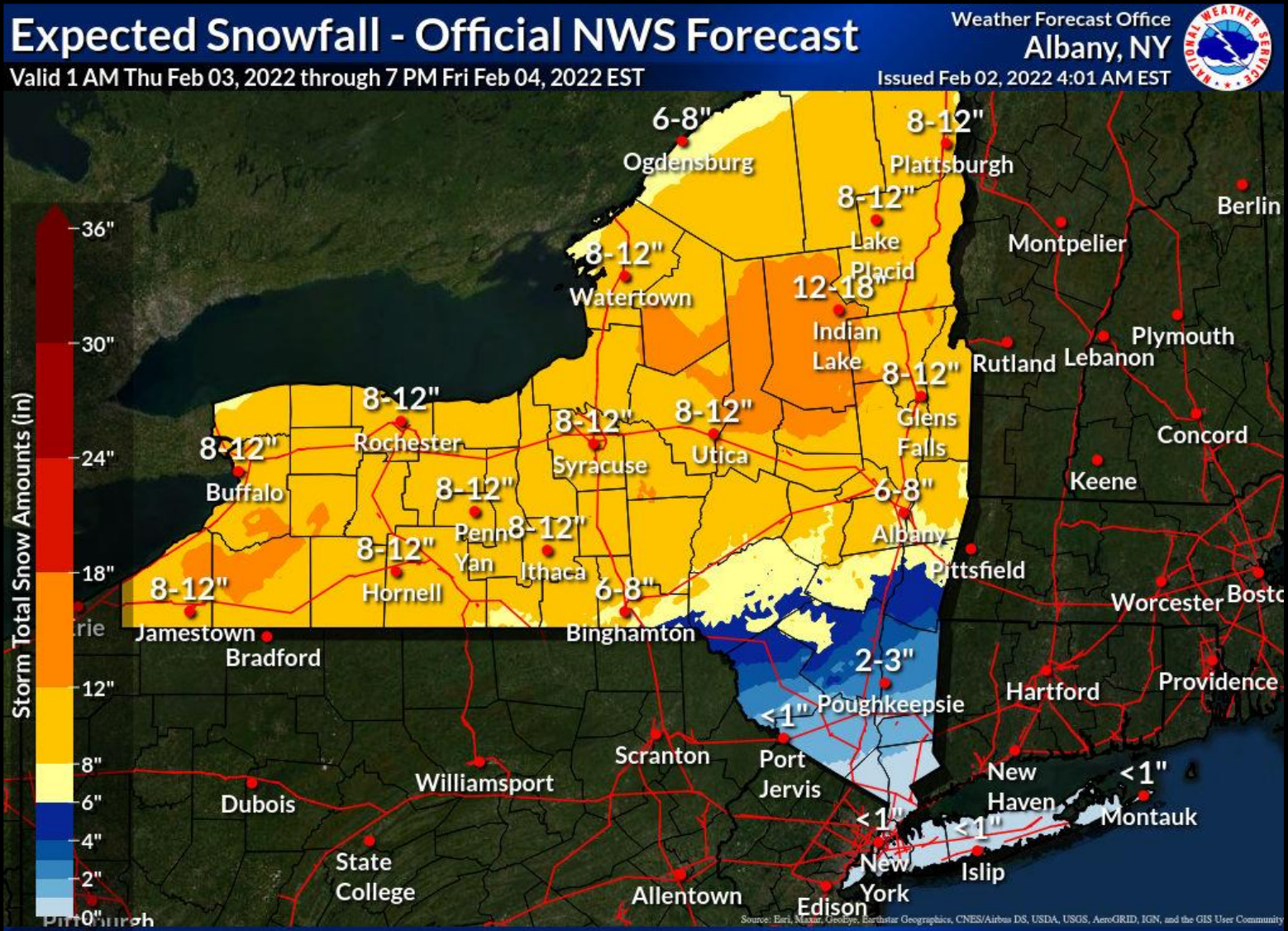
HUDSON VALLEY, NY — A storm system with snow, sleet, rain and freezing rain, along with plummeting temperatures, is headed from the central U.S. into the mid-Atlantic, and the National Weather Service has issued hazardous outlooks for the region.
Rain, sometimes mixed with snow, is expected to start early Thursday morning, changing overnight to freezing rain, snow and sleet.
For Orange, Putnam, Rockland and Westchester counties: A cold front will move through late Thursday night into Friday with quickly falling temperatures behind its passage. As a result, rain Thursday night will change to a wintry mix from northwest to southeast, with several hours of freezing rain, sleet, and snow. This will lead to ice accretion on any untreated surfaces, making travel hazardous potentially for both the morning and evening commutes on Friday. Additionally, any standing water from rainfall and melting snow will freeze, exacerbating these conditions.
Find out what's happening in Nyack-Piermontfor free with the latest updates from Patch.
For Dutchess and Ulster counties: Wintry precipitation including snow, sleet and freezing rain are likely Thursday into Friday with a slow-moving front and low-pressure system moving along it. The eventual location of the front will determine precipitation types, amounts and their locations.
Alex Marra and Bill Potter of Hudson Valley Weather called it "a long duration multitude of precipitation types and winter weather."
Find out what's happening in Nyack-Piermontfor free with the latest updates from Patch.
"Keep in mind any precipitation that does fall on Thursday will freeze solid by Thursday evening," they said. "Rain may fall moderate to heavy on Thursday, check that storm drains are clear of ice and snow."
This will be a heavy, wet snow, especially where sleet occurs in the mid-Hudson.
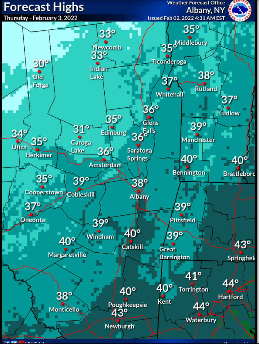
Temperatures will be 10-20 degrees above average in the Hudson Valley during the day Thursday before falling as the cold front sends temps plummeting to near zero, the National Weather Service said.
Here's the contrast as the storm starts and as it ends:
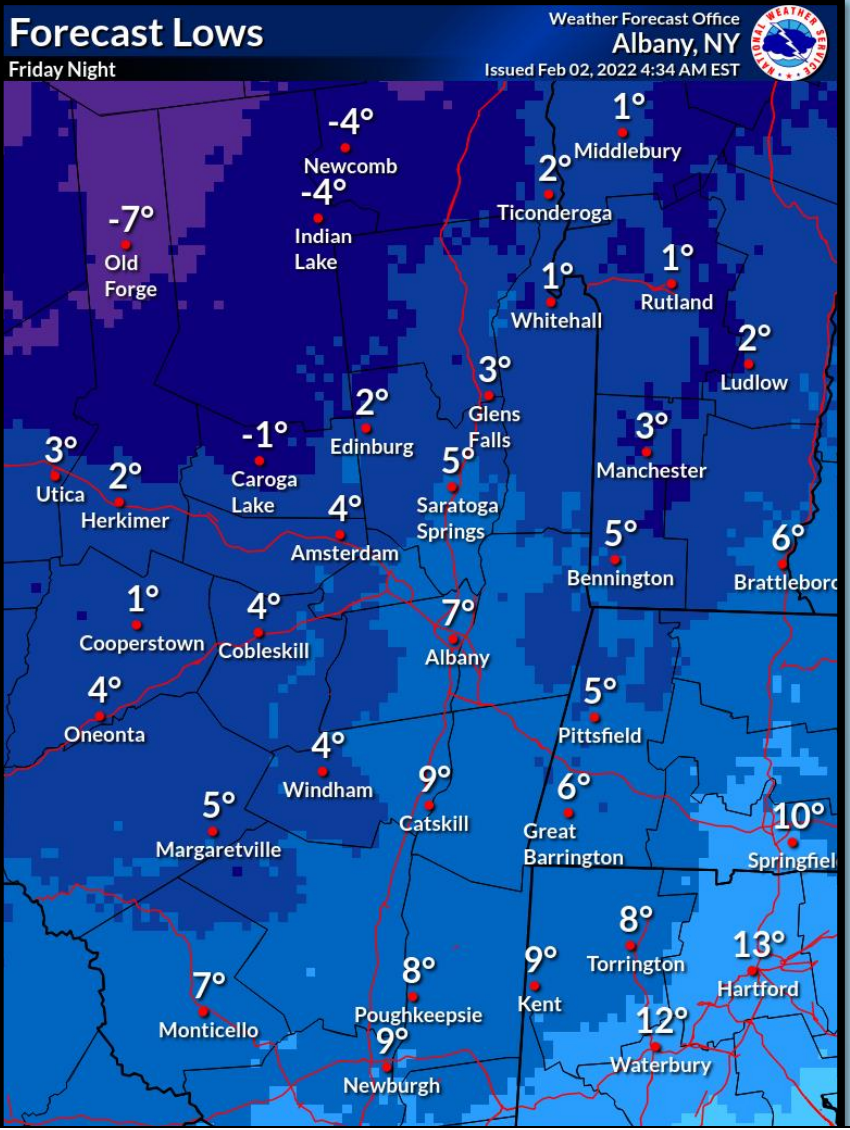
Freezing rain and falling temperatures will mean icy surfaces in the mid- and lower Hudson Valley on Friday, the NWS said.
Get more local news delivered straight to your inbox. Sign up for free Patch newsletters and alerts.

