Community Corner
Polar Vortex Will Keep Nyack in the 20s-40s Through Sunday
Thursday's high will only be 47 and even that won't be seen again....for a while, says the National Weather Service.

Temperatures will drop through the end of the week in Piermont and Nyack.
“One thing for sure is we are quitting the warm weather “cold turkey,” said the meteorologists at Hudson Valley Weather.
Arctic air will sweep away those 60-degree days, and keep coming. From a low of 34 on Thursday night—with a 30 percent chance or snow or rain—the low on Saturday is predicted to be just 29 degrees Fahrenheit.
Find out what's happening in Nyack-Piermontfor free with the latest updates from Patch.
“A dramatic swing in temperatures will then occur for the remainder of the work week as Canadian high pressure builds from the west,” predicts the National Weather Service. “Temperatures will trend several degrees colder than average for Thursday night and Friday after a stronger cold frontal passage.”
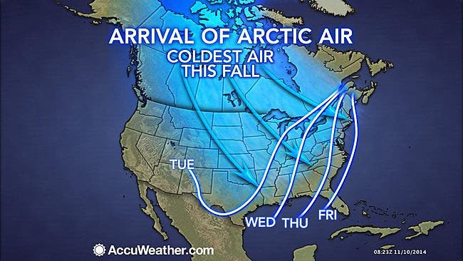
The culprit is, as it has been in recent years, a violent storm. This one formed west of Alaska, with barometric pressure readings lower than SuperStorm Sandy.
Find out what's happening in Nyack-Piermontfor free with the latest updates from Patch.
See the complete NWS forecast for Nyack here.
Weather map: Accuweather.com
Get more local news delivered straight to your inbox. Sign up for free Patch newsletters and alerts.