
HUDSON VALLEY, NY — With less than a day to go before the anticipated snowstorm, the National Weather Service has issued hazardous weather outlooks for the region and upped its estimates of how much snow we should expect before noon Friday.
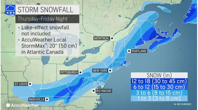
The NWS predicts the most snow will fall in Rockland and Westchester counties: 3-5 inches. The forecast for Dutchess: 2-5 inches. The forecast for Orange and Putnam: 2-4 inches. Ulster: 1-3 inches.
Temperatures will be in the 20s overnight. This will result in snow-covered roads and hazardous travel during the Friday morning commute, the NWS said.
Find out what's happening in Nyack-Piermontfor free with the latest updates from Patch.
Two caveats: Locally higher snowfall amounts are possible if any heavy snowbands develop; and a weaker storm or a track farther offshore would result in lighter snow accumulations, with a stronger and/or closer to the coast track increasing the potential for greater accumulation (especially for northern and northwestern sections).
In a Fireside Chat Wednesday night, Hudson Valley Weather's Bill Potter said "The problem with this storm if you're a snow lover is this storm is probably going to be a little bit too far offshore."
Find out what's happening in Nyack-Piermontfor free with the latest updates from Patch.
Snow should start breaking out in the Hudson Valley around 2 a.m. Friday, he said, the heaviest snow projected to fall closest to the coast.
"Expect lots of delays," Potter said.
Snowfall rates could range between one-half inch and one inch per hour in any heavy snowbands.
Get more local news delivered straight to your inbox. Sign up for free Patch newsletters and alerts.

