Community Corner
Weather Ahead: Another Storm Coming to the Nyack Area
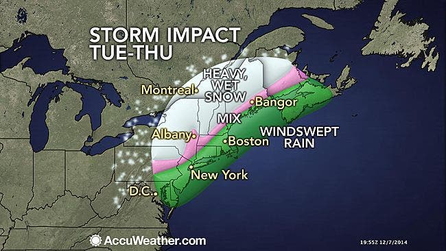
Heavy rain overnight Monday through Thursday, with the proverbial wintry mix thrown in.

The National Weather Service has issued a Hazardous Weather Outlook for Monday night through Thursday for Rockland County.
They’re talking about the slow-moving coastal storm headed toward the Mid-Atlantic and New England. Forecasts are still uncertain—Hudson Valley Weather says the models vary as do the variables, including how fast warm and cold fronts will be moving.
Heavy rain, sleet and strong winds are expected overnight Dec. 8-9. Rain, interspersed with snow or sleet, is expected to continue into Dec. 11.
Find out what's happening in Nyack-Piermontfor free with the latest updates from Patch.
“The storm will be a mainly rain event for the I-95 corridor from Boston southward to Washington, D.C.,” said AccuWeather.com meteorologists who will still monitor the potential for some wet snow at the storm’s onset or end.
The heavy rain could make travel difficult and trigger flooding in low-lying and poor drainage areas, Accuweather said.
Find out what's happening in Nyack-Piermontfor free with the latest updates from Patch.
MAP: Accuweather.com
Get more local news delivered straight to your inbox. Sign up for free Patch newsletters and alerts.