Weather
Winter Storm Icing Up Hudson Valley To End Friday Evening
Thousands lost power before dawn; schools have closed or gone remote.

HUDSON VALLEY, NY — The winter storm battering the region bringing hazards as temperatures drop and rain changes to freezing rain and sleet is expected to taper off by Friday evening.
More than 30,000 people had lost power so far in the region as of 7:30 a.m. Many local schools have gone remote or closed. Municipal offices are closing.
As the cold front slipped south before dawn, the contrast in the valley was mind-blowing. News12 Hudson Valley reported temperatures of 52 degrees in Yonkers compared to 31 in Kingston at 6:15 a.m. "It's just incredible to see these temperatures in the south and east," said meteorologist Matt Hammer.
Find out what's happening in Nyack-Piermontfor free with the latest updates from Patch.
According to the National Weather Service:
Rain will change to a wintry mix of snow, sleet and freezing rain into this afternoon before tapering off late this afternoon and early evening from west to east. Dangerous and icy travel conditions are of concern for this morning’s commute and for the evening commute for much of the area. In addition, widespread minor urban and poor drainage flooding issues are possible today. Winter weather advisories are in effect into early this evening for the entire area.
SEE:
Find out what's happening in Nyack-Piermontfor free with the latest updates from Patch.
- Putnam County Closing Non-Essential Offices At Noon
- Nearly 40,000 Customers Without Power In Mid-Hudson
- 28K+ Customers Without Power In Winter Storm Friday AM
- UPDATE: HV Schools Announce Closings, Remote Learning For Friday
"Temps will only crash further throughout the day and temps tonight will drop into the teens," said Alex Marra and Bill Potter of Hudson Valley Weather. "Crank the thermostat, bottle some water, take steps to protect water lines from freezing. Outages in these areas are growing exponentially by the hour, outages this extensive may lead to extended restoration times."
Commenters on the Hudson Valley Weather Facebook page described spreading outages, flashes of light as falling icy tree limbs took out power lines, and increasing cold.
Brewster Village Hall is closed. The Croton-on-Hudson Municipal Building is closed. Pleasantville and Mount Pleasant municipal offices are closed. Mamaroneck Village Hall and Bedford Town Hall are closed for in-person visits, some online services are still available.
Due to pending inclement weather, COVID-19 testing and vaccination clinics at the Westchester County Center on Fri. Feb 4 have been cancelled. If you have an appointment at the County Center on Feb. 4, please check your email for a message with instructions on how to reschedule.
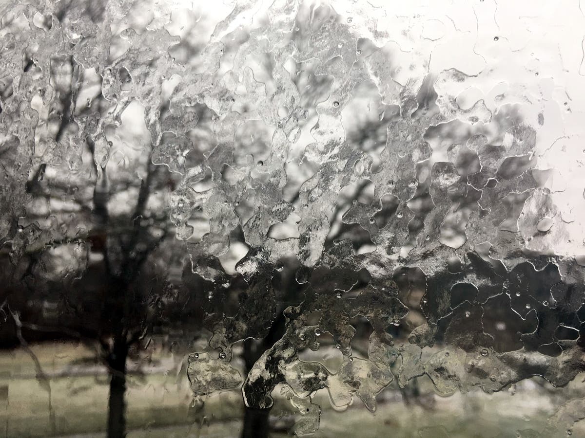
Less than an inch of snow is expected to fall in the lower Hudson Valley, but the combination of snow and sleet will be very dense and difficult to clean up and remove, the NWS said.
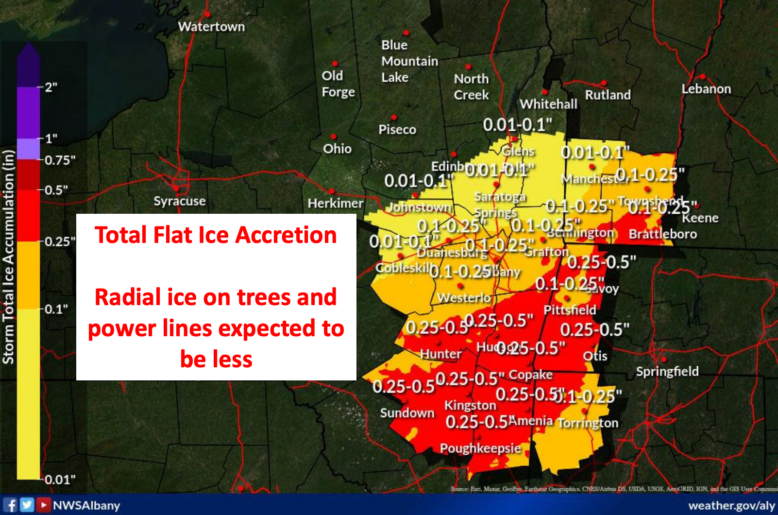
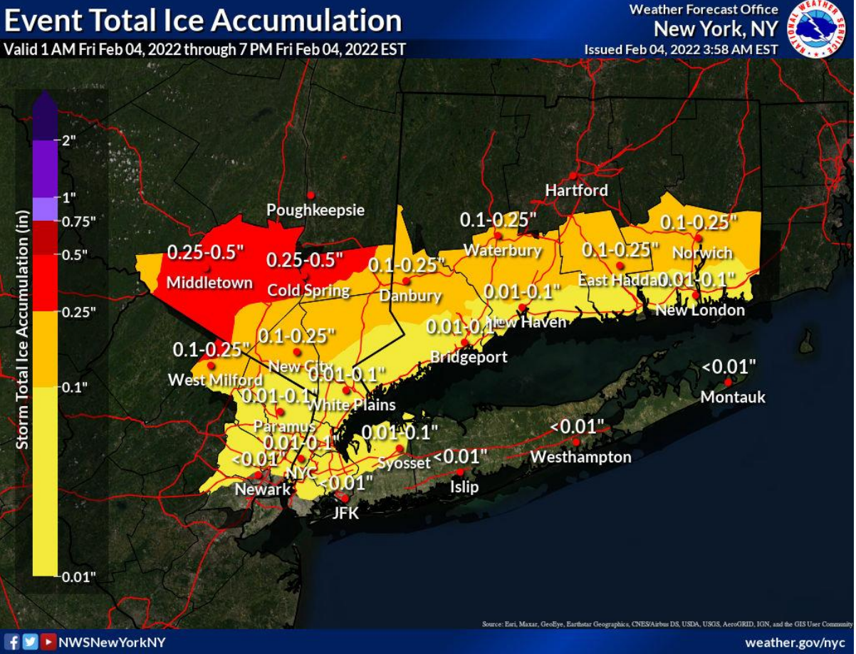
By the time the storm is over, parts of Dutchess, Orange, Putnam and Ulster counties could accumulate a half-inch of ice.
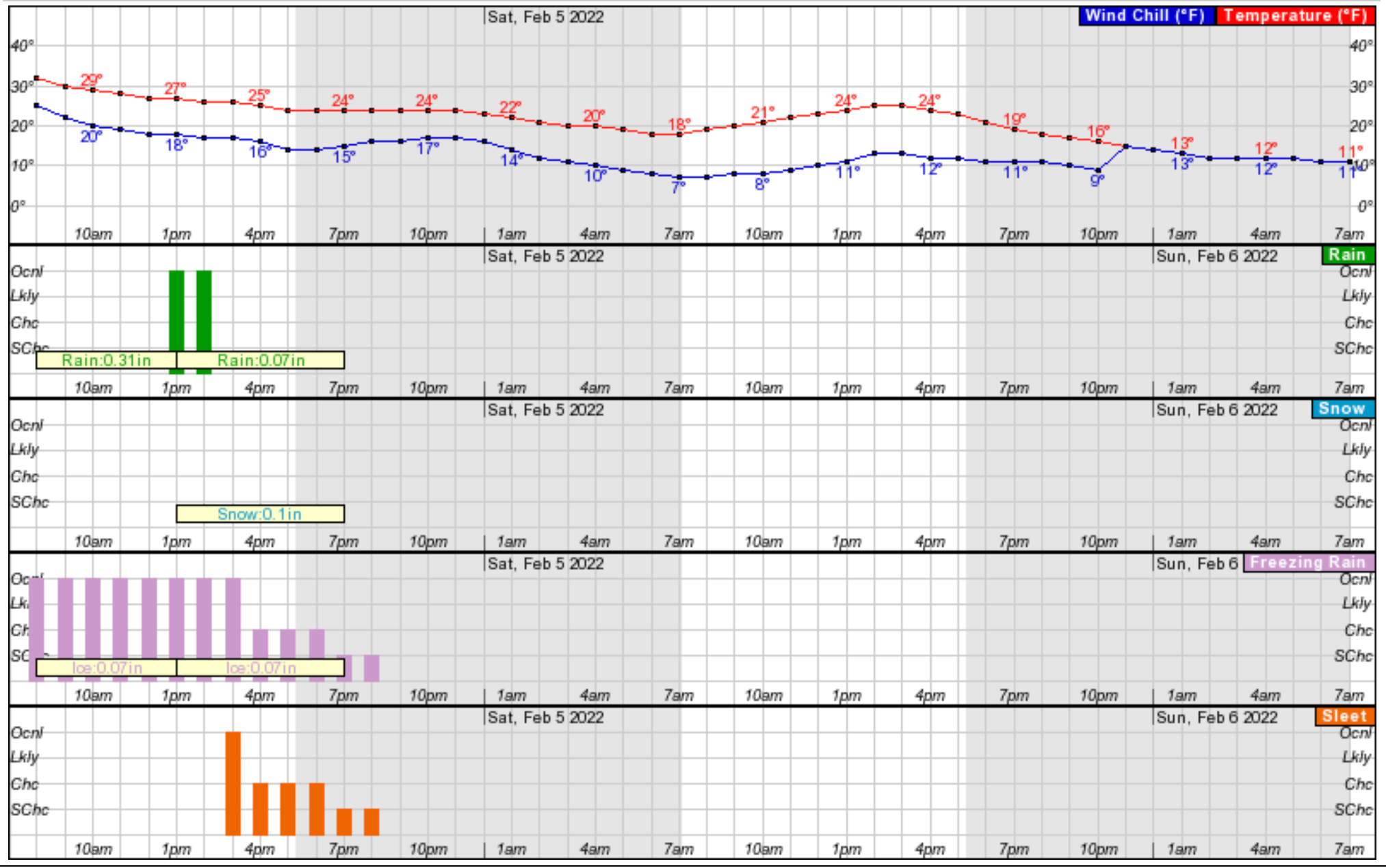
Temperatures will stay below freezing Saturday and Sunday, and the wind chill factor will make it feel even colder. Here's an hour-by-hour look at the next two days based on Rockland County
Get more local news delivered straight to your inbox. Sign up for free Patch newsletters and alerts.

