Weather
Winter Storm Watches Issued For Hudson Valley
Check out the latest details about the storm bearing down on us with snow, sleet and rain.

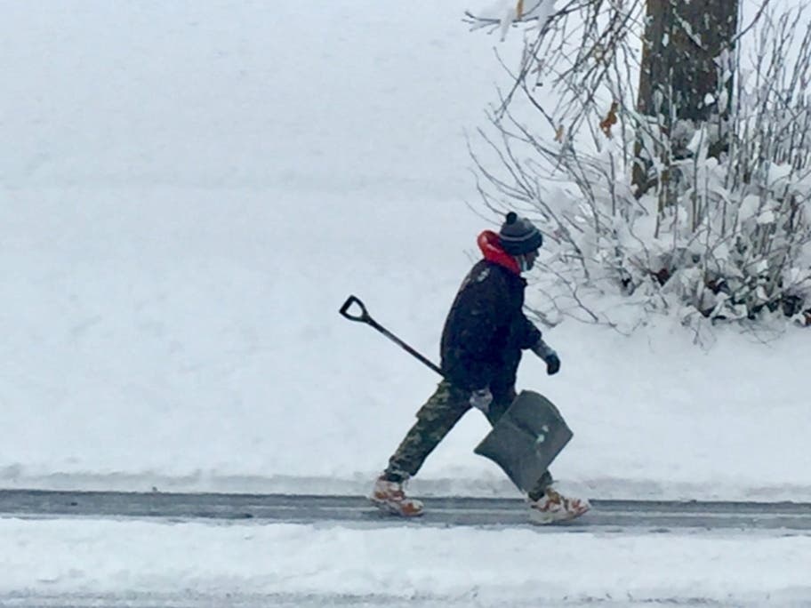
HUDSON VALLEY, NY — Another winter storm is due to blow in Thursday evening, bringing two inches to a foot of snow plus sleet or rain before it exits east Friday evening leaving freezing temperatures behind.
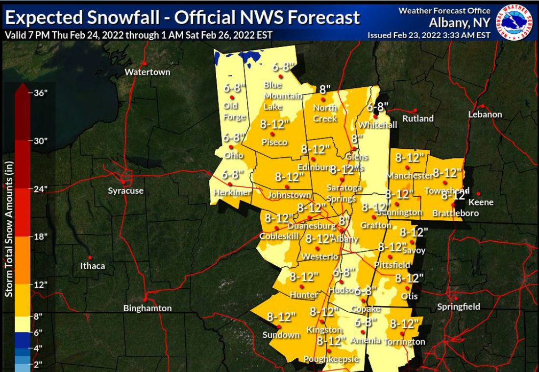
The National Weather Service has issued winter storm watches through Friday at 6 p.m.
- For Orange, Putnam, Rockland and northern Westchester: Total snow and sleet accumulations of 4 to 8 inches and ice accumulations of up to one tenth of an inch are possible.
- Dutchess and Ulster: Total snow accumulations of 6 to 12 inches possible. Snowfall rates could exceed an inch per hour at times from 1 am to 1 pm Friday.
- Southern Westchester: Snow is expected to develop Thursday night, changing over to a wintry mix and/or rain on Friday; 2 to 5 inches of snow is possible before the changeover.
The storm will create dangerous travel conditions, the NWS said.
Find out what's happening in Nyack-Piermontfor free with the latest updates from Patch.
The track of the storm across the Hudson Valley is still uncertain, more than 24 hours out. A more northerly track would lower potential snow/sleet accumulations, while a more southerly track would bring higher accumulations, the NWS said.
"The Friday AM commute will be very hazardous," Alex Marra and Bill Potter of Hudson Valley Weather posted on Facebook, adding that's one thing they can say with high confidence, and promising "more updates as we get more detailed information about how much warm air will be in the mid-levels of the atmosphere, and how much snow vs. sleet vs. freezing rain we expect."
Find out what's happening in Nyack-Piermontfor free with the latest updates from Patch.
The coming snow is part of a gigantic winter storm spreading heavy snow and ice across a 1,800-mile stretch of the country, said Alex Sosnowski, AccuWeather senior meteorologist.
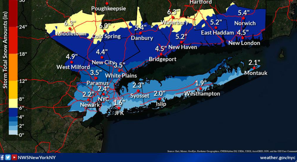
"Because much of this snow will fall in less than 24 hours, the heavy rate of snow will make it difficult for road crews to keep up," he said, adding that while temperatures are forecast to rise above freezing during the day on Friday in New York City, there is a concern for substantially more snow and ice in the northern and western suburbs.
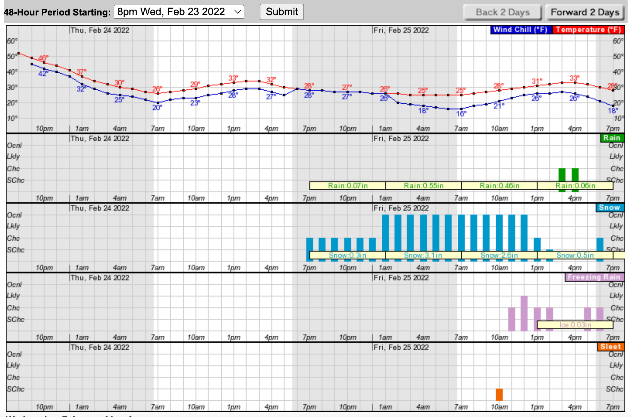
Here's the hour-by-hour outlook for Newburgh (note the above-average temps go down Wednesday night and never recover):
Get more local news delivered straight to your inbox. Sign up for free Patch newsletters and alerts.

