Weather
Hudson Valley Forecast: Spring-like Weather, Then Steep Drop
Rain and wind will usher in some cooler air and sunshine for the weekend. Here's the latest.


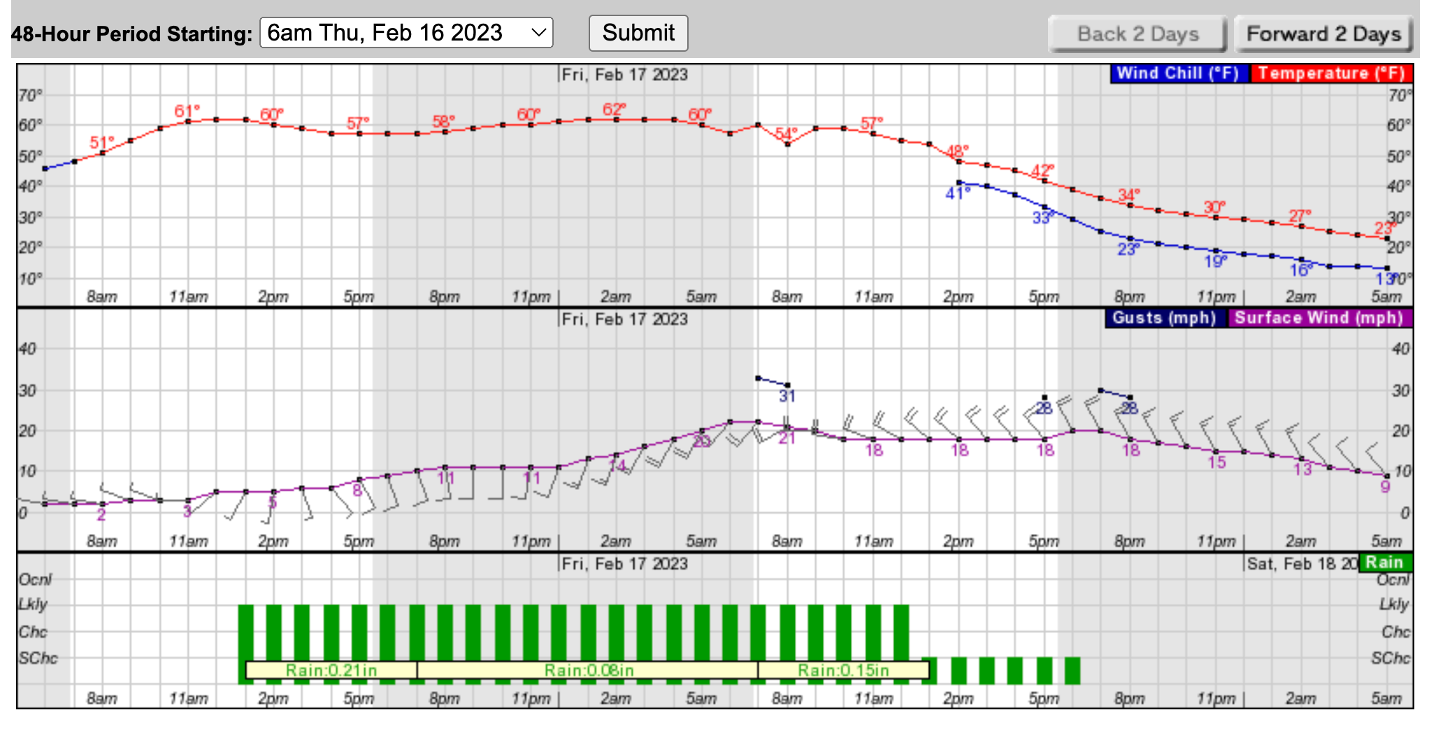
HUDSON VALLEY, NY — Two more spring-like days and then another steep drop in temperatures, that's what the rest of the week will bring the region; however, this time the temps won't get near zero much less below it.
First, things will be way, way warmer than normal.
"By Friday morning parts of the region will be some 35 degrees above the average temp," said Alex Marra of Hudson Valley Weather.
Find out what's happening in Ossining-Croton-On-Hudsonfor free with the latest updates from Patch.
And the temperature won't change much between 8 a.m. Thursday and 8 a.m. Friday, staying around 60 degrees. But then the winds will pick up, and temps will drop —about 30 degrees in 12 hours — and keep dropping through the night.
It's been a weird winter.
Find out what's happening in Ossining-Croton-On-Hudsonfor free with the latest updates from Patch.
"Since meteorological winter started on Dec. 1, 2022, snowfall totals have been below average along the Interstate 95 corridor," said AccuWeather's Allison Finch. "As of Feb. 14, overall precipitation in New York City is 19.2 inches below normal ..."
Here's the five-day forecast from the National Weather Service based on Rockland County:
- Wednesday Afternoon - Sunny. Highs in the lower 60s. South winds 10 to 15 mph.
- Tonight - Mostly clear. Lows in the mid 40s. Southwest winds 5 to 10 mph, becoming west after midnight.
- Thursday - Partly sunny with a slight chance of rain in the morning, then cloudy with rain in the afternoon. Highs in the lower 60s. West winds around 5 mph, becoming south in the afternoon. Chance of rain 80 percent.
- Thursday Night - Showers likely. Breezy with lows in the lower 50s. South winds 10 to 15 mph with gusts up to 25 mph, increasing to southwest 20 to 25 mph with gusts up to 35 mph after midnight. Chance of rain 70 percent.
- Friday - Showers likely in the morning, then partly sunny with a slight chance of showers in the afternoon. Breezy with highs around 60. Temperature falling into the lower 40s in the afternoon. West winds 20 to 25 mph with gusts up to 40 mph, becoming northwest with gusts up to 30 mph in the afternoon. Chance of rain 70 percent.
- Friday Night - Mostly clear. Much cooler with lows in the lower 20s.
- Saturday - Sunny, cooler with highs in the lower 40s.
- Saturday Night - Mostly clear in the evening, then becoming partly cloudy. Lows in the upper 20s.
- Sunday - Mostly sunny. Highs in the upper 40s.
- Sunday Night - Mostly cloudy. Lows in the upper 30s.
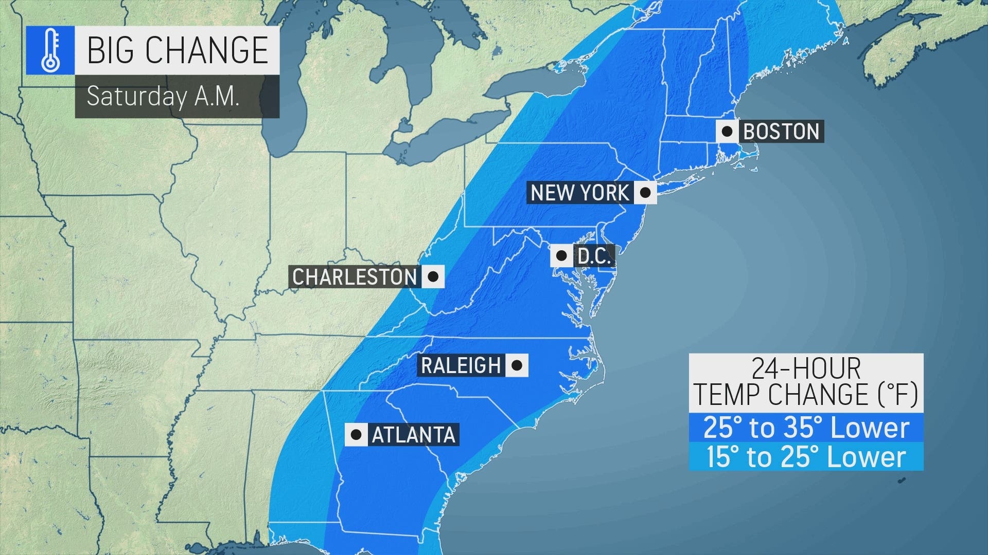
![]()
(AccuWeather.com)
Get more local news delivered straight to your inbox. Sign up for free Patch newsletters and alerts.


