Weather
HV Forecast: Severe Weather, Flash Floods, Tornadoes Possible
Expect up to 2 inches of rain, with even more in some spots. Here are the details.


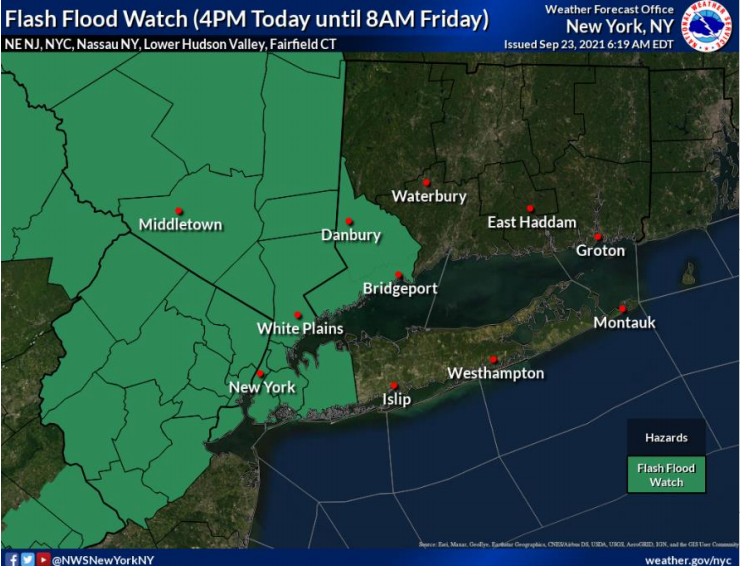
HUDSON VALLEY, NY — The National Weather Service has issued hazardous weather outlooks for the Hudson Valley, with flash flood watches starting from 4 p.m. Thursday for Orange, Putnam, Rockland and Westchester counties and from 5 p.m. for Dutchess and Ulster.
The forecast for severe weather:
- Flash Flooding: 1 to 2 inches of total rainfall with up to near 3 inches locally. Rainfall rates of ½ to 1 inch per hour. Scattered flash flooding of urban and poor drainage areas is possible. Minor flooding along small streams and creeks could occur.
- Damaging Wind: Wind gusts in excess of 58 mph could damage trees and power lines and result in scattered power outages.
- Tornadoes: An Isolated tornado can not be ruled out tonight into early Friday.
AccuWeather predicts some areas could get up to 4 inches of rain because the front is slow-moving. Plus, the chance for flash flooding is enhanced by the time of year, said Accuweather Senior Meteorologist Alex Sosnowski.
Find out what's happening in Ossining-Croton-On-Hudsonfor free with the latest updates from Patch.
"Because of low evaporation rates in September, compared to the middle of the summer, the ground has remained moist in the wake of Ida," Sosnowski said.
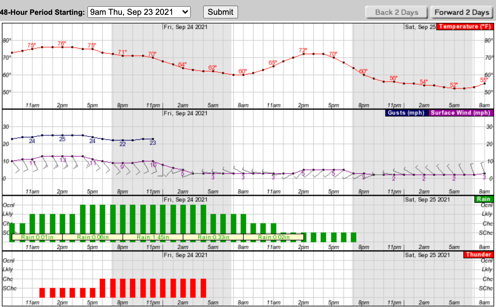
Here's an hour-by-hour graphic look at the NWS forecast based on Rockland County:
Find out what's happening in Ossining-Croton-On-Hudsonfor free with the latest updates from Patch.
Get more local news delivered straight to your inbox. Sign up for free Patch newsletters and alerts.


