Weather
Massive Winter Storm To Bring Snow, Rain, Wind To The Hudson Valley
Hazardous outlooks have been issued for Dutchess, Orange and Ulster counties.


HUDSON VALLEY, NY — Some wild weather is headed to the region due to a significant storm system already producing hazards ranging from blizzard conditions to flash flooding to tornadoes in the Plains, Midwest and South.
There's still a lot of uncertainty about the storm, which is expected to affect us from Thursday afternoon into Saturday morning.
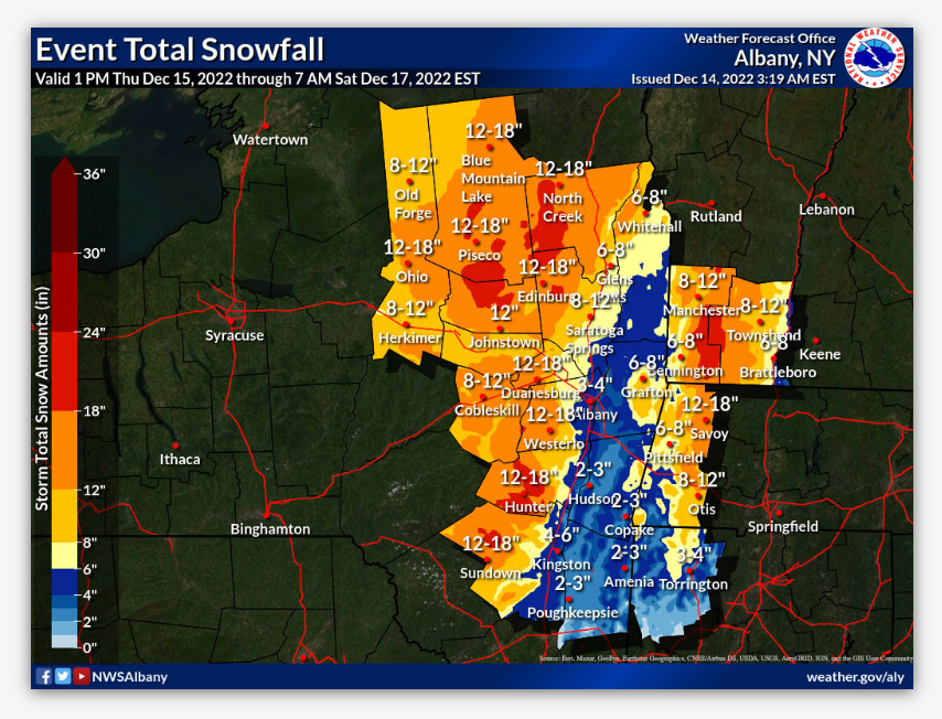
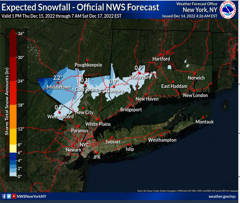
Right now the National Weather Service is predicting up to 2 inches of snow for the interior of the lower and mid-Hudson Valley, with localized amounts up to 5 inches for the far western portions of Orange County, where a hazardous outlook has been issued.
Find out what's happening in Ossining-Croton-On-Hudsonfor free with the latest updates from Patch.
A hazardous outlook has also been issued for Dutchess and Ulster, but the NWS described "uncertainties with precipitation types and amounts."
The NWS now predicts the mid-Hudson will be spared the 8-18 inches of snow possible on either side.
Find out what's happening in Ossining-Croton-On-Hudsonfor free with the latest updates from Patch.
A rain/snow mix is possible but little to no accumulation of snow is expected for other interior locations.
If forecast amounts increase — and there is potential for a more widespread 3-5 inches for parts of the interior — a Winter Weather Advisory could be issued for part of the Lower Hudson Valley, the NWS said.
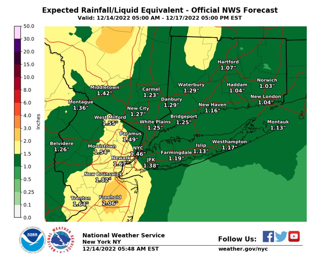
The communities expected to get all rain could get more than an inch.
Plus, it's not all about snow and rain.
A period of easterly/southeasterly wind gusts of 30-35 mph is possible inland, with 35-45 mph gusts over coastal areas and the waters late Thursday and early Friday. A Gale Watch is in effect for all waters Thursday evening through Friday afternoon.
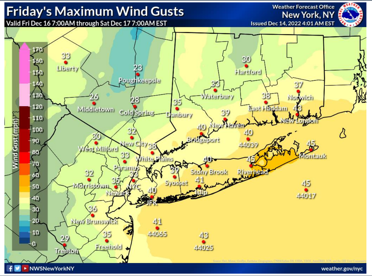
Also, minor isolated coastal flooding is possible late Thursday night through Friday across the Long Island Sound.
Meteorologists are unsure of the timing and precise location of the rain/snow line.
"There is a lot of complexity with this forecast," said the folks at Hudson Valley Weather. "On Friday AM, low level warming will continue to push north up the river valley, transition more locations over to rain. By Friday early morning snow may only be falling in the higher elevations, area west of the river valley and areas north of Poughkeepsie."
They said heavy precipitation rates could mean some areas in the lower Hudson Valley south of 84, especially Rockland, Westchester, and Putnam counties, could see a coating to an inch of snow at most.
They have high confidence that precipitation starting as snow (or a wintry mix in southern Rockland and Westchester) will begin Thursday afternoon and will linger until Saturday AM.
Bottom line:
"Oh and also... calm down! storms and snow maps make some of y'all act crazy... It’s snow in December, we got this!" the Hudson Valley Weather folks said on Facebook.
Get more local news delivered straight to your inbox. Sign up for free Patch newsletters and alerts.


