Weather
Snow Expected To Accumulate: NWS Issues Winter Weather Advisories
The storm arriving in the Hudson Valley Friday evening is just the first; the one due Monday could be more potent. Here's the latest.


HUDSON VALLEY, NY — The first of two back-to-back winter storms is likely to bring wet snow to the region to kick off the weekend. The National Weather Service has issued winter weather advisories in effect from 6 p.m. to 10 a.m. Saturday.
For Orange, Putnam, Rockland and Westchester counties, the NWS predicts total snow accumulations of 3 to 5 inches with locally higher amounts up to near 6 inches on higher elevations, especially in Orange County near and northwest of Interstate 84.
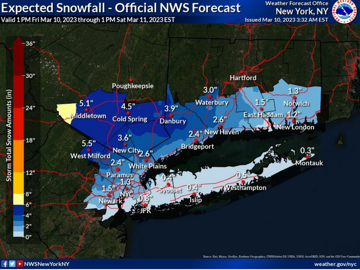
For Dutchess and eastern Ulster, total snow accumulations of 2 to 5 inches, greatest across higher elevations.
Find out what's happening in Ossining-Croton-On-Hudsonfor free with the latest updates from Patch.
Hudson Valley Weather is predicting 4-6 inches of snow could accumulate in parts of Orange and northwestern Rockland counties and even in Dutchess and Putnam. "Highest probability of heavy snowfall amounts are west of the river, and higher terrain facing east or south, such as Hudson Highlands and Eastern Cats. Lowest amounts - southernmost Westchester and Rockland Counties, areas along and east of the river," said Alex Marra.
There's also a potential for minor coastal flooding along western Long Island Sound.
Find out what's happening in Ossining-Croton-On-Hudsonfor free with the latest updates from Patch.
The storm is likely to begin as rain, and then transition to wintry mix and snow around the New York City metro area.
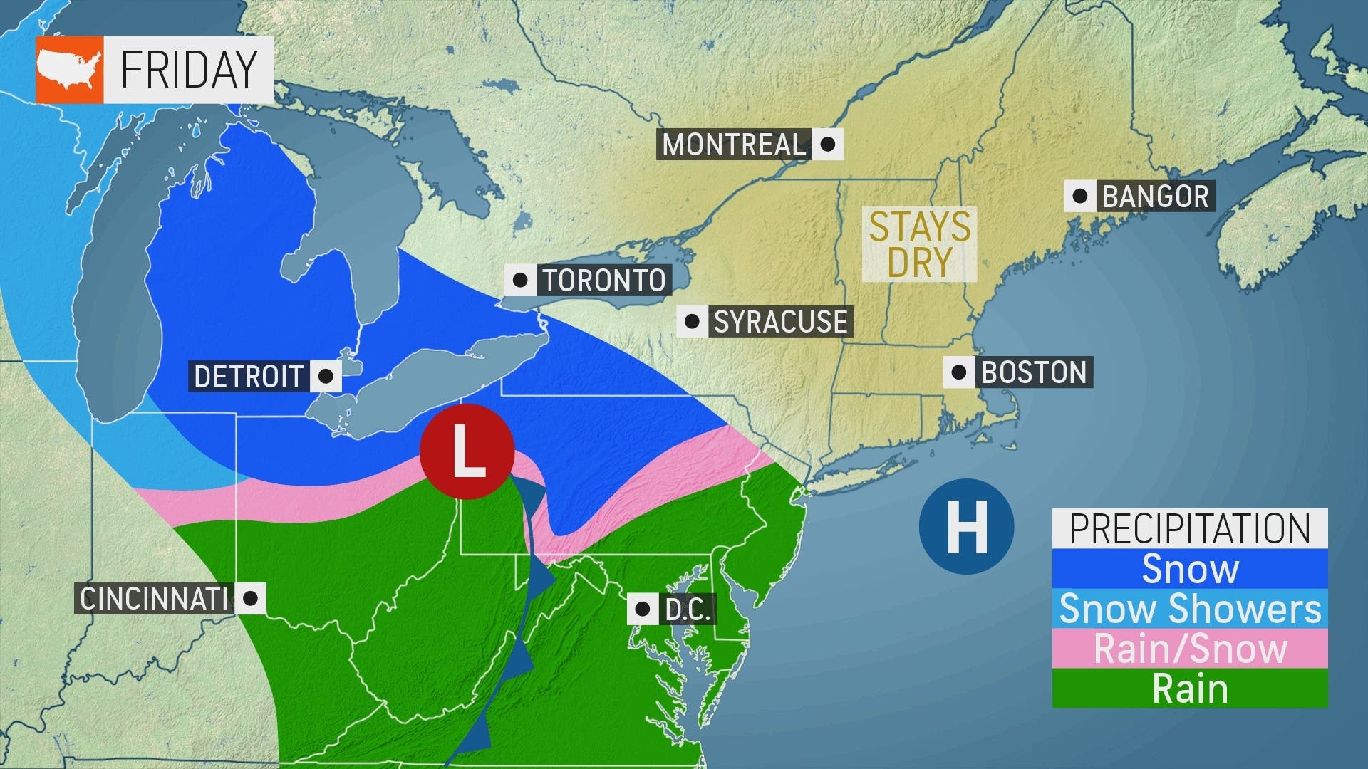
Snowfall rates of up to 3/4 inch per hour are possible from 10 p.m. to 9 a.m., the National Weather Service said.
Still, temperatures above freezing mean low-elevation locations in southern New York are likely to have mainly wet roads, even at night, said AccuWeather Senior Meteorologist Joe Lundberg. "But snow-covered roads are much more likely a few hundred feet higher up over the hills and mountains."
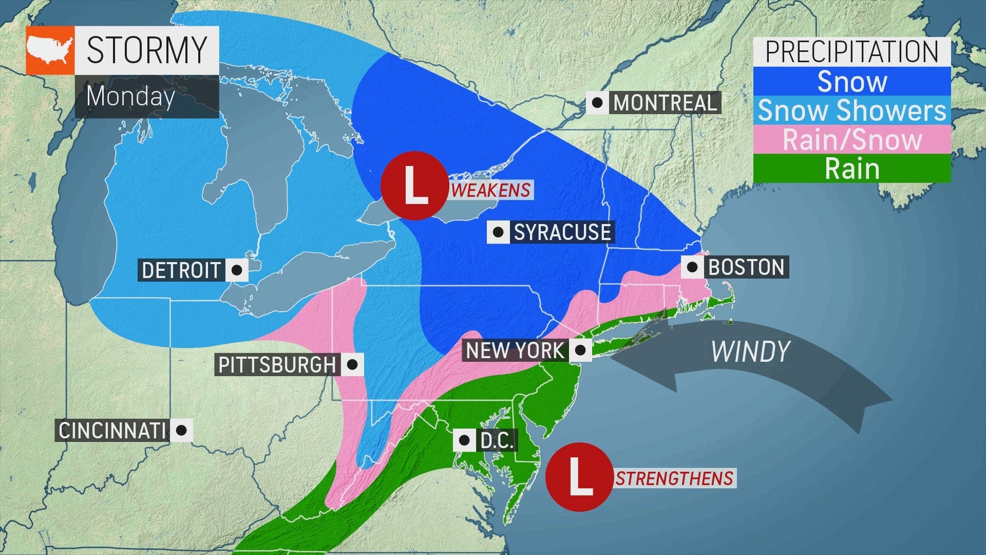
Meteorologists are already looking past the weekend toward another storm system that could become a nor-easter by Monday.
If it hugs the mid-Atlantic coast, then mountainous regions from the Poconos to the Catskills and Berkshires could be "in the thick of the heavy snow," Lundberg said. Gusty winds, storm tides and flooding could also be in the mix.
After Saturday's snow, temps will be in the high 30s during the day and below freezing at night, so there will be a little time for any snow that accumulates overnight Friday to melt before more arrives Monday into Tuesday.
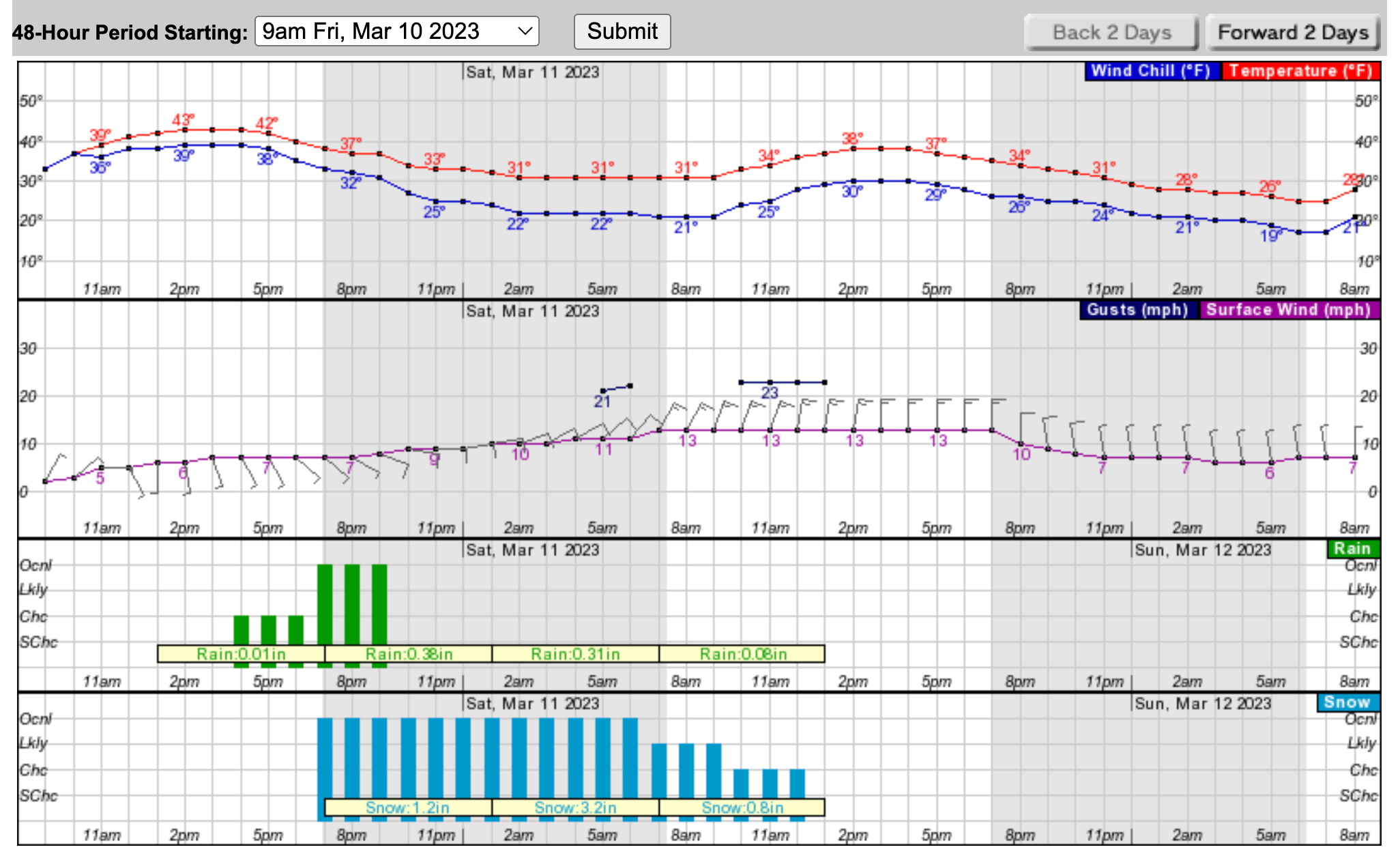
Here's what the next 48 hours look like for Putnam County:
Here's the five-day forecast based on New City:
- Friday - Rain likely after 4pm. Cloudy, with a high near 45. Light and variable wind becoming south 5 to 7 mph in the afternoon. Chance of precipitation is 70%.
- Tonight - Rain before 10pm, then rain and snow between 10pm and 1am, then snow after 1am. Low around 32. Wind chill values between 25 and 30. Southeast wind 7 to 11 mph becoming northeast after midnight. Winds could gust as high as 21 mph. Chance of precipitation is 100%. New snow accumulation of 2 to 4 inches possible.
- Saturday - Snow, possibly mixing with rain after 10am, then gradually ending. High near 41. Wind chill values between 20 and 30. North wind around 13 mph, with gusts as high as 23 mph. Chance of precipitation is 80%. New snow accumulation of 1 to 2 inches possible.
- Saturday Night - Partly cloudy, with a low around 27. North wind 8 to 11 mph.
- Sunday - Increasing clouds, with a high near 45. North wind around 7 mph becoming southeast in the afternoon.
- Sunday Night - A 50 percent chance of snow after 1am. Mostly cloudy, with a low around 34.
- Monday - Rain likely. Cloudy, with a high near 41. Chance of precipitation is 70%.
- Monday Night - Rain and snow likely. Mostly cloudy, with a low around 31. Chance of precipitation is 70%.
- Tuesday - Rain and snow likely, mainly before 1pm. Mostly cloudy, with a high near 38. Chance of precipitation is 60%.
- Tuesday Night - A 40 percent chance of snow before 1am. Mostly cloudy, with a low around 28. Blustery.
Get more local news delivered straight to your inbox. Sign up for free Patch newsletters and alerts.


