Weather
Snow Showers, New Cold Kick Off Hudson Valley Work Week
Gusty winds bring deep cold back to the region whether your community gets any snow or rain. Midweek looks better but the end of the week...

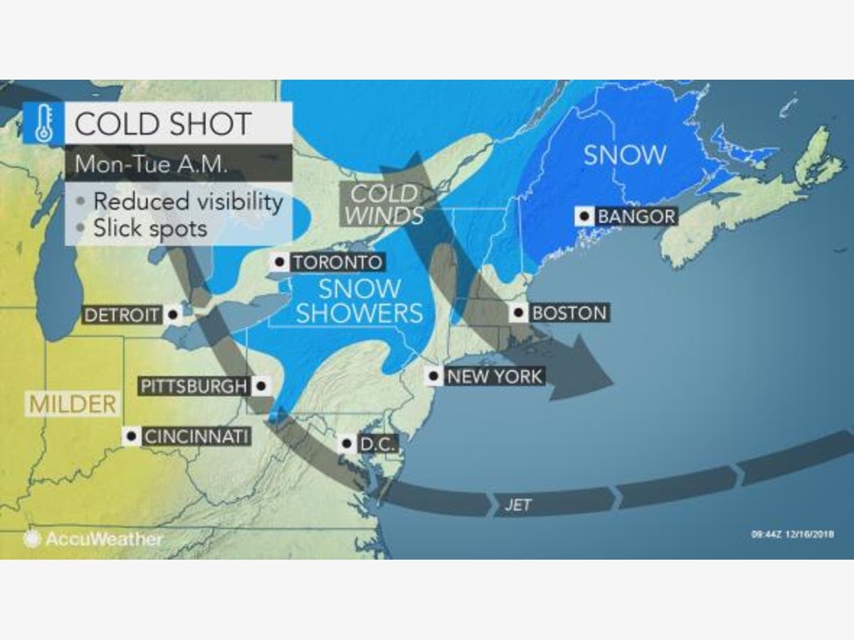
HUDSON VALLEY, NY — The work week kicks off with gusty wind bringing us renewed cold temperatures. The National Weather Service said:
Clouds are expected to increase this afternoon into early evening. There could be some spotty very light rain early this morning as well as a snow or rain shower late this afternoon into early this evening. Winds will become gusty from a general northwest direction starting this afternoon and continuing through Tuesday.
The airmass will become colder in time. Highs in the low to mid-40s today will be followed by lows in the 20s tonight and then highs only in the low to mid 30s Tuesday. Lows Tuesday night are forecast to drop into mainly the upper teens to upper 20s.
That cold won't be here for long.
“This will be a quick cold shot as milder air sweeps back into the mid-Atlantic by Wednesday and Thursday,” AccuWeather Meteorologist Kyle Elliott said.
Find out what's happening in Ossining-Croton-On-Hudsonfor free with the latest updates from Patch.
However, early reports of a late week storm predict it could bring lots of rain and even snow to the region. Check back with Patch for updates. Sign up for Patch news alerts to get snow updates straight to your inbox.
Here's a summary of Hudson Valley Weather's four-day forecast:
Find out what's happening in Ossining-Croton-On-Hudsonfor free with the latest updates from Patch.
- Monday turns blustery, nighttime low of 25
- Tuesday bitter cold, low in the upper teens
- Wednesday seasonable, with variable clouds
- Thursday highs in the 40s, with rain developing
Image via AccuWeather.com
Get more local news delivered straight to your inbox. Sign up for free Patch newsletters and alerts.


