Weather
Sunday Snow, Rain, Wind, Flood Forecast Revised For Hudson Valley
Forecasters know conditions will be "pretty wild" though uncertainties still abound about its track and timing - and the implications.


HUDSON VALLEY, NY — The storm headed toward the region is carrying a lot of moisture, but how much will be dumped on us as snow, as ice and as rain is still up in the air (sorry).
It's also bringing gusty winds, which could lead to downed limbs and power lines, and high seas, which are expected to cause flooding in coastal communities.
"This is a very complex and potentially damaging storm system," said Alex Marra and Bill Potter of Hudson Valley Weather, who offered a preliminary forecast Friday night but warned that changes should be expected.
Find out what's happening in Ossining-Croton-On-Hudsonfor free with the latest updates from Patch.
The NWS on Saturday morning changed its estimates of snowfall versus rainfall, especially along the coast.
- 1-3 inches of snow for Northeast New Jersey, Southern Westchester and much of interior Southern CT, with one to 1.5 inches of rain
- 3-7 inches of snow for interior portions of Northeast New Jersey, the Lower and Mid Hudson and Southwestern Connecticut, plus a couple hundredths of an inch of ice accretion
Forecasters now say there's a potential for high and gusty winds throughout the region, particularly in the Mid-Hudson and over higher elevations, that could lead to downed limbs and power outages.
Find out what's happening in Ossining-Croton-On-Hudsonfor free with the latest updates from Patch.
There's a coastal flood watch for the Sound Shore, where 2-3 feet of inundation is possible, which will affect roads, parking lots, parks, lawns, and homes and businesses with basements near the waterfront. Some road closures are possible, and vehicles parked in vulnerable areas may become flooded. Flooding will also extend inland from the waterfront along tidal rivers and bays. Breaking waves of 4 to 6 ft will result in beach erosion, wave splash-over onto shoreline streets and properties, and minor damage possible to shorefront structures.
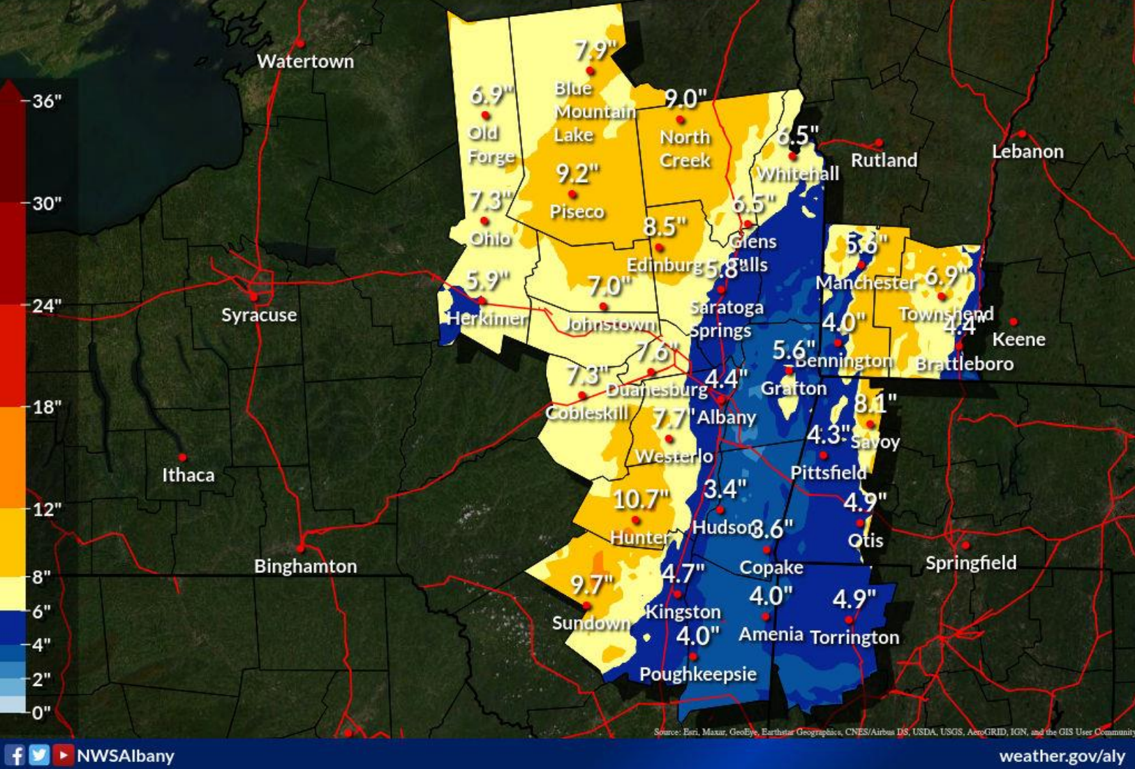
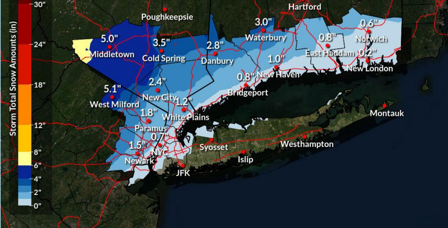
Here are the snow maps from the NWS Saturday morning briefing:
For those who will be working on Martin Luther King Day, the morning commute could be hazardous. Be wary of ice. Do not drive around barricades or through water of unknown depth.
"This weekend's storm is going to be pretty wild if nothing else. It's likely to have a little bit of everything, as it barrels up the east coast Sunday night," Potter and Marra said on Hudson Valley Weather. "And if the current projections pan out, will probably leave just about nobody happy with the end result."
Get more local news delivered straight to your inbox. Sign up for free Patch newsletters and alerts.


