Weather
Temps Plummet, Snow Possible: Hudson Valley Weekend Forecast
Hard to believe now, but a blast of Arctic air will freeze anything wet, which could make traveling tricky Sunday night and Monday morning.

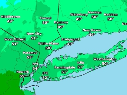
HUDSON VALLEY, NY — The abnormally warm temperatures won't last through the weekend, and some snow may fall as things get colder.
"However, as has been the case repeatedly for our area this winter ... the ingredients do not appear to be in place in time for the Hudson Valley to see a significant impact," said Hudson Valley Weather on Facebook.
In fact, most of the region may not see flurries.
Find out what's happening in Ossining-Croton-On-Hudsonfor free with the latest updates from Patch.
What we could get is slippery roads, sidewalks and driveways.
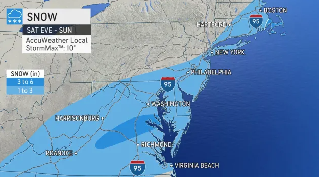
"The quick change to colder conditions during and after the storm will cause untreated wet and slushy areas to freeze," said Ryan Adamson, AccuWeather meteorologist. "So whether a location picks up a coating of snow with wet roads or a few inches of snow and slush, icy conditions are likely to develop Sunday night and last into the Monday morning commute."
Find out what's happening in Ossining-Croton-On-Hudsonfor free with the latest updates from Patch.
What's wet in the Hudson Valley will probably be mostly from the thaw. The National Weather Service gives Dutchess and Ulster counties a 30 percent and Orange and Putnam a 40 percent chance of snow Saturday night. Rockland has a 40 percent chance of snow Saturday night and Sunday. Westchester has a 40 percent chance of snow Saturday night and a 50 percent chance of snow Sunday.
That's another reason to drive carefully, as law enforcement agencies across New York will be stepping up patrols and targeting impaired driving during the Super Bowl weekend.
Here's the five-day forecast based on Ulster County, where a traveling Disaster Assistance Center will be deployed next week to assist residents with recovery needs and insurance claims from last Friday's historic and disastrous ice storm, which dropped up to an inch of ice (the analysis on Hudson Valley Weather is worthwhile reading for any valley resident).
- Today - Sunny. Highs around 50. South winds 10 to 15 mph.
- Tonight - Mostly cloudy. Not as cool with lows in the upper 30s. South winds 5 to 10 mph.
- Saturday - Mostly cloudy in the morning, then becoming partly sunny. Highs in the upper 40s. Temperature falling into the mid 40s in the afternoon. Southwest winds 10 to 15 mph.
- Saturday Night - Mostly cloudy. A chance of light snow after midnight. Much colder with lows around 20. North winds around 5 mph. Chance of snow 30 percent.
- Sunday - Mostly cloudy with a chance of light snow in the morning, then partly sunny in the afternoon. Much colder with highs in the upper 20s. North winds around 5 mph. Chance of snow 30 percent.
- Sunday Night - Mostly cloudy in the evening, then becoming partly cloudy. Colder with lows around 10 above.
- Monday And Monday Night - Partly cloudy. Cold. Highs in the lower 20s. Lows around 10 above.
- Tuesday And Tuesday Night - Partly cloudy. Cold. Highs in the lower 30s. Lows around 15.
Get more local news delivered straight to your inbox. Sign up for free Patch newsletters and alerts.


