Weather
Thunderstorms To Put Hudson Valley On Weather Roller Coaster
There's a hazardous outlook out for part of the region as the forecast goes from steamy to chilly. Here are the latest details.

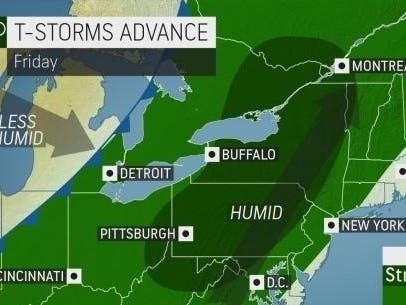
HUDSON VALLEY, NY — The region is in for another roller coaster weather-wise, from steamy to frosty. There's a hazardous weather outlook posted for Dutchess and Ulster counties.
Scattered thunderstorms are expected this afternoon and evening. The Storm Prediction Center has much of our area in a slight risk of severe thunderstorms. Some thunderstorms could contain damaging winds and large hail. An isolated tornado is possible. Frequent lightning and locally heavy rain with ponding of water on roadways is possible as well.
First it'll be hot and humid Friday, once the fog lifts. The National Weather Service said that temperatures could reach into the mid-80s in the lower Hudson Valley.
Also, Friday could see more sunshine breaking through the clouds — a mixed blessing.
Find out what's happening in Ossining-Croton-On-Hudsonfor free with the latest updates from Patch.
"That could allow temps to jump toward 80° for an afternoon high on Friday. But also means that we’ll need to keep an eye out for an afternoon shower or thunderstorm," said Alex Marra and Bill Potter of Hudson Valley Weather. "The chances of a storm will rise as the approaching cold front nears Friday evening … so we’ll have our eyes on that."
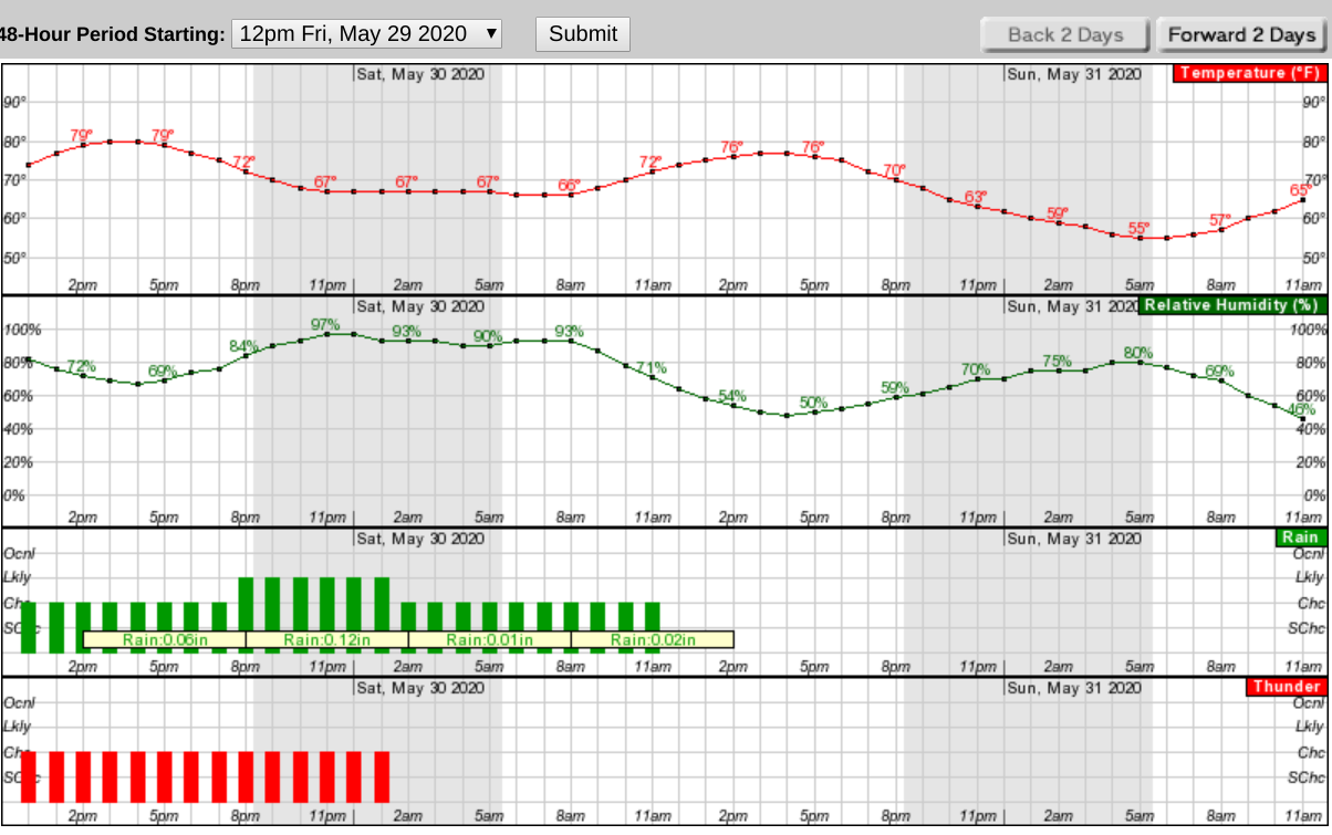
Lows Friday night will once again be warm in the middle to upper 60s.
Find out what's happening in Ossining-Croton-On-Hudsonfor free with the latest updates from Patch.
The chance of showers persists into the early morning on Saturday ahead of that slow moving cold front, which will eventually pass through the area during the day. Highs Saturday will be in the middle to upper 70s, the National Weather Service said.
Here's a look at the next 48 hours (using northern Westchester):
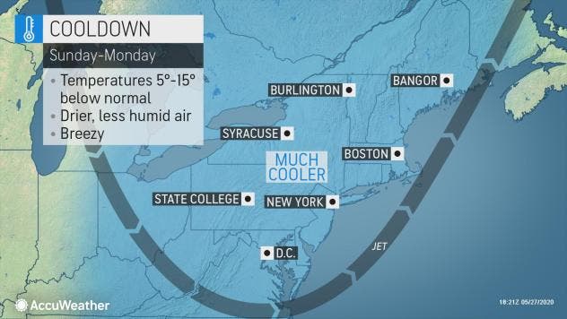
"We are concerned about frost in the normally cold spots from Virginia and West Virginia northward to New York state and northwestern New England from later Sunday night to early Monday morning," said AccuWeather Senior Meteorologist Randy Adkins.
Get more local news delivered straight to your inbox. Sign up for free Patch newsletters and alerts.


