Weather
Rain, Snow To Hit Hudson Valley: Latest Forecast
Here are the latest details about when this mess of a storm bringing snow and rain to the Hudson Valley from the Midwest will start.

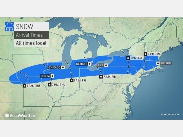
HUDSON VALLEY, NY — What's headed our way is a mess. Light snow will coat Dutchess and Ulster counties; rain will drench Rockland and Westchester counties; Orange and Putnam could see some slush; and accumulating snow will blanket Catskills and Taconics.
The National Weather Service said in its hazardous outlook: "A period of light to moderate accumulating snow is likely over most areas tonight into early Saturday morning. Although accumulation will preferentially be on grassy/colder surfaces, some slippery spots on untreated roadways cannot be ruled out."
The highest snowfall amounts — 6 inches — are expected in the Northern Appalachians into the Catskills and highest elevations of the Berkshires.
Find out what's happening in Ossining-Croton-On-Hudsonfor free with the latest updates from Patch.
Increasing clouds Friday will bring rain starting in the early afternoon from west to east. The low pressure area will move across the region into Saturday. It eventually will taper off — from west to east — with some interior spots possibly getting another rain and snow mix Saturday afternoon.
The remainder of the weekend will be mainly dry with much more mild conditions anticipated for Sunday as forecast highs reach the upper 50s to mid 60s.
Find out what's happening in Ossining-Croton-On-Hudsonfor free with the latest updates from Patch.
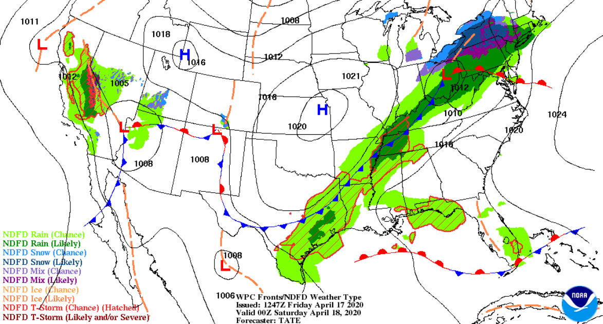
This forecast map from NOAA shows you just how much of a mess this storm is predicted to be:
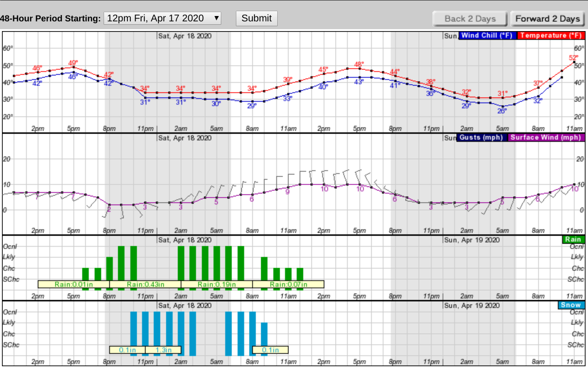
Here's what the next 48 hours look like for Dutchess County:
Get more local news delivered straight to your inbox. Sign up for free Patch newsletters and alerts.


