Weather
Snow, Wintry Mix Headed To The Hudson Valley
A blustery and frigid forecast for the region's work week. Here's the latest.

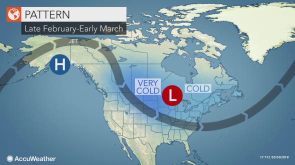
HUDSON VALLEY, NY — High winds will whip through the Hudson Valley until nightfall Monday, leaving colder temperatures. Wind chill values will make it feel on Tuesday as if temps are in the teens. Below-normal temps are expected Tuesday night.
Then by Wednesday night we could have two to five inches of snow.
Right on that storm's heels another storm system could drop another wintry mix on the region Friday night.
Find out what's happening in Ossining-Croton-On-Hudsonfor free with the latest updates from Patch.
"Residents eager for spring will be forced to keep the snow shovels, coats and winter weather attire handy," said Kyle Elliott, AccuWeather meteorologist.
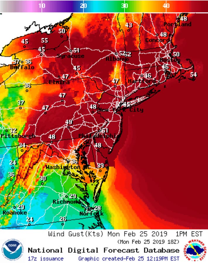
The high winds overnight Sunday through Monday evening blew down tree limbs, knocked down power lines, and left thousands of customers without power.
Find out what's happening in Ossining-Croton-On-Hudsonfor free with the latest updates from Patch.
Monday morning, the highest reported wind gust was 59 mph in Croton-on-Hudson at 10:19 a.m., according to the National Weather Service. In Orange County, a wind gust at Stewart Airport was clocked at 53 mph at 10:45 a.m.
Here's the work week forecast from Hudson Valley Weather:
- Monday night: Very windy, low of 18 degrees.
- Tuesday: Windy. High near 30.
- Tuesday night: Windy and very cold. Wind chill 0-10 degrees.
- Wednesday: High near 30. Snow possible by sunset.
- Wednesday night: Very cold. Chance of snow 70 percent.
- Thursday: Partly sunny, high 34 degrees.
- Thursday night: Increasing clouds, low around 20.
- Friday: Snow showers possible. Highs in the mid 30s.
- Friday night: Wintry mix possible. Lows in the 20s.
Get more local news delivered straight to your inbox. Sign up for free Patch newsletters and alerts.


