Weather
Winter Storm Watch Expanded For Tuesday-Wednesday
As of Monday evening, the National Weather Service predicts 5-11 inches of snow for the lower Hudson Valley starting Tuesday night.

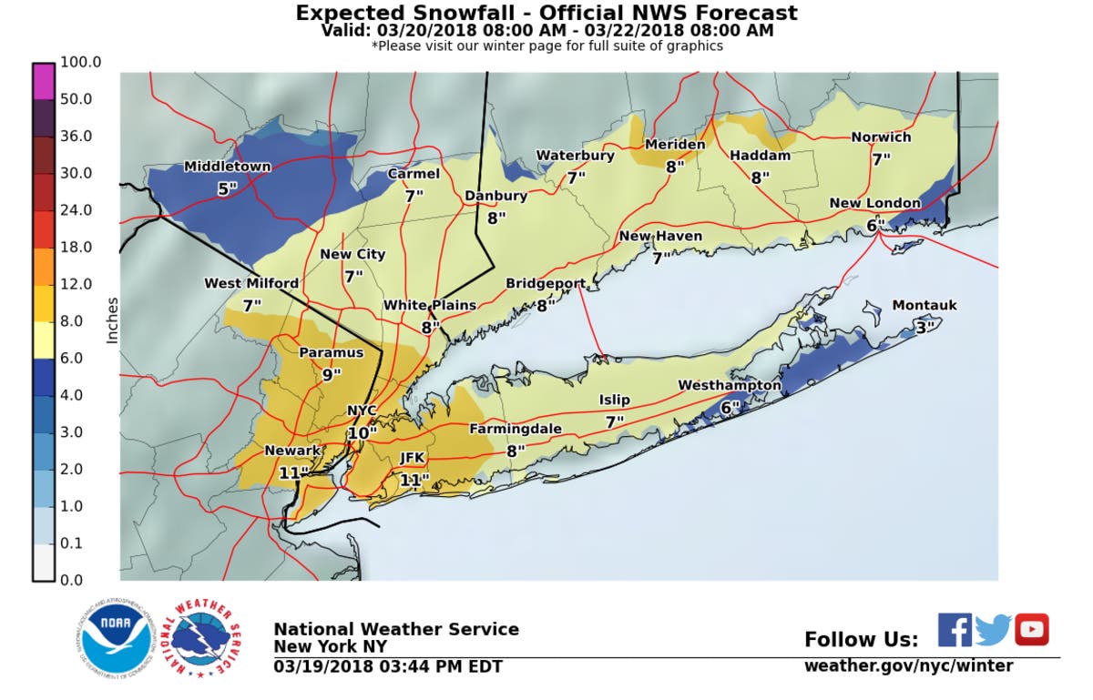
The Hudson Valley should expect its fourth nor'easter. The National Weather Service expanded its Winter Storm Watch for Tuesday on Monday evening.
Now the NWS says:
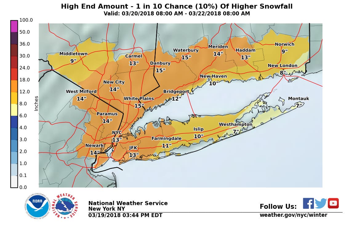
- WHAT...Heavy wet snow possible. Total wet snow accumulations of 5 to 11 inches, with locally higher amounts possible.
- WHERE...New York City, the Lower Hudson Valley and northeast New Jersey.
- WHEN...From Tuesday evening through Wednesday evening.
Plan on difficult travel conditions, including during the evening commute on Wednesday.
Find out what's happening in Ossining-Croton-On-Hudsonfor free with the latest updates from Patch.
Significant reductions in visibility are possible. A combination of the heavy wet snow and wind gusts of 25 to 40 mph could bring down tree limbs and power lines, creating power outages.
Maps via NWS
Find out what's happening in Ossining-Croton-On-Hudsonfor free with the latest updates from Patch.
Get more local news delivered straight to your inbox. Sign up for free Patch newsletters and alerts.