Community Corner
What Now: Snow, Ice, Rain this Weekend in Brewster, Southeast
A break in the cold offers no real relief.

The National Weather Service has issued an advisory about the next snowstorm headed toward Putnam County.
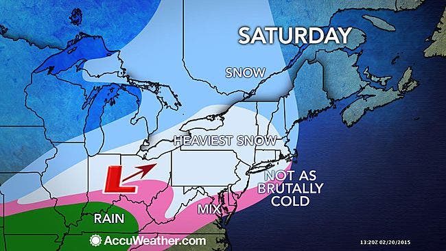
The path of this storm will encompass nearly 2,000 miles, according to accuweather.com, which warns that the storm is likely to transition from snow to ice and rain along the mid-Atlantic and southern New England coasts. However, just enough cold air may linger near the ground to cause an extended period of icing farther inland.
Here’s the weekend forecast:
Find out what's happening in Pleasantville-Briarcliff Manorfor free with the latest updates from Patch.
- Tonight-Partly cloudy, with a low around -2. West wind 5 to 7 mph becoming calm in the evening.
- Saturday-Snow after 1pm. High near 29. Wind chill values between zero and 10. Calm wind becoming south 5 to 9 mph in the morning. Chance of precipitation is 90%. New snow accumulation of 1 to 3 inches possible.
- Saturday Night-Snow before 1am, then freezing rain. Low around 29. Calm wind becoming southwest around 6 mph after midnight. Chance of precipitation is 90%. Little or no ice accumulation expected. New snow accumulation of 3 to 5 inches possible.
- Sunday-Rain or freezing rain likely before 10am, then a chance of rain between 10am and 1pm. Cloudy, then gradually becoming mostly sunny, with a high near 38. Wind chill values between 30 and 35. Northwest wind 3 to 6 mph. Chance of precipitation is 60%. Little or no ice accumulation expected.
- Sunday Night-Partly cloudy, with a low around 7. Light northwest wind increasing to 6 to 11 mph in the evening. Winds could gust as high as 23 mph.
MAPS: accuweather.com
Get more local news delivered straight to your inbox. Sign up for free Patch newsletters and alerts.