Business & Tech
This Land is Your Land…I Think
How well do you know your property? Are you sure you know where the property lines are? Who does that nice big tree belong to?

There is so much to think about when purchasing or selling a home that everyone involved in the process can get easily frustrated. The whole situation can seem overwhelming, not to mention expensive, so people cut corners where they can.
One of these corners tends to be the lack in obtaining a recent property survey. Sure, the seller has one, but it’s from 1940. There tends to be a good chance that things have changed since then -- perhaps a new porch has been added, or Con-Ed has obtained a right-of-way from one of the previous homeowners. It’s important to know these things.
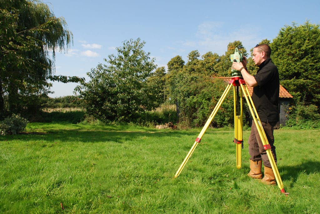
A property survey is a document --usually in the form of a map or sketch -- that outlines all the prominent features of a property, including the house and the physical boundaries of that property. It can also include other items, such as encroachments, or natural features on the property like ponds, lakes or pools.
Find out what's happening in Scarsdalefor free with the latest updates from Patch.
Without a survey, owners have no recourse if at a later date, it is found that their fence encroaches on a neighbor’s land, or that there are rights to easement by a service company (electric, water company, etc.). Often, these companies have access rights to a property to carry out maintenance and repairs.
Most problems, however, arise when improvements done to the property, such as patios, pools, garages and building extensions, are either outside the building limits or encroach on a neighbor’s property. A land survey defines the dimensions of the lot, as well as the positions of easements and building limits.
Find out what's happening in Scarsdalefor free with the latest updates from Patch.
In many states, a property survey is required for a number of reasons. From the perspective of a home buyer, your mortgage lender will want to see a recent property survey of the home and land you are purchasing for their records. The title company insuring your property will also need a recent survey for their purposes.
Often, a buyer will purchase a property and assume they know where the property lines lie. However, they only later come to find out that the fence they thought belonged to their neighbor is actually theirs.
Here are some of the principal reasons to obtain and review a survey:
- To verify that the legal description used for the property in fact describes the property you believe you are buying.
- To determine whether certain improvements (buildings, driveways, fences, utility lines, etc.) encroach legally into your property.
- To mark property boundaries so they are clear.
- To provide a baseline record of the location of existing improvements in order to inform future decisions of whether a new survey is needed.
- To discover trails and other evidence of use by third parties that might suggest that someone has established an implied easement over a portion of the property or might claim a portion of the property by reason of adverse possession.
- To provide the evidence needed by the title insurer to delete certain standard exceptions to coverage and thereby provide “extended coverage” against off-record title matters (including matters that would be revealed by an accurate survey).
The specific information that a surveyor collects in the field and includes in the survey drawing depends upon your needs. More detailed surveys do, of course, tend to be more costly. The minimum information that a survey must provide is dictated by state law. Many surveys can be customized according to the needs of the client.
When you hire a land surveyor, they will locate your described boundaries on the ground by obtaining a copy of your land description from an abstract, title opinion, title certificate, certificate of title, deed or other form of “proof of ownership." The old survey is also helpful.
The surveyor researches available records of your property, and often adjoining properties as well, for any possible conflicts. Using this information, they take measurements of the property to identify property lines.
After measurements are taken, the land surveyor can determine the boundary of the property and advise of any evidence of encroachments or defects in the description of your property. If requested, they can also “stake” the property lines, which makes it clear to you (and your neighbors) where those property lines are. These points might later be used for fencing or construction.
Most surveyors use electronic distance and angle measuring equipment, as well as the traditional transit and tape. Some surveyors also use satellite positioning equipment. The use of these instruments and computers enables the surveyor to perform land surveys efficiently and accurately.
Recently, the Northeast experienced a surprise nor’easter. The snow really packed a wallop on the area, taking out power for days and knocking down trees at an enormous rate. It’s important to know which trees belong to whom so we can make sure that they are being properly taken care of.
Do not rely on anyone’s word about where your property begins and ends. Purchasing a property without a proper land survey could mean problems. Without a registered survey, you will never know the true details of your property and are ultimately risking your entire investment. Even a minor discrepancy in the boundaries can make a huge difference. Something as seemingly insignificant as a fence post crossing the boundaries can create a snowball of expensive litigation, and even worse, nasty looks between neighbors.