Weather
HV Hazardous Outlooks: Winds, Rain, Thunder, Warm Temps, Ice Jams
Here's the latest on what's headed to the region before the three-day Presidents Day weekend.

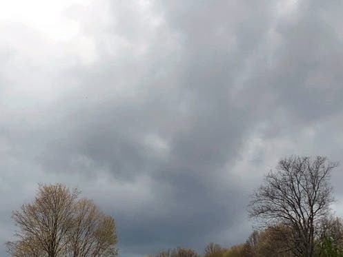
HUDSON VALLEY, NY — The National Weather Service updated its hazardous outlooks for the region Wednesday morning, warning of wild weather including damaging winds, heavy rain and even thunderstorms headed our way on Thursday.
- For Dutchess and Ulster counties, "The combination of snowmelt, frozen ground and rainfall will lead to runoff into rivers and streams for Thursday into Friday. This runoff may allow for river ice to break up in some areas, which may cause ice jams and lead to localized flooding for Thursday evening into Friday. A Flood Watch may be needed. In addition, gusty southerly winds are expected Thursday night across the higher elevations, which may lead to some downed trees and power lines. A Wind Advisory may be needed across parts of the area."
- For Putnam, Rockland and Westchester counties, "Confidence is increasing in the potential of wind gusts of 45 to 55 mph Thursday night into Friday morning as a strong frontal system tracks through the area," the NWS said.
The winds will bring rain and very warm temperatures, "possibly even near 60 degrees Thursday night," Hudson Valley Weather said on Facebook. They'll be in front of a storm system that will have unloaded up to a foot of snow in the mid-West which will bring rain to the region overnight Thursday.
"The threat will come as south to southwesterly winds sweep across coastal areas from the Delmarva Peninsula to New England and the Canadian province of Nova Scotia," said Adam Douty, AccuWeather senior meteorologist. "These strong winds will pile water along the coast and lead to coastal flooding along south-facing coasts."
Find out what's happening in Southeast-Brewsterfor free with the latest updates from Patch.
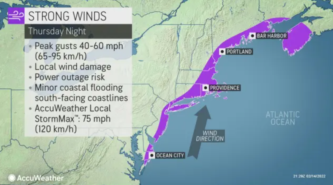
The gusts could down tree branches and lead to isolated power outages, AccuWeather warned.
Here's the NWS forecast through the three-day weekend, based on New City:
Find out what's happening in Southeast-Brewsterfor free with the latest updates from Patch.
- Wednesday - Mostly sunny, with a high near 46. South wind 8 to 11 mph.
- Wednesday night - Mostly cloudy, with a low around 37. South wind around 9 mph, with gusts as high as 22 mph.
- Thursday - A 20 percent chance of rain after 4pm. Mostly cloudy, with a high near 59. Southwest wind 9 to 11 mph, with gusts as high as 25 mph.
- Thursday Night - Rain before 1am, then rain and possibly a thunderstorm between 1am and 4am, then rain after 4am. Some of the storms could produce heavy rainfall. Steady temperature around 59. Breezy, with a south wind 11 to 16 mph increasing to 17 to 22 mph after midnight. Winds could gust as high as 43 mph. Chance of precipitation is 100%. New rainfall amounts between a half and three quarters of an inch possible.
- Friday - Rain before 7am, then a slight chance of showers between 7am and 10am. Temperature falling to around 35 by 5pm. Breezy, with a northwest wind 14 to 21 mph, with gusts as high as 39 mph. Chance of precipitation is 80%. New precipitation amounts of less than a tenth of an inch possible.
- Friday Night - Mostly clear, with a low around 21.
- Saturday - Mostly sunny, with a high near 41.
- Saturday Night - Mostly clear, with a low around 22.
- Sunday - Sunny, with a high near 41.
- Sunday Night - Mostly clear, with a low around 30.
- Washington's Birthday - Mostly sunny, with a high near 53.
- Monday Night - Mostly cloudy, with a low around 36.
Get more local news delivered straight to your inbox. Sign up for free Patch newsletters and alerts.